Fraud Blocker Skip to main content

1500s Collection (page 25)

The 1500s were a time of exploration, innovation, and cultural transformation

Background image1500s Collection: NATI2D-00080

NATI2D-00080
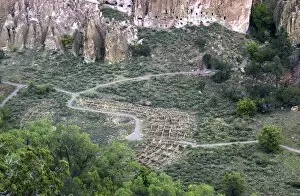
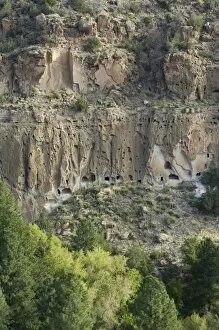
Ruins of Tuonyi, an Ancient Puebloan / Anasazi village in Frijoles Canyon, Bandelier National Monument, New Mexico. Digital photograph

Background image1500s Collection: NATI2A-00141

NATI2A-00141
Native Americans using fishbone hoes to plant maize and beans, Florida, 1500s. Hand-colored woodcut reproduction of a DeBry engraving of a LeMoyne illustration

Background image1500s Collection: NATI2A-00143

NATI2A-00143
Tomb of embalmed Cherokee chiefs, their flesh and bones dried and preserved, North Carolina, 1500s. Hand-colored woodcut reproduction of a John White illustration

Background image1500s Collection: Native American woman of the Virginia coast

Native American woman of the Virginia coast
One of the wives of Wyngyno, a Native American chief, Raleighs Colony, 1500s. Hand-colored woodcut of a 16th-century John White drawing

Background image1500s Collection: NATI2A-00105

NATI2A-00105
" The flyer" - a Native American shaman in Raleighs Colony, 1500s. Hand-colored woodcut reproduction of a John White illustration

Background image1500s Collection: NATI2A-00048

NATI2A-00048
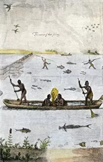
The way the Indians fished, using spears and dugout canoes, Virginia Colony, 1500s Hand-colored woodcut reproduction of a John White illustration

Background image1500s Collection: PART2A-00063

PART2A-00063
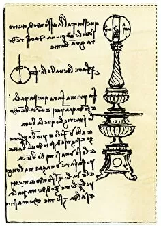
Leonardo da Vincis backward handwriting on his design for a lamp using a globe filled with water. 19th-century woodcut reproduction with a watercolor wash

Background image1500s Collection: PLIT2A-00050

PLIT2A-00050
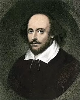
William Shakespeare. Hand-colored woodcut reproduction of the First Folio portrait

Background image1500s Collection: DeSotos route in Louisiana

DeSotos route in Louisiana
Western part of De Sotos route, from Desisles map published in 1707. Hand-colored woodcut reproduction of an 18th-century illustration

Background image1500s Collection: EXPL2A-00354

EXPL2A-00354
Dauphin Map by Pierre Desceliers made for Prince Henry (who became Henri II) by order of the French King Francis I, 1546. Printed color halftone reproduction 19th century

Background image1500s Collection: Erasmus

Erasmus
Portrait of the Dutch philosopher, Erasmus. Digitally colored engraving

Background image1500s Collection: PLIT2D-00004

PLIT2D-00004
Statue of French writer Michel de Montaigne, Paris. Digital photograph

Background image1500s Collection: SOAR2A-00027

SOAR2A-00027
Performance of a Mystery Play at Coventry, England, 1500s. Hand-colored woodcut

Background image1500s Collection: Globe Theatre in London

Globe Theatre in London
Globe Theatre at Southwark, London, where many of Shakespeares plays were performed. Hand-colored 19th-century woodcut reproduction of an earlier drawing

Background image1500s Collection: PEXP2A-00023

PEXP2A-00023
Walter Raleigh and his expedition at Trinidad, off South America, 1595. Hand-colored woodcut of a 19th-century illustration

Background image1500s Collection: PEXP2A-00047

PEXP2A-00047
Bartolome de Las Casas protecting the Aztecs from Spanish conquerors. Hand-colored woodcut of a 19th-century illustration

Background image1500s Collection: PLAT2A-00009

PLAT2A-00009
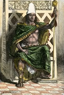
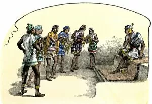
Montezuma II on his throne. Hand-colored woodcut based on a written account by Ramirez

Background image1500s Collection: EXPL2A-00227

EXPL2A-00227
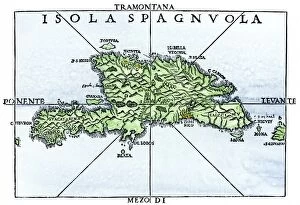
Map of Hispaniola in 1534, from cartography of Peter Martyr and Oviedo. Hand-colored 19th-century woodcut reproduction of a 16th-century map

Background image1500s Collection: EXPL2A-00276

EXPL2A-00276
House of Hernando Cortes in Mexico City, built by native labor in the 1500s. Hand-colored woodcut of a 19th-century illustration

Background image1500s Collection: EXPL2A-00368

EXPL2A-00368
Cortes marches out of Aztec Tenochtitlan to battle the army of Narvaez, 1519. Hand-colored woodcut of a 19th century illustration

Background image1500s Collection: NATI2D-00513

NATI2D-00513
Anasazi/Ancestral Puebloan cliff-dwelling ruins in the Frijoles Canyon, Bandelier National Monument, New Mexico. Digital photograph

Background image1500s Collection: NATI2D-00514

NATI2D-00514
Anasazi/Ancestral Puebloan cliff-dwelling ruins in the Frijoles Canyon, Bandelier National Monument, New Mexico. Digital photograph

Background image1500s Collection: Erasmus Colloquies

Erasmus Colloquies
Colloquies of Erasmus, hand-bound edition published in Basel, 1537. Hand-colored engraving

Background image1500s Collection: PLIT2A-00044

PLIT2A-00044
William Shakespeare, with his autograph. Hand-colored halftone reproduction of a 19th-century illustration

Background image1500s Collection: PLIT2A-00043

PLIT2A-00043
William Shakespeare. Hand-colored engraving

Background image1500s Collection: NATL2A-00003

NATL2A-00003
Aztec merchants on a canal in Tenochtitlan before the Spanish conquest. Hand-colored woodcut of a 19th-century illustration

Background image1500s Collection: NATL2A-00014

NATL2A-00014
An Inca man in the time of Pizarros conquest of Peru, 1500s. Hand-colored woodcut of a 19th-century illustration

Background image1500s Collection: NATL2A-00022

NATL2A-00022
Sandals of Inca soldiers in Peru. Hand-colored woodcut of a 19th-century illustration

Background image1500s Collection: NATL2A-00025

NATL2A-00025
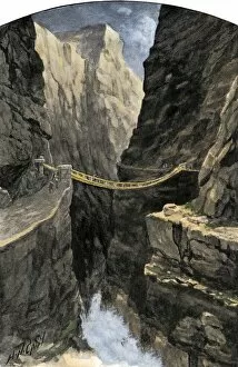
Inca hanging bridge over a gorge in the Andes Mountains. Hand-colored halftone reproduction of a 19th-century illustration

Background image1500s Collection: NATL2A-00029

NATL2A-00029
Inca teacher giving lessons in counting using the quipu. Hand-colored woodcut of a 19th-century illustration

Background image1500s Collection: EXPL2A-00081

EXPL2A-00081
Dona Marina, La Malinche, native interpreter for Hernando Cortes in the Spanish conquest of Aztec Mexico. Hand-colored woodcut of a 19th-century illustration

Background image1500s Collection: EXPL2A-00076

EXPL2A-00076
Hernando Cortes loses two horses in battle with Tlaxcalan natives in conquering Mexico, 1519. Printed color lithograph of a 19th century illustration

Background image1500s Collection: EXPL2A-00100

EXPL2A-00100
Bananas and other fruit trees of Hispaniola, from a sketch published in 1572. Hand-colored woodcut of a 19th-century reproduction of an illustration from Benzoni 1572

Background image1500s Collection: EXPL2A-00211

EXPL2A-00211
Father Juan de Padilla finds the cross set by Coronado, 1540s. Hand-colored halftone of a 19th-century illustration

Background image1500s Collection: EXPL2A-00222

EXPL2A-00222
Vasco Nunez de Balboa discovering the Pacific Ocean, 1513. Hand-colored woodcut of a 19th century illustration

Background image1500s Collection: South America mapped after Magellans voyage, 1519

South America mapped after Magellans voyage, 1519
New World map after Magellans passage around Cape Horn in 1519. Hand-colored woodcut of a 19th century illustration

Background image1500s Collection: EXPL2A-00235

EXPL2A-00235
Balboa raising his sword to claim the Pacific Ocean for Spain, 1513. Hand-colored woodcut of a 19th-century illustration

Background image1500s Collection: EXPL2A-00258

EXPL2A-00258
De Sotos expedition met by Chief Aquixos Native Americans in canoes on the Mississippi River, 1542. Hand-colored woodcut of a 19th-century illustration

Background image1500s Collection: EXPL2A-00260

EXPL2A-00260
De Soto discovering the Mississippi River after an overland journey, 1540. Hand-colored woodcut of a 19th century illustration

Background image1500s Collection: EXPL2A-00263

EXPL2A-00263
Juan Ponce de Leons expedition searching for the Fountain of Youth in Florida, 1500s. Hand-colored woodcut of a 19th-century illustration

Background image1500s Collection: GEUR2A-00067

GEUR2A-00067
Lisbon, Portugal, in the 1500s. Hand-colored 19th-century woodcut reproduction of a 16th-century illustration

Background image1500s Collection: EXPL2A-00286

EXPL2A-00286
Willem Barents expedition in Arctic ice at Nova Zembla searching for a northeast passage, 1500s. Hand-colored woodcut of a 19th-century illustration

Background image1500s Collection: EXPL2A-00293

EXPL2A-00293
Francisco Pizarro draws a line in the sand in Panama daring his men to follow him to Peru, 1530. Hand-colored woodcut of a 19th-century illustration

Background image1500s Collection: GEUR2A-00118

GEUR2A-00118
Religious procession in Moscow during the reign of Ivan IV (the Terrible), 1500s. Hand-colored 19th-century woodcut reproduction of an earlier illustration

Background image1500s Collection: PEXP2A-00002

PEXP2A-00002
Spanish explorer Hernando de Soto, with his signature. Hand-colored 19th-century engraving

Background image1500s Collection: PEXP2A-00017

PEXP2A-00017
Hernando Cortes, conqueror of Mexico. Hand-colored woodcut reproduction of a painting

Background image1500s Collection: PEXP2A-00022

PEXP2A-00022
Spanish conquistador Juan Ponce de Leon. Hand-colored 19th-century woodcut reproduction of an earlier illustration

Background image1500s Collection: PEXP2A-00028

PEXP2A-00028
Spanish conquistador Hernando de Soto Hand-colored 19th-century woodcut reproduction of an earlier illustration


All Professionally Made to Order for Quick Shipping

The 1500s were a time of exploration, innovation, and cultural transformation. In the realm of art and science, geniuses like Leonardo da Vinci left their mark with groundbreaking works such as "Skull anatomy, " revealing the intricacies of human anatomy. Meanwhile, cartographers like Gerardus Mercator (GGBR2A-00076) created maps that expanded our understanding of the world. Orteliuss map of the Ottoman Empire in 1570 showcased the vast territories under its rule, while Durer's world map from 1515 provided a glimpse into how people perceived Earth at that time. These maps painted a picture of an ever-expanding global landscape. In Florence during this era, architects and urban planners crafted detailed plans for cities like never before seen. The 16th Century Plan of Florence exemplified this meticulous approach to city design. Oronce Fine's world map from 1531 furthered geographical knowledge by incorporating new discoveries made during expeditions around the globe. It was through these maps that Europeans began to comprehend just how vast our planet truly is. The use of firearms also revolutionized warfare during this period. Arquebusses became prevalent on battlefields across Europe in the 16th century, changing military tactics forever. Religion played a significant role in shaping society during this time as well. Figures like John Calvin emerged as influential theologians whose ideas would have lasting impacts on Protestantism and beyond. Maps continued to evolve throughout the century; one notable example being Map of Palestine in 1588 which depicted important biblical sites within its borders. Similarly, a detailed map showcasing British Isles shed light on England's growing influence over neighboring lands. By the turn of the century, Europe had undergone immense changes politically and culturally - reflected by Map of Europe from 1600 which captured shifting borders and emerging nation-states.