Framed Print > Europe > France > Canton > Landes
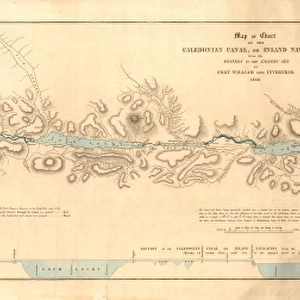
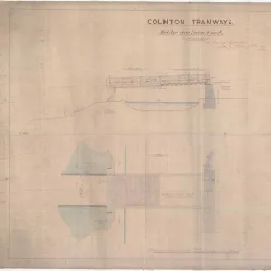
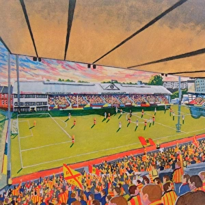
Framed Print : Plan of the Caledonian Canal and lands belonging thereto Part I


![]()
Framed Photos from Scottish Canals
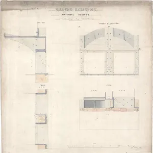
Plan of the Caledonian Canal and lands belonging thereto Part I
Part 1 in a series of plans showing land belonging to the Estate of Muirtown, the Estate of Kinylies and the Estate of Bught where they meet land belonging to the Caledonian Canal from Beauley Firth to Bught Bridge, Millertown
Scottish Canals are in charge of the five canals in Scotland
Media ID 14482753
© Scottish Canals
18"x14" Modern Frame
Discover the rich history of Scottish Canals with our stunning Framed Print of "Plan of the Caledonian Canal and lands belonging thereto Part I" by K. Ramsay. This exquisite piece showcases an intricate and detailed plan of the Caledonian Canal and adjacent lands, including the Estate of Muirtown, the Estate of Kinylies, and the Estate of Bught. A must-have for history enthusiasts, this Framed Print adds elegance and character to any room in your home or office. With meticulous attention to detail and high-quality craftsmanship, our Framed Prints are sure to impress and inspire.
16x12 Print in an MDF Wooden Frame with 180 gsm Satin Finish Paper. Glazed using shatter proof thin plexiglass. Frame thickness is 1 inch and depth 0.75 inch. Fluted cardboard backing held with clips. Supplied ready to hang with sawtooth hanger and rubber bumpers. Spot clean with a damp cloth. Packaged foam wrapped in a card.
Contemporary Framed and Mounted Prints - Professionally Made and Ready to Hang
Estimated Image Size (if not cropped) is 40.6cm x 35.6cm (16" x 14")
Estimated Product Size is 45.7cm x 35.6cm (18" x 14")
These are individually made so all sizes are approximate
Artwork printed orientated as per the preview above, with landscape (horizontal) orientation to match the source image.
FEATURES IN THESE COLLECTIONS
> Europe
> France
> Canton
> Landes
> Europe
> United Kingdom
> Scotland
> Posters
> Europe
> United Kingdom
> Scotland
> Related Images
> Scottish Canals
> ScottishCanals
EDITORS COMMENTS
This print showcases the intricate and detailed "Plan of the Caledonian Canal and lands belonging thereto Part I" by Ramsay, K. It is a remarkable depiction of the vast expanse of land that encompasses the Estate of Muirtown, the Estate of Kinylies, and the Estate of Bught where they converge with the majestic Caledonian Canal. The plan beautifully captures the harmonious meeting point between these estates and their surrounding landscapes. From Beauley Firth to Bught Bridge, Millertown, every inch is meticulously illustrated with precision and accuracy. The viewer can immerse themselves in this visual representation as it transports them into an era long gone. Ramsay's expertise shines through in this extraordinary piece as he effortlessly combines cartography with artistry. Each stroke on paper tells a story about Scotland's rich history and its deep connection to its waterways. As we gaze upon this print, we are reminded not only of its aesthetic appeal but also its historical significance. It serves as a testament to human ingenuity in harnessing nature for transportation purposes while respecting and preserving its natural beauty. This print is more than just a mere image; it encapsulates Scotland's heritage within its borders. It invites us to explore further into our past while appreciating how far we have come today.
MADE IN THE USA
Safe Shipping with 30 Day Money Back Guarantee
FREE PERSONALISATION*
We are proud to offer a range of customisation features including Personalised Captions, Color Filters and Picture Zoom Tools
SECURE PAYMENTS
We happily accept a wide range of payment options so you can pay for the things you need in the way that is most convenient for you
* Options may vary by product and licensing agreement. Zoomed Pictures can be adjusted in the Cart.