Home > North America > Costa Rica > Maps
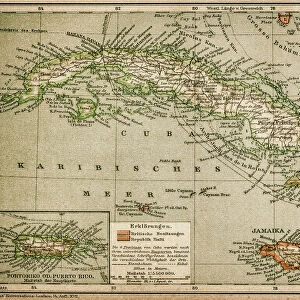
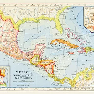
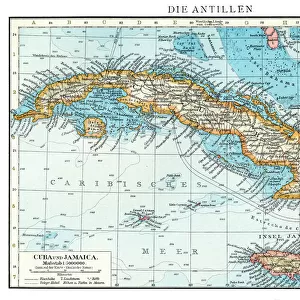
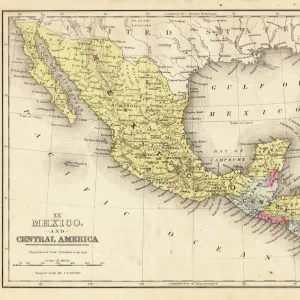
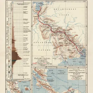
Antique map of West Indies and Central America, 19th Century

![]()
Wall Art and Photo Gifts from Fine Art Storehouse
Antique map of West Indies and Central America, 19th Century
Antique map of West Indies and Central America, 19th Century, 1873
Unleash your creativity and transform your space into a visual masterpiece!
duncan1890
Media ID 14756858
© This content is subject to copyright
1870s Antilles Bad Condition Caribbean Central America Colour Colours Condition Costa Rica Cuba Damaged Dirty Dominican Republic Equipment Faded Greater Antilles Guatemala Haiti Hispaniola Honduras Image Created 1870 1879 Jamaica Navigational Equipment Nicaragua Panama Retro Stained Styles Supplies The Americas Victorian West Indies Obsolete
FEATURES IN THESE COLLECTIONS
> Fine Art Storehouse
> Map
> Historical Maps
> Maps and Charts
> Early Maps
> North America
> Costa Rica
> Maps
> North America
> Cuba
> Maps
> North America
> Dominican Republic
> Maps
> North America
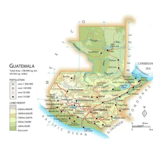
> Guatemala
> Maps
> North America
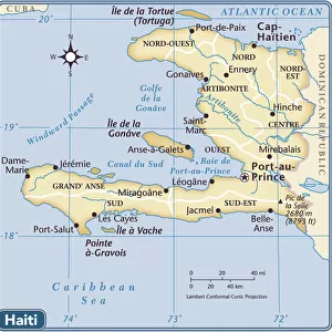
> Haiti
> Maps
> North America
> Honduras
> Maps
> North America
> Jamaica
> Maps
> North America
> Nicaragua
> Maps
EDITORS COMMENTS
This print showcases an antique map of the West Indies and Central America, dating back to the 19th century. Created in 1873, this piece offers a glimpse into the rich history and cartography of that era. Despite its bad condition, with stains and damages evident from years gone by, it exudes a sense of nostalgia that transports us to a different time. The faded colors and worn-out appearance add character to this vintage lithograph. It depicts various countries including Cuba, Jamaica, Haiti, Dominican Republic, Costa Rica, Guatemala, Honduras, Nicaragua, and Panama among others. The intricate details captured through engraving highlight the navigational equipment used during that period. As we observe this image created between 1870-1879 by Duncan1890 at Fine Art Storehouse's collection; we are reminded of how far our world has evolved since then. This old-fashioned map serves as a reminder of the past while also showcasing Victorian styles prevalent during that time. Despite its damaged state and obsolete nature in today's digital age; this print holds immense historical value for enthusiasts interested in exploring the Americas' geographical landscape centuries ago. Its presence on display evokes curiosity about our ancestors' journeys across these lands long before modern technology existed. Incorporating this antique map into your space not only adds a touch of retro charm but also sparks conversations about our collective heritage. Let it transport you back in time as you appreciate both its aesthetic appeal and educational significance
MADE IN THE USA
Safe Shipping with 30 Day Money Back Guarantee
FREE PERSONALISATION*
We are proud to offer a range of customisation features including Personalised Captions, Color Filters and Picture Zoom Tools
SECURE PAYMENTS
We happily accept a wide range of payment options so you can pay for the things you need in the way that is most convenient for you
* Options may vary by product and licensing agreement. Zoomed Pictures can be adjusted in the Cart.