Home > Europe > Latvia > Maps
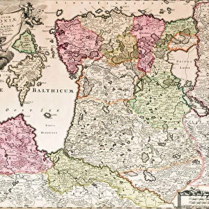
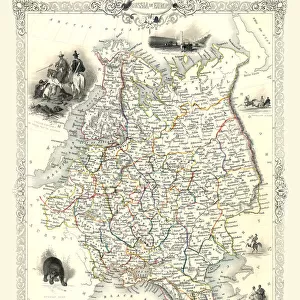
Old map of Russia and the Baltic States, published 1857

![]()
Wall Art and Photo Gifts from Fine Art Storehouse
Old map of Russia and the Baltic States, published 1857
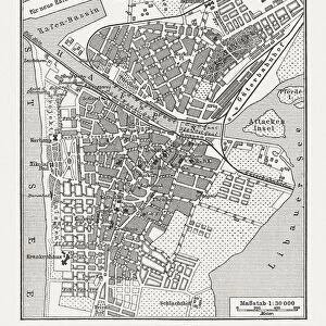
Old map of Russia, Estonia, Livonia (Latvia and Estonia), district and city of St. Petersburg. Steel eengraving with hand coloured borderlines, published in 1857
Unleash your creativity and transform your space into a visual masterpiece!
ZU_09
Media ID 19860047
FEATURES IN THESE COLLECTIONS
> Fine Art Storehouse
> Map
> Historical Maps
> Maps and Charts
> Early Maps
EDITORS COMMENTS
This print showcases an exquisite piece of history - an old map of Russia and the Baltic States, published in 1857. The intricate details and craftsmanship of this steel engraving are truly remarkable, capturing the essence of a bygone era. With hand-coloured borderlines adding a touch of vibrancy, this map transports us back to a time when cartography was both art and science. The map encompasses not only Russia but also Estonia, Livonia (present-day Latvia and Estonia), as well as the district and city of St. Petersburg. It offers a fascinating glimpse into the geopolitical landscape of that period, highlighting the vast territories under Russian influence. As we delve into its intricacies, we can trace ancient trade routes, decipher names long forgotten or altered over time, and appreciate how borders have shifted throughout history. This print serves as a tangible reminder that maps are not just tools for navigation; they hold stories within their lines. Whether you're an avid historian or simply captivated by vintage aesthetics, this print is sure to spark curiosity and conversation. Display it proudly in your home or office space to evoke a sense of nostalgia while celebrating the rich heritage encapsulated within these beautifully illustrated boundaries.
MADE IN THE USA
Safe Shipping with 30 Day Money Back Guarantee
FREE PERSONALISATION*
We are proud to offer a range of customisation features including Personalised Captions, Color Filters and Picture Zoom Tools
SECURE PAYMENTS
We happily accept a wide range of payment options so you can pay for the things you need in the way that is most convenient for you
* Options may vary by product and licensing agreement. Zoomed Pictures can be adjusted in the Cart.