Home > Africa > Egypt > Maps
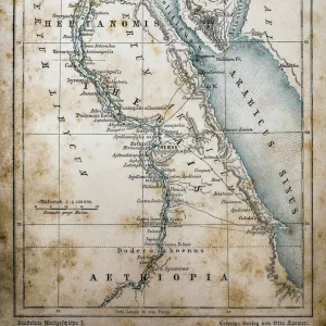
Photographic Print : Historical map of Cairo and surroundings, Egypt, lithograph, published 1897


![]()
Photo Prints from Fine Art Storehouse
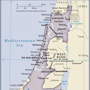
Historical map of Cairo and surroundings, Egypt, lithograph, published 1897
Historical map of Cairo and surrounding area, Egypt. Lithograph, published in 1897
Unleash your creativity and transform your space into a visual masterpiece!
ZU_09
Media ID 18292309
14"x11" Photo Print
Step back in time with our exquisite Historical Map of Cairo and Surroundings, Egypt, from the Media Storehouse Fine Art Collection. This stunning lithograph, published in 1897, offers a captivating glimpse into the past with intricate details of the urban layout and surrounding areas of Cairo during that era. The rich history of Egypt comes alive in this beautifully preserved piece, making it a must-have for history enthusiasts and collectors alike. Add an air of sophistication and character to your home or office décor with this unique and authentic work of art.
Photo prints are produced on Kodak professional photo paper resulting in timeless and breath-taking prints which are also ideal for framing. The colors produced are rich and vivid, with accurate blacks and pristine whites, resulting in prints that are truly timeless and magnificent. Whether you're looking to display your prints in your home, office, or gallery, our range of photographic prints are sure to impress. Dimensions refers to the size of the paper in inches.
Our Photo Prints are in a large range of sizes and are printed on Archival Quality Paper for excellent colour reproduction and longevity. They are ideal for framing (our Framed Prints use these) at a reasonable cost. Alternatives include cheaper Poster Prints and higher quality Fine Art Paper, the choice of which is largely dependant on your budget.
Estimated Product Size is 27.9cm x 35.5cm (11" x 14")
These are individually made so all sizes are approximate
Artwork printed orientated as per the preview above, with landscape (horizontal) or portrait (vertical) orientation to match the source image.
FEATURES IN THESE COLLECTIONS
> Africa
> Egypt
> Related Images
> Fine Art Storehouse
> Map
> Historical Maps
> Maps and Charts
> Early Maps
> Maps and Charts
> Related Images
EDITORS COMMENTS
This lithograph, titled "Historical map of Cairo and surroundings, Egypt" takes us on a mesmerizing journey through time. Published in 1897, this intricate piece of art offers a glimpse into the rich history and cultural heritage of one of the world's most iconic cities. The attention to detail is astounding as every street, alleyway, and landmark is meticulously illustrated with utmost precision. The artist's skillful hand has beautifully captured the essence of Cairo during that era, allowing us to immerse ourselves in its vibrant past. As we gaze upon this historical map, we are transported back to a bygone era when bustling markets filled with exotic spices and textiles lined the narrow streets. We can almost hear the echoes of horse-drawn carriages passing by majestic mosques adorned with intricate minarets. Beyond just being aesthetically pleasing, this lithograph serves as an invaluable resource for historians and enthusiasts alike. It provides valuable insights into urban planning and architectural development over time while also shedding light on how Cairo evolved into the sprawling metropolis it is today. Whether you have a deep appreciation for cartography or simply admire fine art that tells stories from yesteryears, this print will undoubtedly captivate your imagination. Let it transport you to an enchanting world where ancient civilizations coexist harmoniously with modernity – all within the timeless boundaries of Cairo's magnificent cityscape.
MADE IN THE USA
Safe Shipping with 30 Day Money Back Guarantee
FREE PERSONALISATION*
We are proud to offer a range of customisation features including Personalised Captions, Color Filters and Picture Zoom Tools
SECURE PAYMENTS
We happily accept a wide range of payment options so you can pay for the things you need in the way that is most convenient for you
* Options may vary by product and licensing agreement. Zoomed Pictures can be adjusted in the Cart.