Fraud Blocker Skip to main content

Home > Maps and Charts > Early Maps
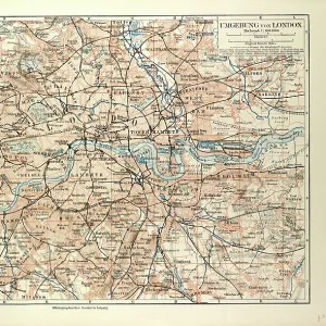
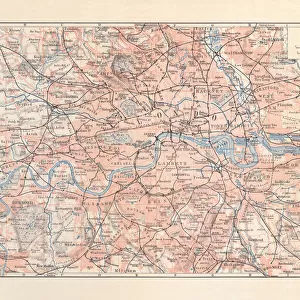
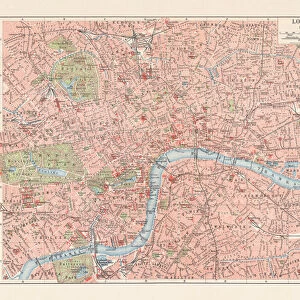
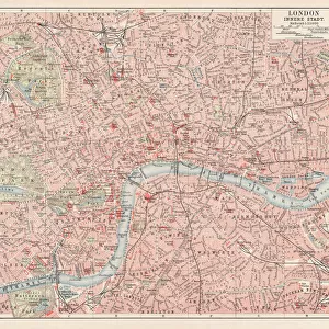
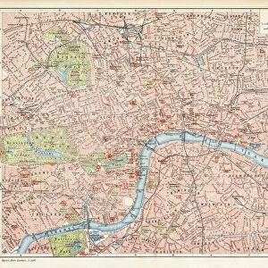
Map of London 1900

Map of London 1900


Photo Prints
Jigsaw Puzzles
Poster Prints
Canvas Prints
Fine Art Prints
Metal Prints
Home Decor


We accept all major credit cards

Fine Art Storehouse

Wall Art and Photo Gifts from Fine Art Storehouse

Map of London 1900

Meyers hand-Atlas Leipzig und Wien Verlag des Bibliographischen Instituts 1900

Unleash your creativity and transform your space into a visual masterpiece!

THEPALMER

Media ID 18106871

© 2014 Roberto Adrian Photography


FEATURES IN THESE COLLECTIONS

> Europe > United Kingdom > England > London > Related Images

> Fine Art Storehouse > Map > Historical Maps

> Fine Art Storehouse > Map

> Maps and Charts > Early Maps


MADE IN THE USA
Safe Shipping with 30 Day Money Back Guarantee

FREE PERSONALISATION*
We are proud to offer a range of customisation features including Personalised Captions, Color Filters and Picture Zoom Tools

SECURE PAYMENTS
We happily accept a wide range of payment options so you can pay for the things you need in the way that is most convenient for you

* Options may vary by product and licensing agreement. Zoomed Pictures can be adjusted in the Cart.


redeem
Beautiful Photo Prints and Gifts
image
Professionally Printed
inventory
Photo Prints are in stock
thumb_up
Professional quality finish
diamond
Made with high-grade materials
inventory_2
Carefully packed to aid safe arrival


Related Images


Old Map of London
Old Map of London
City map of London with suburbs, England, lithograph, published 1897
London Map 1806
London Map 1806
City of London EC4M 5 Map
City of London EC2N 1 Map
Postcode Sector Map sheet 8 London and M25
City map of London, England, downtown district, lithograph, published 1897
Plan of London looking towards Southwark (hand-coloured engraving)
Map of London (colour engraving)
Map of London 1900
Map of London 1900
London city map 1895
Croydon London UK City Street Map

+

Shipping

+

Choices

+

Reviews

+

Guaranteed


Related Collections


Early Maps
Early Maps
Browse 24,907 Prints
Map
Map
Browse 9,856 Prints
London Related Images
Browse 63,439 Prints
Historical Maps
Historical Maps
Browse 3,307 Prints