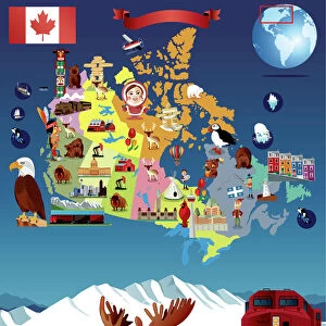
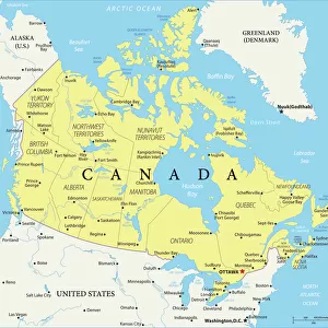
Home > North America > Canada > Maps
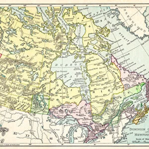
Map of Canada and Nova Scotia, 17th Century

![]()
Wall Art and Photo Gifts from Fine Art Storehouse
Map of Canada and Nova Scotia, 17th Century
Vintage engraving of Map of Canada and Nova Scotia, 17th Century
Unleash your creativity and transform your space into a visual masterpiece!
duncan1890
Media ID 18356577
FEATURES IN THESE COLLECTIONS
> Fine Art Storehouse
> Map
> Historical Maps
> Maps and Charts
> Early Maps
> North America
> Canada
> Maps
EDITORS COMMENTS
This vintage engraving takes us back in time to the 17th century, showcasing a meticulously detailed map of Canada and Nova Scotia. Crafted by the talented artist duncan1890, this print captures the essence of cartography from an era long gone. The intricacy of this map is truly remarkable, as it highlights the vastness and diversity of these Canadian territories during that period. Every contour line, river system, and mountain range has been delicately etched onto paper with utmost precision. The attention to detail allows us to immerse ourselves in a world where exploration was at its peak. As we gaze upon this historical masterpiece, our imagination runs wild with thoughts of early settlers navigating through uncharted lands and indigenous communities thriving amidst breathtaking landscapes. It serves as a reminder of the rich history that shaped these regions into what they are today. The sepia tones add an air of nostalgia to this print, evoking a sense of reverence for those who came before us and paved the way for future generations. Whether you're a history enthusiast or simply appreciate fine artistry, this piece will undoubtedly transport you back in time while igniting your curiosity about Canada's past. Displaying this exquisite print on your wall not only adds aesthetic appeal but also sparks conversations about our collective heritage. Let yourself be captivated by the allure of ancient cartography with this stunning depiction of Canada and Nova Scotia from centuries ago.
MADE IN THE USA
Safe Shipping with 30 Day Money Back Guarantee
FREE PERSONALISATION*
We are proud to offer a range of customisation features including Personalised Captions, Color Filters and Picture Zoom Tools
SECURE PAYMENTS
We happily accept a wide range of payment options so you can pay for the things you need in the way that is most convenient for you
* Options may vary by product and licensing agreement. Zoomed Pictures can be adjusted in the Cart.