Home > Africa > Cameroon > Maps
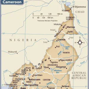
Historical map of Cameroon, lithograph, published in 1893

![]()
Wall Art and Photo Gifts from Fine Art Storehouse
Historical map of Cameroon, lithograph, published in 1893
Historical map of Cameroon during the German colonization in the late 19th century. Lithograph, published in 1893
Unleash your creativity and transform your space into a visual masterpiece!
ZU_09
Media ID 35842614
FEATURES IN THESE COLLECTIONS
> Fine Art Storehouse
> Map
> Historical Maps
> Maps and Charts
> Early Maps
EDITORS COMMENTS
This historical map of Cameroon, published in 1893, offers a fascinating glimpse into the geography and political landscape of the region during the late 19th century, a time marked by intense European colonization. The lithograph, produced by an unknown publisher, depicts the coastal areas of present-day Cameroon with remarkable detail, highlighting the numerous bays, inlets, and rivers that characterize this part of the African continent. At the time, Cameroon was a major point of contention between European powers, with Germany, France, and Britain vying for control. This map reflects the German colonization efforts, with the country's territorial claims clearly marked in red. The map also includes the names of several important German settlements and fortifications, such as Douala, Victoria, and Kamerun, which would go on to become major centers of German colonial administration. The map's intricate detail and accurate representation of the coastline are a testament to the advanced cartographic techniques of the late 19th century. The use of lithography, a printing process that allows for high-quality, detailed images, further enhances the map's visual appeal. Despite its historical significance, this map is not without its imperfections. The interior regions of Cameroon, which were less explored and understood at the time, are depicted with less accuracy, reflecting the limitations of European knowledge and exploration during this period. Overall, this historical map of Cameroon provides a valuable window into the past, offering insights into the geography, politics, and European colonial ambitions of the late 19th century. Its intricate detail and historical significance make it a must-have for collectors of historical maps and Africana.
MADE IN THE USA
Safe Shipping with 30 Day Money Back Guarantee
FREE PERSONALISATION*
We are proud to offer a range of customisation features including Personalised Captions, Color Filters and Picture Zoom Tools
SECURE PAYMENTS
We happily accept a wide range of payment options so you can pay for the things you need in the way that is most convenient for you
* Options may vary by product and licensing agreement. Zoomed Pictures can be adjusted in the Cart.