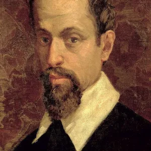
Home > Arts > Artists > I > Italian School Italian School
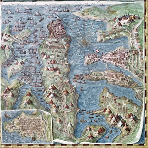
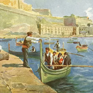
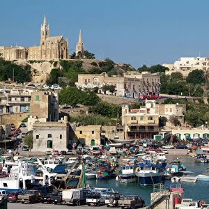
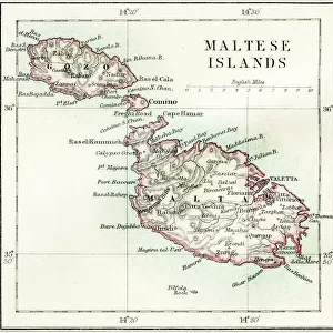
Map of Malta, detail from the Galleria delle Carte Geografiche, 1580-83

![]()
Poster Prints from Fine Art Finder
Map of Malta, detail from the Galleria delle Carte Geografiche, 1580-83
XIR260199 Map of Malta, detail from the Galleria delle Carte Geografiche, 1580-83 (fresco) (see 259885 for detail) by Italian School, (16th century); Vatican Museums and Galleries, Vatican City; (add.info.: 40 panels commissioned by Gregory XIII; Carte de l Ile de Malte; ); Italian, out of copyright
Media ID 12774719
© www.bridgemanimages.com
FEATURES IN THESE COLLECTIONS
> Arts
> Art Movements
> Renaissance Art
> Arts
> Artists
> I
> Italian School Italian School
> Europe
> Malta
> Related Images
> Europe
> Vatican City
> Maps
> Fine Art Finder
> Schools
> Italian School
> Historic
> Renaissance art
> Italian Renaissance art
EDITORS COMMENTS
This print showcases a remarkable detail from the Galleria delle Carte Geografiche, a masterpiece created between 1580 and 1583 by the Italian School of the 16th century. Housed in the Vatican Museums and Galleries in Vatican City, this particular section of the map focuses on Malta, an island rich with history and beauty. The intricate fresco reveals a wealth of fascinating elements that transport us back to Renaissance times. Ships gracefully navigate through bustling ports as they bring life to this vibrant island. An angel hovers above, perhaps symbolizing divine protection over this strategic Mediterranean location. A compass prominently displayed at the center reminds us of Malta's importance as a navigational hub during this era. Tents dotting the landscape suggest military encampments or temporary settlements, hinting at historical events that unfolded on these shores. Every brushstroke captures both artistic finesse and meticulous cartographic accuracy, making it clear why these maps were commissioned by Pope Gregory XIII himself. The level of detail is astonishing; every nook and cranny meticulously rendered with precision. As we gaze upon this stunning image, we are transported to another time - one where exploration was paramount and new worlds awaited discovery. It serves as a testament to human curiosity and ingenuity while also reminding us of our connection to history's great explorers who ventured into uncharted territories.
MADE IN THE USA
Safe Shipping with 30 Day Money Back Guarantee
FREE PERSONALISATION*
We are proud to offer a range of customisation features including Personalised Captions, Color Filters and Picture Zoom Tools
SECURE PAYMENTS
We happily accept a wide range of payment options so you can pay for the things you need in the way that is most convenient for you
* Options may vary by product and licensing agreement. Zoomed Pictures can be adjusted in the Cart.