Home > Maps and Charts > World
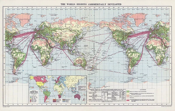
The world, regions commercially developed (colour litho)
![]()

Wall Art and Photo Gifts from Fine Art Finder
The world, regions commercially developed (colour litho)
3630823 The world, regions commercially developed (colour litho) by English School, (20th century); Private Collection; (add.info.: The world, regions commercially developed. Illustration for An Atlas of Commercial Geography compiled by Fawcett Allen (Cambridge, 1913).); © Look and Learn
Media ID 23637552
© Look and Learn / Bridgeman Images
Annual Bound Closing Commercial Dates Developed Foreign Geographical Interesting Navigation Opening Ports Principal Regions Unusual Approximate Commercially
FEATURES IN THESE COLLECTIONS
> Fine Art Finder
> Artists
> English School
> Maps and Charts
> Related Images
> Maps and Charts
> World
EDITORS COMMENTS
This print titled "The world, regions commercially developed" takes us on an unusual journey through the opening of geographical trade routes. The image showcases a beautifully detailed map, created in vibrant colour litho by an English School artist from the 20th century. Bound within this print is a fascinating glimpse into the annual cycle of commerce and development across the globe. The approximate dates marked on the map highlight when principal ports and regions were bustling with activity or closing for winter due to icy conditions. It's truly mesmerizing to see how trade flows shifted throughout history. What makes this piece even more interesting is its origin as an illustration for "An Atlas of Commercial Geography" compiled by Fawcett Allen in Cambridge back in 1913. This historical context adds depth to our understanding of how foreign markets were navigated during that era. As we explore each intricately drawn region, we are reminded of the immense influence commercial activities have had on shaping our world. From bustling ports to remote trading posts, this print encapsulates centuries worth of economic exchange and global interconnectedness. Displayed proudly in a private collection, this print serves as a reminder that geography and trade go hand-in-hand, forever leaving their mark on our shared human history.
MADE IN THE USA
Safe Shipping with 30 Day Money Back Guarantee
FREE PERSONALISATION*
We are proud to offer a range of customisation features including Personalised Captions, Color Filters and Picture Zoom Tools
SECURE PAYMENTS
We happily accept a wide range of payment options so you can pay for the things you need in the way that is most convenient for you
* Options may vary by product and licensing agreement. Zoomed Pictures can be adjusted in the Cart.


