Fraud Blocker Skip to main content

Home > Europe > United Kingdom > Maps

Maps Collection (page 7)

Maps of the United Kingdom and Europe are essential tools for travelers, businesses, and researchers

12,347 items

Background imageMaps Collection: A new map of Ireland civil and ecclesiastical, 1797 (manuscript)

A new map of Ireland civil and ecclesiastical, 1797 (manuscript)
7340441 A new map of Ireland civil and ecclesiastical, 1797 (manuscript) by Beaufort, Daniel Augustus (1739-1821); 53x88 cm; National Maritime Museum, London, UK; (add.info.: Creator: Daniel A)

Background imageMaps Collection: Plan of the harbour, fort, town and environs of Fort Royal in Martinique, 1793 (engraving)

Plan of the harbour, fort, town and environs of Fort Royal in Martinique, 1793 (engraving)
7340437 Plan of the harbour, fort, town and environs of Fort Royal in Martinique, 1793 (engraving) by Booth, William (18th century); 88x70 cm; National Maritime Museum, London

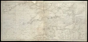
Background imageMaps Collection: The British Channel with a part of the Atlantic Ocean and of the Coast of Ireland, 1788 (print)

The British Channel with a part of the Atlantic Ocean and of the Coast of Ireland, 1788 (print)
7340084 The British Channel with a part of the Atlantic Ocean and of the Coast of Ireland, 1788 (print) by Sayer, Robert (1724/5-94); 44.2x92.9 cm; National Maritime Museum, London

Background imageMaps Collection: Sagittarius and Corona Australis. Microscopium and Telescopium., c.1825 (card, paper, tissue)

Sagittarius and Corona Australis. Microscopium and Telescopium., c.1825 (card, paper, tissue)
7340083 Sagittarius and Corona Australis. Microscopium and Telescopium., c.1825 (card, paper, tissue) by Hall, Sydney (fl.1826); National Maritime Museum, London

Background imageMaps Collection: A view of the town & harbour of Halifax, from Dartmouth shore, 1777 (engraving)

A view of the town & harbour of Halifax, from Dartmouth shore, 1777 (engraving)
7340422 A view of the town & harbour of Halifax, from Dartmouth shore, 1777 (engraving) by DesBarres, Joseph Frederick Wallet (1721-1824); 54.5x79 cm; National Maritime Museum, London

Background imageMaps Collection: A chart of the bay and harbour of Pensacola in the province of West Florida

A chart of the bay and harbour of Pensacola in the province of West Florida, 1780 (single sheet engraving)
7340421 A chart of the bay and harbour of Pensacola in the province of West Florida, 1780 (single sheet engraving) by DesBarres

Background imageMaps Collection: The River St. John, 1780 (engraving)

The River St. John, 1780 (engraving)
7340407 The River St. John, 1780 (engraving) by DesBarres, Joseph Frederick Wallet (1721-1824); 54.5x78.5 cm; National Maritime Museum, London, UK; (add.info.: Creator: J. F. W. Des Barres Scale: ca)

Background imageMaps Collection: The River St. John, 1776 (engraving)

The River St. John, 1776 (engraving)
7340401 The River St. John, 1776 (engraving) by DesBarres, Joseph Frederick Wallet (1721-1824); 54.5x78.5 cm; National Maritime Museum, London, UK; (add.info.: Creator: J. F. W. Des Barres Scale: ca)

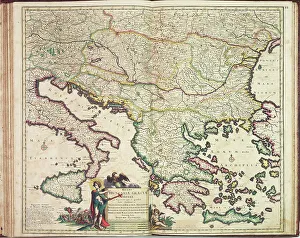
Background imageMaps Collection: Justus Danckers's atlas: Hungary and Greece, c.1688 (coloured engraving)

Justus Danckers's atlas: Hungary and Greece, c.1688 (coloured engraving)
7340066 Justus Danckers's atlas: Hungary and Greece, c.1688 (coloured engraving) by Danckertsz, Justus (1635-1701); 50x59 cm; National Maritime Museum, London

Background imageMaps Collection: The Carybsche Eylanden of Barbados to the bend of Mexico, 1656 (engraving)

The Carybsche Eylanden of Barbados to the bend of Mexico, 1656 (engraving)
7340058 The Carybsche Eylanden of Barbados to the bend of Mexico, 1656 (engraving) by Colom, Arnold (1624-68) & Colom, Jacob Aertsz (1600-73); 55x64 cm; National Maritime Museum, London

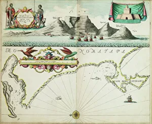
Background imageMaps Collection: A chart of Guinea describing the sea coast from Cape de Verde to Cape Bona Esperanca

A chart of Guinea describing the sea coast from Cape de Verde to Cape Bona Esperanca, 1677 (coloured engraving)
7340049 A chart of Guinea describing the sea coast from Cape de Verde to Cape Bona Esperanca, 1677 (coloured engraving) by Seller, John (1632-97); 43x54 cm; National Maritime Museum, London

Background imageMaps Collection: Angliae, Scotiae, et Hiberniae, sive Britannicar: Insularum descriptio (England)

Angliae, Scotiae, et Hiberniae, sive Britannicar: Insularum descriptio (England, Scotland and Ireland)
7340123 Angliae, Scotiae, et Hiberniae, sive Britannicar: Insularum descriptio (England, Scotland and Ireland, otherwise known as the British Isles)

Background imageMaps Collection: Americae Sive Novi Orbis, Nova Descriptio (The Americas or the New World, newly described)

Americae Sive Novi Orbis, Nova Descriptio (The Americas or the New World, newly described)
7340118 Americae Sive Novi Orbis, Nova Descriptio (The Americas or the New World, newly described), 1573 (copperplate engraving on paper) by Ortelius

Background imageMaps Collection: The Spanish and English fleets near Plymouth on 30 - 31 July, 1588, c.1590 (coloured engraving)

The Spanish and English fleets near Plymouth on 30 - 31 July, 1588, c.1590 (coloured engraving)
7340024 The Spanish and English fleets near Plymouth on 30 - 31 July, 1588, c.1590 (coloured engraving) by Adams, Robert (1540-95) (after); 38x50 cm; National Maritime Museum, London

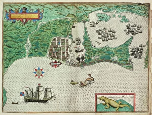
Background imageMaps Collection: Map of Cartagena, 1588 (engraving)

Map of Cartagena, 1588 (engraving)
7340018 Map of Cartagena, 1588 (engraving) by Boazio, Baptista (fl.1588-1606); National Maritime Museum, London, UK; (add.info.: Creator)

Background imageMaps Collection: A description of the sea coastes, of the land of Algarbe, and a parte of the Condado with their

A description of the sea coastes, of the land of Algarbe, and a parte of the Condado with their shew & opening
7340014 A description of the sea coastes, of the land of Algarbe, and a parte of the Condado with their shew & opening, c.1588 (drawing) by Janszoon Waghenaer

Background imageMaps Collection: England east coast entrance to the River Humber surveyed by Staff Captain J

England east coast entrance to the River Humber surveyed by Staff Captain J
7339967 England east coast entrance to the River Humber surveyed by Staff Captain J. Parsons, Royal Navy, 1878-90 (technical drawing) by British School

Background imageMaps Collection: Chart of the River Thames and Estuary, 1790 (coloured engraving)

Chart of the River Thames and Estuary, 1790 (coloured engraving)
7337586 Chart of the River Thames and Estuary, 1790 (coloured engraving) by Stanier, Richard (fl.1790); 43.5x54 cm; National Maritime Museum, London

Background imageMaps Collection: A Representation of the Battell fought betweene the English Fleet... And the Dutch Fleet

A Representation of the Battell fought betweene the English Fleet... And the Dutch Fleet... on the 25th July 1666
7337559 A Representation of the Battell fought betweene the English Fleet... And the Dutch Fleet... on the 25th July 1666

Background imageMaps Collection: The Thames Estuary from The Sea-Mirrour atlas by Willem Janszoon Blaeu

The Thames Estuary from The Sea-Mirrour atlas by Willem Janszoon Blaeu, published in Amsterdam in 1633, 1633 (chart)
7337555 The Thames Estuary from The Sea-Mirrour atlas by Willem Janszoon Blaeu, published in Amsterdam in 1633, 1633 (chart) by Blaeu, Willem (1571-1638); 25.5x21.5 cm; National Maritime Museum

Background imageMaps Collection: The Arctic Council, 19th century (mezzotint, board)

The Arctic Council, 19th century (mezzotint, board)
7295271 The Arctic Council, 19th century (mezzotint, board) by Pearce, Stephen (1819-1904) (after); 55.5x77.5 cm; National Maritime Museum, London, UK; (add.info.: Print)

Background imageMaps Collection: A new map or chart of the western or Atlantic ocean with part of Europe, Africa and America

A new map or chart of the western or Atlantic ocean with part of Europe, Africa and America
7295401 A new map or chart of the western or Atlantic ocean with part of Europe, Africa and America: showing the course of the galleons to and from the West Indies, 1740 (engraving) by Bowen

Background imageMaps Collection: Cook's Third Voyage 1778-1779, 1784-1804 (technical drawing)

Cook's Third Voyage 1778-1779, 1784-1804 (technical drawing)
7295389 Cook's Third Voyage 1778-1779, 1784-1804 (technical drawing) by Faden, William (1750-1836); National Maritime Museum, London

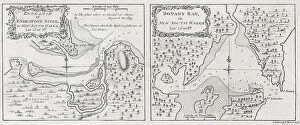
Background imageMaps Collection: Captain James Cook's charts entrance of Endeavour River and Botany Bay in New South Wales

Captain James Cook's charts entrance of Endeavour River and Botany Bay in New South Wales
7295280 Captain James Cook's charts entrance of Endeavour River and Botany Bay in New South Wales, 1772-73 (engraving & etching) by Bowen, Thomas (c.1790); 28.5x46.6 cm; National Maritime Museum

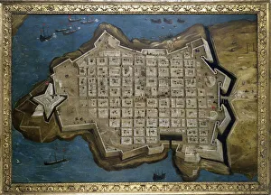
Background imageMaps Collection: Siege of Malta: Valletta (Valletta), late 16th century (oil on canvas)

Siege of Malta: Valletta (Valletta), late 16th century (oil on canvas)
MMM5457818 Siege of Malta: Valletta (Valletta), late 16th century (oil on canvas); National Maritime Museum, London, UK; (add.info.: Siege of Malta: Valletta (Valletta), September 13, 1565

Background imageMaps Collection: Marine compass, used to measure distances on maps. Copper and steel object

Marine compass, used to measure distances on maps. Copper and steel object, c.1770 (copper and steel)
MMM5476139 Marine compass, used to measure distances on maps. Copper and steel object, c.1770 (copper and steel); National Maritime Museum, London, UK; (add.info.: Marine compass)

Background imageMaps Collection: Celestial globe with table, supported by Hercules, c.1651 (ivory statuette and gilded copper)

Celestial globe with table, supported by Hercules, c.1651 (ivory statuette and gilded copper)
MMM5475266 Celestial globe with table, supported by Hercules, c.1651 (ivory statuette and gilded copper); National Maritime Museum, London, UK; (add.info.: Celestial globe with table)

Background imageMaps Collection: 'Rhodes and Symi (Greek islands) facing the Turkish coast

'Rhodes and Symi (Greek islands) facing the Turkish coast
MMM5474179 'Rhodes and Symi (Greek islands) facing the Turkish coast; National Maritime Museum, London, UK; (add.info.: Rhodes and Symi (Greek islands) facing the Turkish coast

Background imageMaps Collection: Symi, cartographic survey of the Greek island, with handwritten notes on vellum

Symi, cartographic survey of the Greek island, with handwritten notes on vellum
MMM5474161 Symi, cartographic survey of the Greek island, with handwritten notes on vellum by Buondelmonti, Cristoforo (1385-1430); National Maritime Museum, London, UK; (add.info.: Symi)

Background imageMaps Collection: Map of the inland navigation of England and Wales by the canals and principal rivers, 1809

Map of the inland navigation of England and Wales by the canals and principal rivers, 1809
FLO4974709 Map of the inland navigation of England and Wales by the canals and principal rivers, 1809. Copperplate engraving by Mutlow from John Mason Good's Pantologia, a New Encyclopedia, G

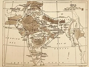
Background imageMaps Collection: Map showing the British Control over India

Map showing the British Control over India
3523302 Map showing the British Control over India; (add.info.: Map showing the British Control over India. Dated 19th Century); Universal History Archive/UIG

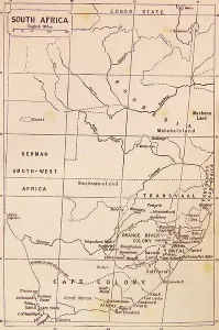
Background imageMaps Collection: Map of South Africa during the 19th Century

Map of South Africa during the 19th Century
3523214 Map of South Africa during the 19th Century; (add.info.: Map of South Africa during the 19th Century); Universal History Archive/UIG

Background imageMaps Collection: Map of British Fortifications in Boston (Massachusetts, USA) 1775-1776

Map of British Fortifications in Boston (Massachusetts, USA) 1775-1776. (War of Independence of the United States)
NWI4843691 Map of British Fortifications in Boston (Massachusetts, USA) 1775-1776. (War of Independence of the United States, 1776-1783)

Background imageMaps Collection: War of Independence of the United States of America (1775-1783)

War of Independence of the United States of America (1775-1783): English colony of North America in 1776
NWI4842561 War of Independence of the United States of America (1775-1783): English colony of North America in 1776. Color lithography.; (add.info)

Background imageMaps Collection: United States of America Independence War (1775-1783): Route of American ships 'Ranger'

United States of America Independence War (1775-1783): Route of American ships "Ranger"
NWI4842352 United States of America Independence War (1775-1783): Route of American ships "Ranger" and "Bonhomme Richard" near the British islands during the war

Background imageMaps Collection: First World War: Patriotic Map of a Hairy Young from Scotland entitled Let's Help You, 1916

First World War: Patriotic Map of a Hairy Young from Scotland entitled Let's Help You, 1916
LUX4744643 First World War: Patriotic Map of a Hairy Young from Scotland entitled Let's Help You, 1916; (add.info.: World War I - War 14-18 (1914-1918) - World War I (WWI or WW1)

Background imageMaps Collection: First World War: Patriotic map showing three sailors of the allies: French, English and Russian

First World War: Patriotic map showing three sailors of the allies: French, English and Russian
LUX4745102 First World War: Patriotic map showing three sailors of the allies: French, English and Russian, hand in hand on a warship, declaring: 'But let's always go and hand in hand a babord

Background imageMaps Collection: First World War: France, Patriotic Map showing a dog lying down with writing

First World War: France, Patriotic Map showing a dog lying down with writing, Who said german sausage
LUX4741340 First World War: France, Patriotic Map showing a dog lying down with writing, Who said german sausage? (who said German sausage)

Background imageMaps Collection: Geographic map of Great Britain, Scotland and Ireland, the Atlantic Ocean and the North Sea

Geographic map of Great Britain, Scotland and Ireland, the Atlantic Ocean and the North Sea
NWI4832911 Geographic map of Great Britain, Scotland and Ireland, the Atlantic Ocean and the North Sea, showing the route of the Spanish Great Armada (Invincible Armada) in 1588

Background imageMaps Collection: First World War: France, Patriotic Map showing an Australian soldier

First World War: France, Patriotic Map showing an Australian soldier and an English soldier stand by hand to defend
LUX4739490 First World War: France, Patriotic Map showing an Australian soldier and an English soldier stand by hand to defend France, titled 'United we stall'

Background imageMaps Collection: First World War: France, Patriotic Map showing four young children in Italian, English

First World War: France, Patriotic Map showing four young children in Italian, English
LUX4738404 First World War: France, Patriotic Map showing four young children in Italian, English, Belgian and Russian soldier uniforms around the French flag

Background imageMaps Collection: First World War: France, Patriotic Map showing the five new nes of five allies under

First World War: France, Patriotic Map showing the five new nes of five allies under the protective leadership of
LUX4738234 First World War: France, Patriotic Map showing the five new nes of five allies under the protective leadership of France, entitled: 'For Law, for Liberty, Peace through Victory'

Background imageMaps Collection: Chart of the Rio de la Plata (river Plate), 1806 (engraving)

Chart of the Rio de la Plata (river Plate), 1806 (engraving)
7342111 Chart of the Rio de la Plata (river Plate), 1806 (engraving) by Arrowsmith (19th century); 14.2x23.1 cm; National Maritime Museum, London

Background imageMaps Collection: Chart of New Zealand, 1856-81 (print)

Chart of New Zealand, 1856-81 (print)
7342581 Chart of New Zealand, 1856-81 (print) by Walker, J. & C. (19th century); 67x98 cm; National Maritime Museum, London

Background imageMaps Collection: A Map of the World, c.1805 (silk)

A Map of the World, c.1805 (silk)
7342574 A Map of the World, c.1805 (silk) by Unknown Artist, (19th century); 51x85.3 cm; National Maritime Museum, London

Background imageMaps Collection: A chart of the southern hemisphere; shewing the tracks of some of the most distinguished navigators

A chart of the southern hemisphere; shewing the tracks of some of the most distinguished navigators
7342328 A chart of the southern hemisphere; shewing the tracks of some of the most distinguished navigators, by Captain James Cook, of His Majesty's Navy, 1777 (print) by Cook

Background imageMaps Collection: (Wind chart, showing winds for the four quarters of the year) Cape Horn (1)

(Wind chart, showing winds for the four quarters of the year) Cape Horn (1) eastern vicinity (sold by J.D Potter, 31)
7342743 (Wind chart, showing winds for the four quarters of the year) Cape Horn (1) eastern vicinity (sold by J.D Potter, 31, poultry, price one shilling, 1855 (print) by British School

Background imageMaps Collection: Mediterranean anchorages on the south coast of Spain from Spanish Government surveys of 1891

Mediterranean anchorages on the south coast of Spain from Spanish Government surveys of 1891
7342490 Mediterranean anchorages on the south coast of Spain from Spanish Government surveys of 1891, 1891-1913 (technical drawing) by British School


All Professionally Made to Order for Quick Shipping


-

Maps Collection

Maps of the United Kingdom and Europe are essential tools for travelers, businesses, and researchers. They provide an overview of the physical landscape as well as political boundaries. Maps of the UK include detailed road maps, topographic maps, and tourist maps. Maps of Europe show countries, cities, rivers and mountains in great detail. In addition to traditional paper maps there are digital versions available online that can be used on mobile devices or computers. With these digital versions users can zoom in to get a closer look at any area they wish to explore or research further and can an invaluable resource for understanding geography and planning trips around the world.
+

Our beautiful pictures are available as Framed Prints, Photos, Wall Art and Photo Gifts

The Maps of United Kingdom Europe collection from Media Storehouse is a stunning range of wall art and framed prints that showcase the beauty and diversity of the European continent. Our collection features an extensive selection of maps, including antique maps, modern maps, topographical maps, and political maps. Each map has been carefully curated to provide a unique perspective on the geography and history of Europe. Whether you're looking for a vintage-style map to add character to your home decor or a contemporary map that showcases the latest geographic data, our collection has something for everyone. The Maps of United Kingdom Europe collection is perfect for anyone who loves travel, geography or history. These high-quality prints are available in various sizes and formats to suit any space. They make excellent gifts for friends and family members who share your passion for exploring new places or learning about different cultures. With its vast array of options, our collection is sure to inspire wanderlust in all those who view it.
+

What are Maps of United Kingdom Europe art prints?

Maps of United Kingdom Europe art prints are high-quality reproductions of antique and contemporary maps depicting the geography, topography, and landmarks of the UK and Europe. These prints showcase intricate details such as borders, cities, rivers, mountains, forests, and other natural features that make up these regions. These art prints are perfect for history buffs or anyone interested in exploring the rich cultural heritage of the UK and Europe. They can be used to decorate homes or offices with a unique touch of sophistication while also serving as educational tools for students studying geography or history. We offer a wide range of Maps of United Kingdom Europe art prints from various sources including museums, archives, libraries and private collections. The collection includes vintage maps dating back centuries ago to modern-day digital cartography created by skilled artists. Whether you're looking for an antique map to add character to your living room or a contemporary print for your office space Media Storehouse has something suitable for every taste.
+

What Maps of United Kingdom Europe art prints can I buy from Media Storehouse?

We offer a wide range of Maps of United Kingdom Europe art prints that are perfect for decorating your home or office. You can choose from vintage maps, modern maps, and even satellite images of the UK and Europe. These art prints come in various sizes to fit any space you have in mind. Some popular options include antique-style world maps with intricate details, colourful political maps showing country borders and capital cities, as well as topographic maps highlighting mountain ranges and rivers. Additionally, Media Storehouse also offers city street maps featuring London's famous landmarks or Paris' charming streets. Whether you're looking for a unique gift or want to add some character to your living space, we have plenty of Maps of United Kingdom Europe art prints to choose from. With high-quality printing on premium paper stock, these art prints will make a stunning addition to any room.
+

How do I buy Maps of United Kingdom Europe art prints?

To purchase Maps of United Kingdom Europe art prints from Media Storehouse, you can browse our extensive collection online. We offer a range of maps in different styles and sizes to suit your preferences. Once you have found the map that you would like to buy, simply add it to your cart and proceed to checkout. During the checkout process, you will be prompted to enter your payment details and shipping address. You can choose from a variety of payment options including credit card, PayPal or Apple Pay. We offer high-quality prints on premium paper using state-of-the-art printing technology. Their prints are produced using archival quality ink which ensures long-lasting color vibrancy. Once your order has been processed, it will be carefully packaged and shipped directly to your doorstep. If you have any questions about the ordering process or need assistance with selecting a print, our customer service team is available to help via email or phone.
+

How much do Maps of United Kingdom Europe art prints cost?

The cost of Maps of United Kingdom Europe art prints can vary depending on a number of factors. The size, quality, and type of paper used for printing are all factors that can affect the price. Additionally, the artist or publisher who created the print may also influence its cost. Generally speaking, smaller prints will be less expensive than larger ones. Prints made with lower-quality materials may also be cheaper than those made with higher-quality materials. However, it's important to note that some collectors and enthusiasts may place a premium on certain types of prints or artists. Ultimately, the best way to determine how much a Maps of United Kingdom Europe art print will cost is to research different options from various sources. By comparing prices and features across different retailers and publishers, you'll be able to find a print that fits your budget while still meeting your needs in terms of style and quality.
+

How will my Maps of United Kingdom Europe art prints be delivered to me?

Your Maps of United Kingdom Europe art prints will be delivered to you in a safe and secure manner. The prints are carefully packaged using high-quality materials to ensure that they arrive at your doorstep in pristine condition. Depending on the size and quantity of your order, the prints may be rolled up and shipped in a sturdy tube or flat-packed with additional protection. Media Storehouse takes great care when handling your artwork, so you can rest assured that it will arrive safely. Once dispatched, you will receive an email confirmation along with tracking information so that you can monitor the progress of your delivery. The company works with trusted shipping partners who have years of experience delivering fragile items such as artwork. They aim to deliver all orders promptly and efficiently while keeping their customers informed throughout the process. Media Storehouse ensures that your Maps of United Kingdom Europe art prints are delivered securely and reliably, giving you peace of mind knowing that your purchase is in good hands.