
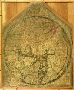
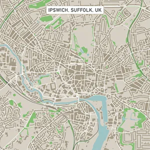
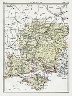
Maps Collection
Maps of the United Kingdom and Europe are essential tools for travelers, businesses, and researchers
Choose a picture from our Maps Collection for your Wall Art and Photo Gifts
12,293 items


All Professionally Made to Order for Quick Shipping
-
Maps Collection
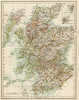
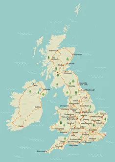
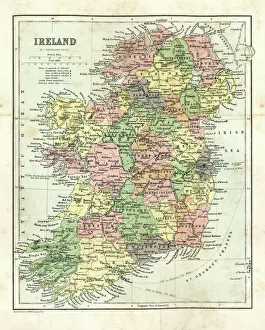
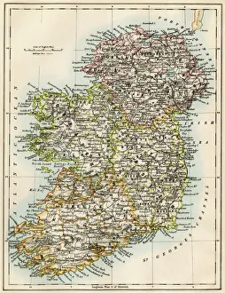
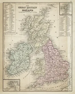
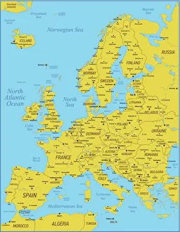
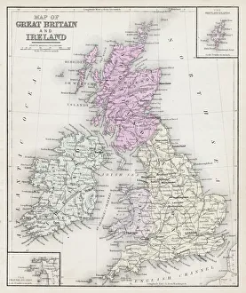
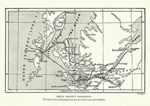
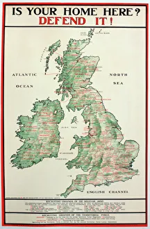
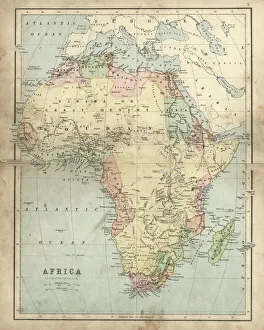
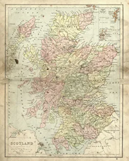
Maps of the United Kingdom and Europe are essential tools for travelers, businesses, and researchers. They provide an overview of the physical landscape as well as political boundaries. Maps of the UK include detailed road maps, topographic maps, and tourist maps. Maps of Europe show countries, cities, rivers and mountains in great detail. In addition to traditional paper maps there are digital versions available online that can be used on mobile devices or computers. With these digital versions users can zoom in to get a closer look at any area they wish to explore or research further and can an invaluable resource for understanding geography and planning trips around the world.
+
Our beautiful pictures are available as Framed Prints, Photos, Wall Art and Photo Gifts
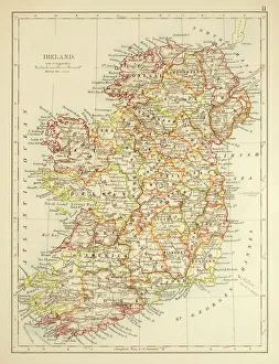
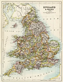
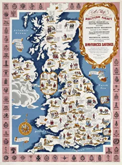
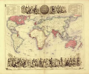
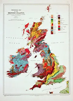
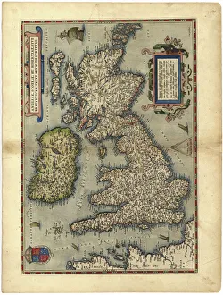
The Maps of United Kingdom Europe collection from Media Storehouse is a stunning range of wall art and framed prints that showcase the beauty and diversity of the European continent. Our collection features an extensive selection of maps, including antique maps, modern maps, topographical maps, and political maps. Each map has been carefully curated to provide a unique perspective on the geography and history of Europe. Whether you're looking for a vintage-style map to add character to your home decor or a contemporary map that showcases the latest geographic data, our collection has something for everyone. The Maps of United Kingdom Europe collection is perfect for anyone who loves travel, geography or history. These high-quality prints are available in various sizes and formats to suit any space. They make excellent gifts for friends and family members who share your passion for exploring new places or learning about different cultures. With its vast array of options, our collection is sure to inspire wanderlust in all those who view it.
+
What are Maps of United Kingdom Europe art prints?
Maps of United Kingdom Europe art prints are high-quality reproductions of antique and contemporary maps depicting the geography, topography, and landmarks of the UK and Europe. These prints showcase intricate details such as borders, cities, rivers, mountains, forests, and other natural features that make up these regions. These art prints are perfect for history buffs or anyone interested in exploring the rich cultural heritage of the UK and Europe. They can be used to decorate homes or offices with a unique touch of sophistication while also serving as educational tools for students studying geography or history. We offer a wide range of Maps of United Kingdom Europe art prints from various sources including museums, archives, libraries and private collections. The collection includes vintage maps dating back centuries ago to modern-day digital cartography created by skilled artists. Whether you're looking for an antique map to add character to your living room or a contemporary print for your office space Media Storehouse has something suitable for every taste.
+
What Maps of United Kingdom Europe art prints can I buy from Media Storehouse?
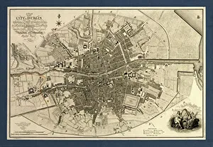
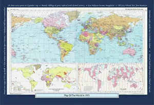
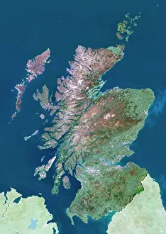
We offer a wide range of Maps of United Kingdom Europe art prints that are perfect for decorating your home or office. You can choose from vintage maps, modern maps, and even satellite images of the UK and Europe. These art prints come in various sizes to fit any space you have in mind. Some popular options include antique-style world maps with intricate details, colourful political maps showing country borders and capital cities, as well as topographic maps highlighting mountain ranges and rivers. Additionally, Media Storehouse also offers city street maps featuring London's famous landmarks or Paris' charming streets. Whether you're looking for a unique gift or want to add some character to your living space, we have plenty of Maps of United Kingdom Europe art prints to choose from. With high-quality printing on premium paper stock, these art prints will make a stunning addition to any room.
+
How do I buy Maps of United Kingdom Europe art prints?
To purchase Maps of United Kingdom Europe art prints from Media Storehouse, you can browse our extensive collection online. We offer a range of maps in different styles and sizes to suit your preferences. Once you have found the map that you would like to buy, simply add it to your cart and proceed to checkout. During the checkout process, you will be prompted to enter your payment details and shipping address. You can choose from a variety of payment options including credit card, PayPal or Apple Pay. We offer high-quality prints on premium paper using state-of-the-art printing technology. Their prints are produced using archival quality ink which ensures long-lasting color vibrancy. Once your order has been processed, it will be carefully packaged and shipped directly to your doorstep. If you have any questions about the ordering process or need assistance with selecting a print, our customer service team is available to help via email or phone.
+
How much do Maps of United Kingdom Europe art prints cost?
The cost of Maps of United Kingdom Europe art prints can vary depending on a number of factors. The size, quality, and type of paper used for printing are all factors that can affect the price. Additionally, the artist or publisher who created the print may also influence its cost. Generally speaking, smaller prints will be less expensive than larger ones. Prints made with lower-quality materials may also be cheaper than those made with higher-quality materials. However, it's important to note that some collectors and enthusiasts may place a premium on certain types of prints or artists. Ultimately, the best way to determine how much a Maps of United Kingdom Europe art print will cost is to research different options from various sources. By comparing prices and features across different retailers and publishers, you'll be able to find a print that fits your budget while still meeting your needs in terms of style and quality.
+
How will my Maps of United Kingdom Europe art prints be delivered to me?
Your Maps of United Kingdom Europe art prints will be delivered to you in a safe and secure manner. The prints are carefully packaged using high-quality materials to ensure that they arrive at your doorstep in pristine condition. Depending on the size and quantity of your order, the prints may be rolled up and shipped in a sturdy tube or flat-packed with additional protection. Media Storehouse takes great care when handling your artwork, so you can rest assured that it will arrive safely. Once dispatched, you will receive an email confirmation along with tracking information so that you can monitor the progress of your delivery. The company works with trusted shipping partners who have years of experience delivering fragile items such as artwork. They aim to deliver all orders promptly and efficiently while keeping their customers informed throughout the process. Media Storehouse ensures that your Maps of United Kingdom Europe art prints are delivered securely and reliably, giving you peace of mind knowing that your purchase is in good hands.