Fraud Blocker Skip to main content

Home > Europe > Spain > Maps

Maps Collection (page 8)

Maps of Spain Europe are a great way to explore the country and its surroundings

1,429 items

Background imageMaps Collection: Bahia de Ancon de Sardinas, 1682 (coloured manuscript)

Bahia de Ancon de Sardinas, 1682 (coloured manuscript)
7339598 Bahia de Ancon de Sardinas, 1682 (coloured manuscript) by Ringrose, Basil (c.1653-83); 16x20 cm; National Maritime Museum, London, UK; (add.info.: Creator: Basil Ringrose Bound sheet. Col)

Background imageMaps Collection: Chart of the harbour of Rio de Janeiro, Brazil, c.1849 (pen, ink)

Chart of the harbour of Rio de Janeiro, Brazil, c.1849 (pen, ink)
7295643 Chart of the harbour of Rio de Janeiro, Brazil, c.1849 (pen, ink) by Fanshawe, Admiral Sir Edward Gennys (1814-1906); 47.7x45.3 cm; National Maritime Museum, London

Background imageMaps Collection: A chart of the coast of America from Newfoundland to Cape Cod, 1675 (engraving)

A chart of the coast of America from Newfoundland to Cape Cod, 1675 (engraving)
7295422 A chart of the coast of America from Newfoundland to Cape Cod, 1675 (engraving) by Seller, John (1632-97); 45x55.5 cm; National Maritime Museum, London

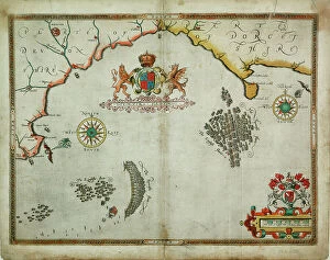
Background imageMaps Collection: Course of Spanish Armada, British Isles and Ireland, 1588 (print)

Course of Spanish Armada, British Isles and Ireland, 1588 (print)
7419890 Course of Spanish Armada, British Isles and Ireland, 1588 (print); (add.info.: Ornamental map, decorated allegorically)

Background imageMaps Collection: The Port of Mahon and surrounding area, from Cala Murte to Cala Rafalet, 1786 (engraving)

The Port of Mahon and surrounding area, from Cala Murte to Cala Rafalet, 1786 (engraving)
7339376 The Port of Mahon and surrounding area, from Cala Murte to Cala Rafalet, 1786 (engraving) by Salvador Carmona, Manuel (1734-1820); 63x99 cm; National Maritime Museum, London

Background imageMaps Collection: The southern coast of Spain, 1804 (engraving)

The southern coast of Spain, 1804 (engraving)
7339363 The southern coast of Spain, 1804 (engraving) by Knight, John (19th century); 59x90 cm; National Maritime Museum, London, UK; (add.info.: Creator: John Knight; P Steel Single sheet. Engr)

Background imageMaps Collection: Nelson explains the Trafalgar battle plan, 1806 (coloured engraving)

Nelson explains the Trafalgar battle plan, 1806 (coloured engraving)
7341898 Nelson explains the Trafalgar battle plan, 1806 (coloured engraving) by Craig, William Marshall (fl.1788-1828) (after); 50.5x34.9 cm; National Maritime Museum, London

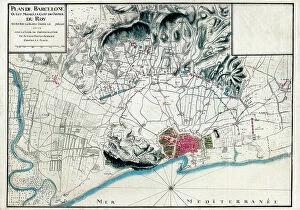
Background imageMaps Collection: Guerre de la ligue d'Augsbourg ou guerre de neuf ans: le siege de Barcelone (1697)

Guerre de la ligue d'Augsbourg ou guerre de neuf ans: le siege de Barcelone (1697)
AIS5386881 Guerre de la ligue d'Augsbourg ou guerre de neuf ans: le siege de Barcelone (1697), carte francaise avec la position des troupes de Louis XIV (1638-1715)

Background imageMaps Collection: Map of the Archbishopric of Mexico, View of the Tenochtitlan Region, Chalco Lagoon

Map of the Archbishopric of Mexico, View of the Tenochtitlan Region, Chalco Lagoon, and Tesco (Manuscript)
AIS5391590 Map of the Archbishopric of Mexico, View of the Tenochtitlan Region, Chalco Lagoon, and Tesco (Manuscript); Castilla-La Mancha, Toledo, Spain; (add.info.: Colour manuscript from 1767)

Background imageMaps Collection: French map of the city of Roses and the Fortress of Trinity in Spain (xylography)

French map of the city of Roses and the Fortress of Trinity in Spain (xylography)
AIS5350299 French map of the city of Roses and the Fortress of Trinity in Spain (xylography); © Iberfoto

Background imageMaps Collection: Plan of the positions of the Franco-Spanish fleets at the start of the Battle of Trafalgar (1805)

Plan of the positions of the Franco-Spanish fleets at the start of the Battle of Trafalgar (1805)
MMM5482391 Plan of the positions of the Franco-Spanish fleets at the start of the Battle of Trafalgar (1805). 19th century watercolor.; National Maritime Museum, London

Background imageMaps Collection: Map of the Siege of Barcelona in April 1706 (colour litho)

Map of the Siege of Barcelona in April 1706 (colour litho)
6317519 Map of the Siege of Barcelona in April 1706 (colour litho) by English School, (18th century); (add.info.: Print by Pieter van Call after a work by Alexander Forbes.); Photo © Ken Welsh

Background imageMaps Collection: Geography : map representing the Americas with the traces of the voyages of the navigator

Geography : map representing the Americas with the traces of the voyages of the navigator Christopher Columbus to
VEN5031147 Geography : map representing the Americas with the traces of the voyages of the navigator Christopher Columbus to the New World.; (add.info)

Background imageMaps Collection: A description of the sea coastes of Eyder Ditmers and a part of Jeverland with the rivers of

A description of the sea coastes of Eyder Ditmers and a part of Jeverland with the rivers of Weser, Elve, Eyder
7340017 A description of the sea coastes of Eyder Ditmers and a part of Jeverland with the rivers of Weser, Elve, Eyder, Hever and other entrees sandes and shoaldes

Background imageMaps Collection: The southern tip of Peru, South America, c.1590 (hand coloured)

The southern tip of Peru, South America, c.1590 (hand coloured)
7340745 The southern tip of Peru, South America, c.1590 (hand coloured) by Doetechum, Johannes Baptista van, the Younger (c.1560-1630); National Maritime Museum, London

Background imageMaps Collection: Geographic map of Spain and Portugal under the Romans, 409 AD (Map of Spain)

Geographic map of Spain and Portugal under the Romans, 409 AD (Map of Spain)
ELD4924796 Geographic map of Spain and Portugal under the Romans, 409 AD (Map of Spain and Portugal at the times of roman reign 109 AD) Engraving from " Atlas Universel" by Houze

Background imageMaps Collection: Geographic map of Spain and Portugal at the time of the reconquista from the Battle of Las Navas

Geographic map of Spain and Portugal at the time of the reconquista from the Battle of Las Navas de Tolosa in 1212 to
ELD4924729 Geographic map of Spain and Portugal at the time of the reconquista from the Battle of Las Navas de Tolosa in 1212 to the fall of Granada in 1492 (Al-Andalus)

Background imageMaps Collection: Map of the Iberian Peninsula (Kingdom of Spain and Aragon and Portugal) in the 14th and 15th century

Map of the Iberian Peninsula (Kingdom of Spain and Aragon and Portugal) in the 14th and 15th century
NWI4869685 Map of the Iberian Peninsula (Kingdom of Spain and Aragon and Portugal) in the 14th and 15th century. Lithograph of the 19th century; (add.info)

Background imageMaps Collection: Geographic map of European claims on North American territories in 1733 when the last colony

Geographic map of European claims on North American territories in 1733 when the last colony, Georgia was founded
NWI4853381 Geographic map of European claims on North American territories in 1733 when the last colony, Georgia was founded

Background imageMaps Collection: Map of Mexico and the Gulf of Mexico during the debarkage of Hernan Cortes

Map of Mexico and the Gulf of Mexico during the debarkage of Hernan Cortes (Fernando Cortes Monroy Pizarro Altamirano)
NWI4850926 Map of Mexico and the Gulf of Mexico during the debarkage of Hernan Cortes (Fernando Cortes Monroy Pizarro Altamirano, 1485-1547, Spanish conquistador), 1519

Background imageMaps Collection: Spanish miltary marine. Navigation Manual and dictionary Tratado instructivo y practico de

Spanish miltary marine. Navigation Manual and dictionary Tratado instructivo y practico de maniobras navales
CUL4856771 Spanish miltary marine. Navigation Manual and dictionary Tratado instructivo y practico de maniobras navales, 1766 (engraving); Biblioteca Nacional, Madrid

Background imageMaps Collection: Theatrum Orbis Terrarum, 1570 (etching)

Theatrum Orbis Terrarum, 1570 (etching)
CUL4853049 Theatrum Orbis Terrarum, 1570 (etching) by Ortelius, Abraham (1527-98) (after); (add.info.: ORTELIUS, Abraham (1527-1598). Theatrum Orbis Terrarum. 1570

Background imageMaps Collection: BRAUN, George (1541-1622). ORTELIUS, Abraham (1527-1598). HOGENBERG, Franz (1535-1590)

BRAUN, George (1541-1622). ORTELIUS, Abraham (1527-1598). HOGENBERG, Franz (1535-1590)
CUL4853288 BRAUN, George (1541-1622). ORTELIUS, Abraham (1527-1598). HOGENBERG, Franz (1535-1590). Civitatis Orbis Terrarum (Theatrum orbis terrarum). 1572-1617. Mexico City (1576)

Background imageMaps Collection: MAGELLAND, Ferdinand (1480-1521). English navigator and discoverer

MAGELLAND, Ferdinand (1480-1521). English navigator and discoverer. Portrait of Ferdinand Magellan. Litography
CUL4866747 MAGELLAND, Ferdinand (1480-1521). English navigator and discoverer. Portrait of Ferdinand Magellan. Litography.; (add.info.: MAGELLAND, Ferdinand (1480-1521)

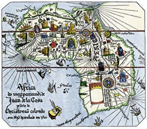
Background imageMaps Collection: Map of Africa after the discoveries of Vasco de Gama (1469-1524)

Map of Africa after the discoveries of Vasco de Gama (1469-1524, Portuguese explorer) around Africa, around 1487
NWI4848506 Map of Africa after the discoveries of Vasco de Gama (1469-1524, Portuguese explorer) around Africa, around 1487, with the passage of the Cape of Good Esperance (South Africa)

Background imageMaps Collection: Civitatis Orbis Terrarum (Theatrum orbis terrarum). 1572-1617. Moriscos from Alhama

Civitatis Orbis Terrarum (Theatrum orbis terrarum). 1572-1617. Moriscos from Alhama. Volume II (etching)
CUL4935177 Civitatis Orbis Terrarum (Theatrum orbis terrarum). 1572-1617. Moriscos from Alhama. Volume II (etching); (add.info.: BRAUN, George (1541-1622). ORTELIUS, Abraham (1527-1598)

Background imageMaps Collection: ORTELIUS, Abraham (1527-1598). Theatrum Orbis Terrarum. 1570

ORTELIUS, Abraham (1527-1598). Theatrum Orbis Terrarum. 1570. It is considered to be the first modern atlas
CUL4695089 ORTELIUS, Abraham (1527-1598). Theatrum Orbis Terrarum. 1570. It is considered to be the first modern atlas. CHAVES, Jeronimo de (1523-1574). Mathematic, astronomer and navigator

Background imageMaps Collection: A view of 16th Century Seville

A view of 16th Century Seville
3329959 A view of 16th Century Seville; (add.info.: Illustration depicting a view of 16th Century Seville in Spain. Dated 16th Century.); Universal History Archive/UIG

Background imageMaps Collection: Map of Spain in the middle ages during the Muslim occupation

Map of Spain in the middle ages during the Muslim occupation
3253078 Map of Spain in the middle ages during the Muslim occupation; (add.info.: Map of Spain in the middle ages during the Muslim occupation. From Enciclopedia Ilustrada Segui, published c. 1900)

Background imageMaps Collection: Mexican statuary, plazas, courtyards, thoroughfares, roads, 1885

Mexican statuary, plazas, courtyards, thoroughfares, roads, 1885
2902265 Mexican statuary, plazas, courtyards, thoroughfares, roads, 1885; (add.info.: Historic map of Mexico with Mexican statuary, plazas, courtyards, thoroughfares, roads, 1885)

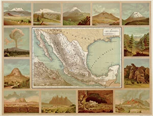
Background imageMaps Collection: Mexican map of Major Physical Geologic Features, 1885

Mexican map of Major Physical Geologic Features, 1885
2902258 Mexican map of Major Physical Geologic Features, 1885; (add.info.: Mexican map of Major Physical Geologic Features, mountains, volcanoes, grottos, forests, plateaus)

Background imageMaps Collection: Defenses at Gibraltar

Defenses at Gibraltar
2900913 Defenses at Gibraltar; (add.info.: Straits, Defenses at Gibraltar, 1700.); Buyenlarge Archive/UIG

Background imageMaps Collection: The Armada, 1588 (litho)

The Armada, 1588 (litho)
8652541 The Armada, 1588 (litho) by Bartholomew, John George (1860-1920) ; Private Collection; (add.info.: The Armada, 1588)

Background imageMaps Collection: MADRID

MADRID
StudioSix

Background imageMaps Collection: Tatiana world map in Spanish

Tatiana world map in Spanish
Rosana Laiz Blursbyai

Background imageMaps Collection: Piper world map in Spanish

Piper world map in Spanish
Rosana Laiz Blursbyai

Background imageMaps Collection: Nadiin world map in Spanish

Nadiin world map in Spanish
Rosana Laiz Blursbyai

Background imageMaps Collection: Wanderlust world map in spanish

Wanderlust world map in spanish
Rosana Laiz Blursbyai

Background imageMaps Collection: Rossie world map in Spanish

Rossie world map in Spanish
Rosana Laiz Blursbyai

Background imageMaps Collection: Plan Of The Naval Battle Of Lepanto, October 7, 1571. After A Drawing By Don Juan Of Austria

Plan Of The Naval Battle Of Lepanto, October 7, 1571. After A Drawing By Don Juan Of Austria Preserved In The Spanish
UIG5420793 Plan Of The Naval Battle Of Lepanto, October 7, 1571. After A Drawing By Don Juan Of Austria Preserved In The Spanish National Archives Of Simancas

Background imageMaps Collection: Primary cities of Europe, their population and degree of trade of individual states (print)

Primary cities of Europe, their population and degree of trade of individual states (print)
6202957 Primary cities of Europe, their population and degree of trade of individual states (print; (add.info.: CARTOGRAPHY "Primary cities of Europe)

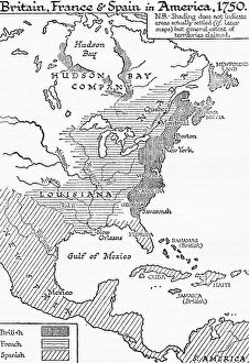
Background imageMaps Collection: Map showing Britain, France and Spain in America, 1750, 1936

Map showing Britain, France and Spain in America, 1750, 1936
7125156 Map showing Britain, France and Spain in America, 1750, 1936; (add.info.: Map showing Britain, France and Spain in America, 1750)

Background imageMaps Collection: A chart of the Bay of Honduras, 1773 (print)

A chart of the Bay of Honduras, 1773 (print)
7340634 A chart of the Bay of Honduras, 1773 (print) by Speer, Joseph Smith (fl.1773); 47x74x1 cm; National Maritime Museum, London, UK; (add.info.: Creator: Captain Joseph Smith Speer A chart)

Background imageMaps Collection: The most complete description of the kingdom of Spain, based on all publications

The most complete description of the kingdom of Spain, based on all publications, 1573 (copperplate engraving on paper)
7340126 The most complete description of the kingdom of Spain, based on all publications, 1573 (copperplate engraving on paper) by Ortelius, Abraham (1527-98); 42x53 cm; National Maritime Museum

Background imageMaps Collection: The battle off the Isle of Wight on 4 August, 1588, c.1590 (coloured engraving)

The battle off the Isle of Wight on 4 August, 1588, c.1590 (coloured engraving)
7340028 The battle off the Isle of Wight on 4 August, 1588, c.1590 (coloured engraving) by Adams, Robert (1540-95) (after); 38x50 cm; National Maritime Museum, London

Background imageMaps Collection: The English engage the Spanish fleet near Plymouth on 31 July, 1588, c.1590 (coloured engraving)

The English engage the Spanish fleet near Plymouth on 31 July, 1588, c.1590 (coloured engraving)
7340026 The English engage the Spanish fleet near Plymouth on 31 July, 1588, c.1590 (coloured engraving) by Adams, Robert (1540-95) (after); 37x50 cm; National Maritime Museum, London

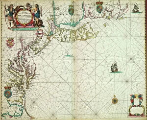
Background imageMaps Collection: A chart of the sea coasts of new England, New Jersey, Virginia

A chart of the sea coasts of new England, New Jersey, Virginia, Maryland and Carolina from Cape Cod to Cape Hatteras
7340051 A chart of the sea coasts of new England, New Jersey, Virginia, Maryland and Carolina from Cape Cod to Cape Hatteras, 1675 (print) by Seller

Background imageMaps Collection: A chart of the seacoasts from the Landsend of England to Cape Bona Esperanca, 1675 (engraving)

A chart of the seacoasts from the Landsend of England to Cape Bona Esperanca, 1675 (engraving)
7340048 A chart of the seacoasts from the Landsend of England to Cape Bona Esperanca, 1675 (engraving) by Seller, John (1632-97); 45x55.5 cm; National Maritime Museum, London


All Professionally Made to Order for Quick Shipping


-

Maps Collection

Maps of Spain Europe are a great way to explore the country and its surroundings. They provide detailed information about the geography, topography, and cultural features of the area, and are be used to plan trips, find points of interest, or just get an overview of the region. They also provide information about transportation networks, political boundaries, and other important facts. Some maps even include historical data such as ancient ruins or battles that took place in the area and can an invaluable tool for anyone looking to learn more about Spain and its surrounding countries. With a map in hand, travelers can easily navigate their way around this beautiful part of Europe with ease.
+

Our beautiful Wall Art and Photo Gifts include Framed Prints, Photo Prints, Poster Prints, Canvas Prints, Jigsaw Puzzles, Metal Prints and so much more

The Maps of Spain Europe collection from Media Storehouse is a stunning assortment of wall art and framed prints that showcase the beauty and diversity of Spain. Our collection features an array of maps, ranging from antique to modern, highlighting various regions in Spain and other parts of Europe. The intricate details on these maps are sure to captivate any viewer's attention. Each piece in our collection is carefully crafted using high-quality materials, ensuring that they will last for years to come. Whether you're looking for a unique addition to your home decor or a thoughtful gift for someone special, the Maps of Spain Europe collection has something for everyone. From vintage-style maps featuring detailed illustrations to contemporary designs with bold colors and typography, our collection offers a wide range of options that cater to different tastes and preferences. The Maps of Spain Europe collection is an excellent choice for anyone who appreciates beautiful artwork inspired by geography and history.
+

What are Maps of Spain Europe art prints?

Maps of Spain Europe art prints are high-quality reproductions of vintage and contemporary maps depicting the geography, topography, and political boundaries of Spain and its neighboring European countries. These art prints showcase intricate details such as cities, rivers, mountains, coastlines, and landmarks that make them not only informative but also visually appealing. These maps can be used for educational purposes in schools or universities to aid students' understanding of geography or history. They can also serve as decorative pieces in homes or offices for those who appreciate cartography or have a connection to Spain or Europe. We offer a wide range of Maps of Spain Europe art prints in various sizes and formats such as framed posters, canvas prints, metal signs, and more. With their vast collection of images sourced from renowned archives worldwide combined with their state-of-the-art printing technology ensures that customers receive high-quality products that will last for years to come.
+

What Maps of Spain Europe art prints can I buy from Media Storehouse?

We offer a wide range of Maps of Spain Europe art prints that are perfect for both personal and professional use. You can choose from a variety of styles, sizes, and formats to suit your needs. Whether you're looking for vintage maps or modern designs, we have something for everyone. Some popular options include detailed topographical maps that show the terrain and landscape features of Spain and Europe. These are great for hikers, campers, and outdoor enthusiasts who want to explore the region's natural beauty. Other popular choices include political maps that show the boundaries between countries, cities, towns, and other important landmarks. These are ideal for students studying geography or history or professionals working in international business or politics. If you're looking for high-quality Maps of Spain Europe art prints that are both informative and visually stunning, Media Storehouse is an excellent choice.
+

How do I buy Maps of Spain Europe art prints?

To buy Maps of Spain Europe art prints from Media Storehouse, you can browse our extensive collection online. Our website features a user-friendly interface that allows you to search for specific maps or browse by category. Once you have found the print(s) you want, simply add them to your cart and proceed to checkout. We offer a variety of sizes and framing options for their prints, so be sure to select the one that best suits your needs. We also offer a range of paper types, including glossy and matte finishes. If you have any questions about purchasing Maps of Spain Europe art prints from Media Storehouse, our customer service team is available to assist you via email or phone. We are happy to help with any inquiries related to ordering, payment processing or shipping information. With high-quality products and excellent customer service, buying Maps of Spain Europe art prints from Media Storehouse is an easy and enjoyable experience.
+

How much do Maps of Spain Europe art prints cost?

We offer a wide range of Maps of Spain Europe art prints at varying prices. Our collection includes vintage maps, contemporary designs and everything in between to suit all tastes and budgets. The cost of our Maps of Spain Europe art prints depends on several factors such as the size, quality, and type of print you choose. We have options for both framed and unframed prints that can be customized to your preferences. Our high-quality Maps of Spain Europe art prints are perfect for adding character to any room or office space. They make great gifts for travel enthusiasts or anyone who loves exploring new places. With our extensive collection, you're sure to find something that fits your style and budget. We take pride in providing affordable yet top-notch quality products that meet the needs of our customers. Browse through our selection today to find the perfect Map of Spain Europe art print for your home or office.
+

How will my Maps of Spain Europe art prints be delivered to me?

We take pride in delivering your Maps of Spain Europe art prints with the utmost care and attention. We use high-quality packaging materials to ensure that your artwork arrives in perfect condition. Your print will be carefully rolled and placed inside a sturdy cardboard tube for safe transportation. We work with trusted courier partners who specialize in handling delicate items such as art prints. Once your order has been dispatched, you will receive a tracking number so you can keep an eye on its progress. When your Maps of Spain Europe art print arrives, simply unroll it and lay it flat on a clean surface to allow any creases or curls to settle naturally. You can then frame it or display it however you choose. We are committed to providing our customers with the highest level of service possible. If you have any questions about delivery or anything else related to your order, please don't hesitate to get in touch with us.