
Maps Collection
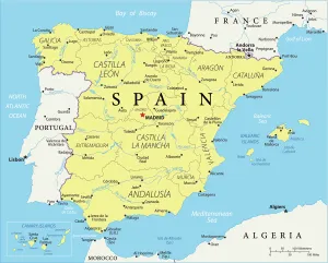
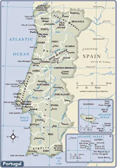
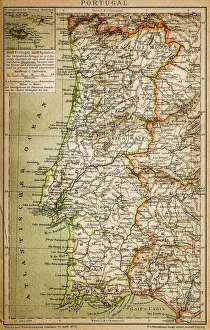
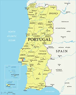
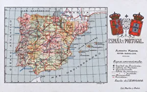
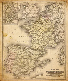
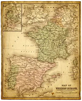
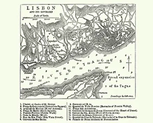
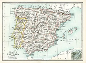
Portugal is a country located in the southwest corner of Europe, and is bordered by Spain to the north and east, and the Atlantic Ocean to the south and west
Choose a picture from our Maps Collection for your Wall Art and Photo Gifts
573 items


All Professionally Made to Order for Quick Shipping
-
Maps Collection
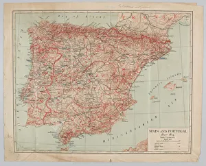
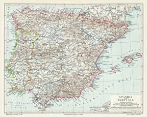
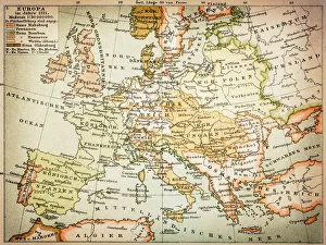
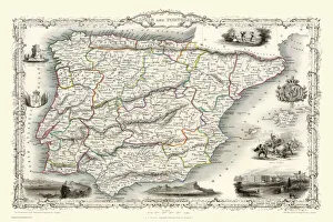
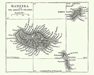
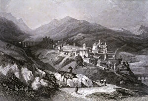
Portugal is a country located in the southwest corner of Europe, and is bordered by Spain to the north and east, and the Atlantic Ocean to the south and west. Maps of Portugal are useful for travelers who wish to explore this beautiful country. They provide an overview of Portugal's geography, including its major cities, rivers, mountain ranges, and coastal areas. Additionally they can show visitors attractions such as museums, monuments, parks, beaches and other points of interest. It also help travelers plan their route around Portugal by providing information on roads and highways as well as public transportation options like buses or trains. With a map in hand travelers can easily navigate their way around this fascinating country with ease.
+
Our beautiful pictures are available as Framed Prints, Photos, Wall Art and Photo Gifts
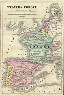
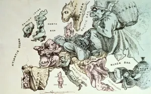
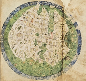
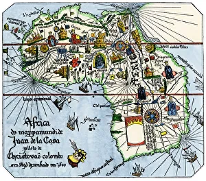
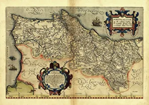
The Maps of Portugal Europe collection is a stunning assortment of wall art and framed prints that showcase the geography, history, and culture of Portugal. This exquisite collection features a wide range of maps that depict different regions, cities, landmarks, and historical events in Portugal. From vintage maps dating back to the 16th century to modern-day cartography, our collection offers something for everyone who loves Portuguese history or wants to add an elegant touch to their home decor. Each map in our collection is carefully selected by our team of experts who ensure that only high-quality prints are included. The Maps of Portugal Europe collection includes various sizes and styles ranging from colorful antique-style maps with intricate details to minimalist black-and-white designs perfect for contemporary interiors. Whether you're looking for a unique gift or want to decorate your living room with beautiful artwork inspired by Portuguese culture and heritage, the Maps of Portugal Europe collection has something special for you.
+
What are Maps of Portugal Europe art prints?
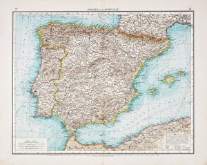
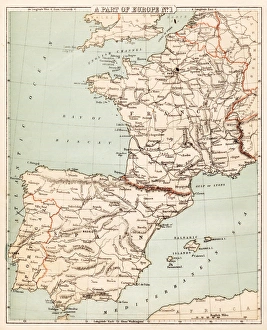
Maps of Portugal Europe art prints are high-quality reproductions of antique and contemporary maps of Portugal, a country located in southwestern Europe. These art prints showcase the geography, topography, cities, towns and landmarks of Portugal with intricate details that make them both informative and decorative. These maps can be used to decorate homes or offices while also serving as educational tools for those interested in Portuguese history or geography. They come in various sizes and styles to suit different tastes and preferences. Some Maps of Portugal Europe art prints feature vintage designs that offer a glimpse into the past while others display modern cartographic techniques that highlight current political boundaries, transportation networks, natural resources among other features. These art prints are perfect for anyone who wants to add some sophistication to their living space or office while also celebrating the rich culture and heritage of Portugal.
+
What Maps of Portugal Europe art prints can I buy from Media Storehouse?
We offer a wide range of Maps of Portugal Europe art prints for purchase. These maps showcase the intricate details and features of Portugal, including its cities, regions, and topography. You can choose from a variety of styles and designs to suit their personal preferences or home decor. Some popular options include antique-style maps that feature hand-drawn illustrations and historical information about Portugal's past. Other contemporary designs showcase vibrant colors and modern typography for a more updated look. In addition to traditional paper prints, Media Storehouse also offers canvas prints that add texture and depth to any room. These high-quality reproductions are perfect for adding a touch of sophistication to your living space or office. Whether you're looking for a unique gift or simply want to decorate your own walls with beautiful artwork, we have plenty of Maps of Portugal Europe art prints available for purchase.
+
How do I buy Maps of Portugal Europe art prints?
To buy Maps of Portugal Europe art prints from Media Storehouse, you can browse our extensive collection of high-quality images online. Simply search for "Maps of Portugal" or "Europe art prints" on our website and select the image that catches your eye. Once you have found the perfect print, choose the size and format that suits your needs best - whether it be a canvas, framed print or poster. After selecting your preferred options, add the item to your cart and proceed to checkout. You will then be prompted to enter your payment details and shipping information before completing the purchase. We offer a wide range of beautiful artwork featuring maps of Portugal and other European countries. Their prints are perfect for adding a touch of sophistication to any room in your home or office, making them an ideal gift for friends and family who love travel or geography.
+
How much do Maps of Portugal Europe art prints cost?
We offer a wide range of Maps of Portugal Europe art prints that are available at different prices. The cost of these prints may vary depending on the size and type of print you choose. We have a selection of high-quality paper prints, canvas prints, and framed prints to suit your preferences. Our Maps of Portugal Europe art prints feature detailed maps showcasing the beautiful country's regions, cities, towns, and landmarks. These pieces make great additions to any home or office decor and can also be used as educational tools for students studying geography or history. We take pride in providing our customers with affordable yet top-notch quality products that meet their needs. Our collection is constantly updated with new designs to ensure that there is always something fresh for everyone. If you're looking for stunning Maps of Portugal Europe art prints without breaking the bank, we have got you covered.
+
How will my Maps of Portugal Europe art prints be delivered to me?
We take great care in delivering your Maps of Portugal Europe art prints to you. Your order will be carefully packaged and shipped using a reliable delivery service. We use high-quality materials to ensure that your print arrives in perfect condition. Once your order has been processed, we will send you an email confirmation with the expected delivery date. You can also track the progress of your shipment online using the tracking number provided. We offer a range of shipping options to suit your needs, including standard and express delivery services. Our team is dedicated to ensuring that your order is delivered on time and in excellent condition. If you have any questions or concerns about the delivery of your Maps of Portugal Europe art prints, please do not hesitate to contact us for assistance. We are always happy to help.