Fraud Blocker Skip to main content

Home > Europe > Italy > Maps

Maps Collection (page 3)

Maps of Italy Europe are invaluable resources for anyone looking to explore the country

3,953 items

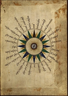
Background imageMaps Collection: Atlas compass, 16th century

Atlas compass, 16th century
Atlas compass in a 1544 copy of the Agnese Atlas. Several copies of this atlas were produced between 1536 and 1564, in Venice, by the Italian mapmaker Battista Agnese

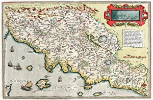
Background imageMaps Collection: Map of Tuscany in Italy, 1570 (engraving)

Map of Tuscany in Italy, 1570 (engraving)
LRI4704766 Map of Tuscany in Italy, 1570 (engraving) by Ortelius, Abraham (1527-98); Museo Navale di Pegli, Genoa, Italy; (add.info.: Thusciae)

Background imageMaps Collection: Antique map of Southern Italy, Sardinia, Sicily, 19th Century

Antique map of Southern Italy, Sardinia, Sicily, 19th Century
Vintage engraving of a Antique map of Southern Italy, Sardinia, Sicily, 19th Century

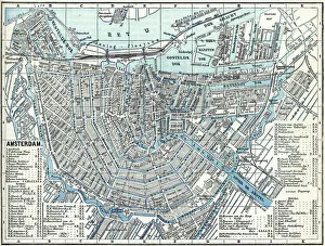
Background imageMaps Collection: Map of city Amsterdam Netherlands from 1881

Map of city Amsterdam Netherlands from 1881 Original edition from my own archives Source : Illustriertes Konversations Lexikon 1881

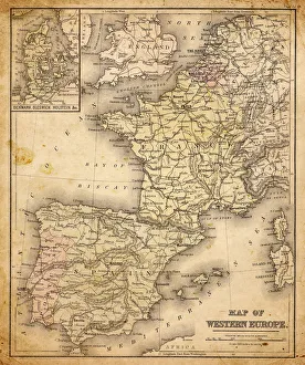
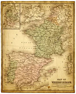
Background imageMaps Collection: western europe map 1883

western europe map 1883
a map of Western europe from 1883

Background imageMaps Collection: western europe 1867

western europe 1867
a map of Western europe from 1867, overlay with grunge burnt texture paper

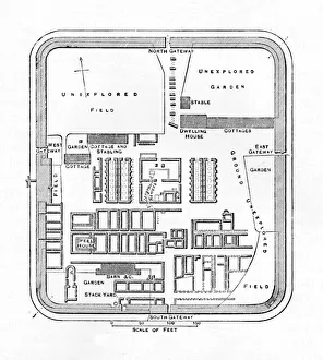
Background imageMaps Collection: Plan of Bremenium, 1902

Plan of Bremenium, 1902. Bremenium was an ancient Roman fort (castra) located at Rochester, Northumberland, England. The fort was one of the defensive structures built along Dere Street

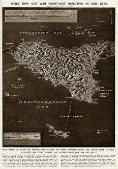
Background imageMaps Collection: Map of Sicily by G. H. Davis

Map of Sicily by G. H. Davis
A contour map of Sicily, giving the shortest air distances from Cape Bon and Malta. At this stage in the Second World War it was a British front-line objective in Axis eyes

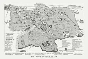
Background imageMaps Collection: Rome in the birds eye view, published in 1878

Rome in the birds eye view, published in 1878
Rome in the birds eye view with the known historic buildings and places. Wood engraving, published in 1878

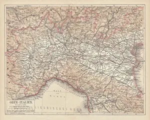
Background imageMaps Collection: Ancient map of Northern Italy, lithograph, published in 1876

Ancient map of Northern Italy, lithograph, published in 1876
Ancient map of Northern Italy. Lithograph, published in 1876

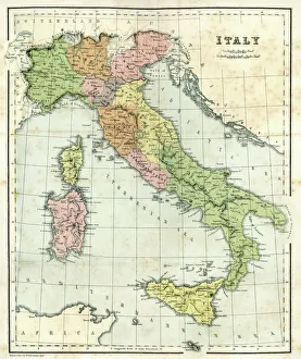
Background imageMaps Collection: Antique map of Italy

Antique map of Italy, 1864

Background imageMaps Collection: MYTHOLOGY: POSEIDON. Poseidon riding on a dolphin into the harbor of Venice, Italy

MYTHOLOGY: POSEIDON. Poseidon riding on a dolphin into the harbor of Venice, Italy. Detail of Jacopo Barbaris bird s-eye-view of Venice. Woodcut, 1500

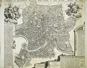
Background imageMaps Collection: New and Accurate Map of Ancient and Modern Rome by Jean van Ram, copperplate

New and Accurate Map of Ancient and Modern Rome by Jean van Ram, copperplate, printed in Amsterdam circa 1691-1693
Cartography. Italy, 17th century. New and accurate map of Ancient and Modern Rome by Jean van Ram, Amsterdam 1691-1693 ca. Copperplate 50 x 59 cm

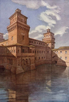
Background imageMaps Collection: The Castle of Ferrara (colour litho)

The Castle of Ferrara (colour litho)
7161838 The Castle of Ferrara (colour litho) by Formili, C.T.G. (1860-1942); Private Collection; (add.info.: The Castle of Ferrara)

Background imageMaps Collection: Map of the Roman provinces of Gaul, Britannia and Germania (coloured engraving)

Map of the Roman provinces of Gaul, Britannia and Germania (coloured engraving)
7148263 Map of the Roman provinces of Gaul, Britannia and Germania (coloured engraving) by Kiepert, Heinrich (1818-99); Private Collection; (add.info.: Map of the Roman provinces of Gaul)

Background imageMaps Collection: The Roman Emperor Caligula entertaining his favourite horse, Incitatus, at supper (engraving)

The Roman Emperor Caligula entertaining his favourite horse, Incitatus, at supper (engraving)
7148832 The Roman Emperor Caligula entertaining his favourite horse, Incitatus, at supper (engraving) by English School, (19th century); Private Collection; (add.info)

Background imageMaps Collection: Norma, opera by Vincenzo Bellini, sheet music cover (colour litho)

Norma, opera by Vincenzo Bellini, sheet music cover (colour litho)
7149592 Norma, opera by Vincenzo Bellini, sheet music cover (colour litho) by English School, (19th century); Private Collection; (add.info.: Norma, opera by Vincenzo Bellini)

Background imageMaps Collection: Map of the province of Mantova (Italy) (Engraving, 1717)

Map of the province of Mantova (Italy) (Engraving, 1717)
LRI4712986 Map of the province of Mantova (Italy) (Engraving, 1717) by Nolin, Jean-Baptiste (c.1657-1708); Private Collection; (add.info.: Map of the Duche of Mantua (Lombardy)

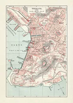
Background imageMaps Collection: Historical city map of Trieste, Italy, lithograph, published in 1897

Historical city map of Trieste, Italy, lithograph, published in 1897
Historical city map of Trieste, Italy (formerly Austria). Lithograph, published in 1897

Background imageMaps Collection: Topographic map of Sardinia, Italy, wood engraving, published 1897

Topographic map of Sardinia, Italy, wood engraving, published 1897
Topographic map of Sardinia, Italy - second-largest island in the Mediterranean Sea. Wood engraving, published in 1897

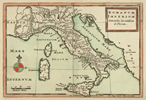
Background imageMaps Collection: Antique Map of Italy 1732

Antique Map of Italy 1732
Mediterranean Countries, Antique Maps, 91822666

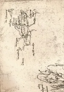
Background imageMaps Collection: Sketch map of Armenia, c1472-c1519 (1883). Artist: Leonardo da Vinci

Sketch map of Armenia, c1472-c1519 (1883). Artist: Leonardo da Vinci
Sketch map of Armenia, c1472-c1519 (1883). From the Codex Atlanticus. From The Literary Works of Leonardo Da Vinci, Vol. II by Jean Paul Richter, PH. DR

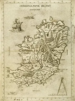
Background imageMaps Collection: Hybernia Nunc Irlant. Ireland. Map

Hybernia Nunc Irlant. Ireland. Map was clearly made by a member of the Lafreri School of cartographers, Antonio Lafreri (1512-77). Rome, 1570. Renaissance. Engraving by Paolo Forlani, 16th C

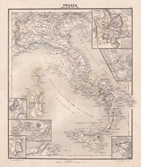
Background imageMaps Collection: Ancent Italy, c. 450 BC, steel engraving, published in 1861

Ancent Italy, c. 450 BC, steel engraving, published in 1861
The territory of Italy around 450 BC with separate maps of Rome, Roman Forum, surrounding area of Rome, Syracuse, Carthage and surrounding area of Pompeji and Naples. Legend in Latin language

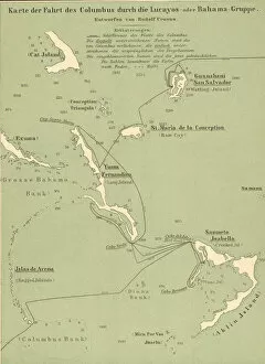
Background imageMaps Collection: Map Of Columbus Route In Bahamas

Map Of Columbus Route In Bahamas
Map tracing Italian explorer Christopher Columbus route upon his arrival in the Bahamas, 1492. (Kean Collection/Getty Images)

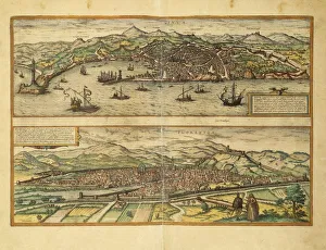
Background imageMaps Collection: Map of Genoa and Florence from Civitates Orbis Terrarum by Georg Braun

Map of Genoa and Florence from Civitates Orbis Terrarum by Georg Braun, 1541-1622 and Franz Hogenberg, 1540-1590
Cartography, Italy, 16th century. Map of Genoa and Florence. From Civitates Orbis Terrarum by Georg Braun (1541-1622) and Franz Hogenberg (1540-1590), Cologne. Engraving

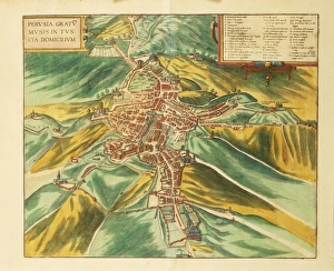
Background imageMaps Collection: Map of Perugia from Civitates Orbis Terrarum by Georg Braun, 1541-1622 and Franz Hogenberg

Map of Perugia from Civitates Orbis Terrarum by Georg Braun, 1541-1622 and Franz Hogenberg, 1540-1590, engraving
Cartography, Italy, 16th century. Map of Perugia. From Civitates Orbis Terrarum by Georg Braun (1541-1622) and Franz Hogenberg (1540-1590), Cologne. Engraving

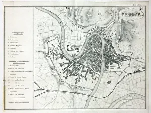
Background imageMaps Collection: Map of Verona

Map of Verona
Map of the city of Verona, Italy Date: 19th century

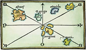
Background imageMaps Collection: AZORES, 1528. Map of the Azores Islands. Woodcut from Benedetto Bordones Isolario

AZORES, 1528. Map of the Azores Islands. Woodcut from Benedetto Bordones Isolario, Venice, 1528

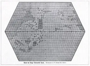
Background imageMaps Collection: Toscanellis world map, 1474

Toscanellis world map, 1474
Toscanellis world map. This map was drawn by the Italian mathematician and astronomer Paolo Toscanelli (1397-1482) in 1474

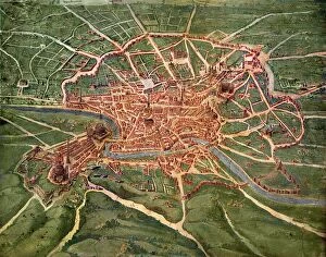
Background imageMaps Collection: 16th Century Plan of Rome

16th Century Plan of Rome
16th century plan of Rome. Details from the map of Latium et Sabina (Southern Lazio), in the Gallery of Maps in the Vatican Museum.The Gallery of Maps holds maps which were commissioned between 1578
Background imageMaps Collection: Cooks Tours to the Riviera, Italy, etc

Cooks Tours to the Riviera, Italy, etc
Poster or handbill advertising Cooks Tours to the Riviera, Italy, etc, using the London, Brighton and South Coast Railway to Newhaven and Dieppe, programme free from any office of Thomas Cook & Son

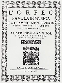
Background imageMaps Collection: Claudio Monteverdis opera Orpheus (engraving)

Claudio Monteverdis opera Orpheus (engraving)
7149743 Claudio Monteverdis opera Orpheus (engraving) by Italian School, (17th century) (after); Private Collection; (add.info.: Italian compser Claudio Monteverdis opera Orpheus)

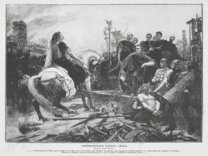
Background imageMaps Collection: Vercingetorix before Julius Caesar after his surrender at the Siege of Alesia, 52 BC (engraving)

Vercingetorix before Julius Caesar after his surrender at the Siege of Alesia, 52 BC (engraving)
7185199 Vercingetorix before Julius Caesar after his surrender at the Siege of Alesia, 52 BC (engraving) by Royer, Lionel Noel (1852-1926); Private Collection; (add.info)

Background imageMaps Collection: Poster for 'Madame Butterfly 'and child with American flag

Poster for "Madame Butterfly "and child with American flag
LSE4093280 Poster for " Madame Butterfly " and child with American flag, poster for the opera by Giacomo Puccini, n.d. deb. 20th S.Ricordi editore

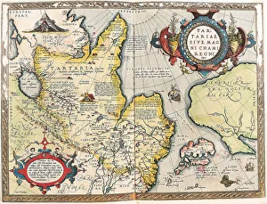
Background imageMaps Collection: Map of the Tartar territory, 1570 (engraving)

Map of the Tartar territory, 1570 (engraving)
LRI4704938 Map of the Tartar territory, 1570 (engraving) by Ortelius, Abraham (1527-98); Museo Navale di Pegli, Genoa, Italy; (add.info)

Background imageMaps Collection: Map of Ptolemy published in 1482

Map of Ptolemy published in 1482
GIA4812936 Map of Ptolemy published in 1482. by Unknown Artist, (15th century); Pinacoteca di Brera, Milan, Italy; (add.info.: Map of Ptolemy published in 1482.); eGiancarlo Costa; out of copyright

Background imageMaps Collection: Map of Franconia in Germany, 1570 (engraving)

Map of Franconia in Germany, 1570 (engraving)
LRI4704575 Map of Franconia in Germany, 1570 (engraving) by Ortelius, Abraham (1527-98); Museo Navale di Pegli, Genoa, Italy; (add.info.: Franciae Orientalis)

Background imageMaps Collection: View of the Island of Saint Helena, early 19th century

View of the Island of Saint Helena, early 19th century, taken from a recent English map. Handcoloured copperplate engraving by Andrea Bernieri after an illustration by Beaugean from Giulio Ferrarios

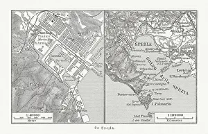
Background imageMaps Collection: City map of La Spezia, Italy, and surroundings, published 1897

City map of La Spezia, Italy, and surroundings, published 1897
City map of La Spezia, Italy, and surroundings. La Spezia is one of the main Italian military and commercial harbours and a major Italian Navy base. Wood engraving, published in 1897

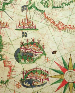
Background imageMaps Collection: The Cities of Marseille and Genoa with their ports, from a nautical atlas, 1651

The Cities of Marseille and Genoa with their ports, from a nautical atlas, 1651
XOT330921 The Cities of Marseille and Genoa with their ports, from a nautical atlas, 1651 (ink on vellum) (detail from 330919) by Pietro Giovanni Prunes (fl)

Background imageMaps Collection: Antiquae Urbis Perfecta Imago, Map of Rome, c. 1600 (engraving)

Antiquae Urbis Perfecta Imago, Map of Rome, c. 1600 (engraving)
XJF359082 Antiquae Urbis Perfecta Imago, Map of Rome, c.1600 (engraving) by Brambilla, Ambrogio (1549-1629); Private Collection; (add.info.: drawn by Nicolas van Aelst; ); Italian, out of copyright

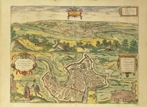
Background imageMaps Collection: Map of Verona from Civitates Orbis Terrarum by Georg Braun, 1541-1622 and Franz Hogenberg

Map of Verona from Civitates Orbis Terrarum by Georg Braun, 1541-1622 and Franz Hogenberg, 1540-1590, engraving
Cartography, Italy, 16th century. Map of Verona, from Civitates Orbis Terrarum by Georg Braun (1541-1622) and Franz Hogenberg (1540-1590), Cologne. Engraving

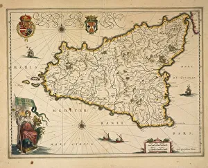
Background imageMaps Collection: Map of Sicily, by Willem Blaeu, from Regionum Italiae, engraving

Map of Sicily, by Willem Blaeu, from Regionum Italiae, engraving
Cartography, Italy, 17th century. Map of Sicily. From Regionum Italiae, by Willem Blaeu. Engraving

Background imageMaps Collection: Italy, Tuscany, Lucca, map of Lucca, cartography

Italy, Tuscany, Lucca, map of Lucca, cartography 17th century, Archivio Di Stato (National Archives)

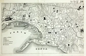
Background imageMaps Collection: Map of Genoa

Map of Genoa
Map of the city of Genoa, Italy Date: 19th century

Background imageMaps Collection: The Island of Crete, from a nautical atlas, 1651 (ink on vellum) (detail from 330925)

The Island of Crete, from a nautical atlas, 1651 (ink on vellum) (detail from 330925)
XOT330926 The Island of Crete, from a nautical atlas, 1651 (ink on vellum) (detail from 330925) by Pietro Giovanni Prunes (fl. 17th Century); Museo Correr, Venice, Italy; Italian, out of copyright

Background imageMaps Collection: The French Coast, England, Scotland and Ireland, from a nautical atlas, 1520 (ink on vellum)

The French Coast, England, Scotland and Ireland, from a nautical atlas, 1520 (ink on vellum)
XOT330911 The French Coast, England, Scotland and Ireland, from a nautical atlas, 1520 (ink on vellum) (detail from 330910) by Giovanni Xenodocus da Corfu (fl)


All Professionally Made to Order for Quick Shipping


-

Maps Collection

Maps of Italy Europe are invaluable resources for anyone looking to explore the country. They provide detailed information about the terrain, roads, cities, and other points of interest, and are be found in a variety of formats such as paper maps, online maps, and apps. Paper they can great for planning trips or getting an overview of the area while online maps provide more detailed information such as street names and directions. Apps are also useful for navigating while on-the-go. Maps of Italy Europe can help travelers find their way around unfamiliar places with ease and make sure they don’t miss out on any must-see attractions along their journey.
+

Our beautiful pictures are available as Framed Prints, Photos, Wall Art and Photo Gifts

The Maps of Italy Europe collection from Media Storehouse is a stunning range of wall art and framed prints that showcase the beauty and diversity of Italy. Our collection features an extensive selection of maps, ranging from antique maps dating back to the 16th century to modern-day cartography. Each map has been carefully selected for its historical significance or aesthetic appeal, making it a perfect addition to any home or office space. The Maps of Italy Europe collection offers something for everyone, with maps depicting different regions and cities across Italy. From the rolling hills of Tuscany to the bustling streets of Rome, these maps capture the essence of this beautiful country in intricate detail. Whether you are looking for a unique piece of wall art or a thoughtful gift for someone special, the Maps of Italy Europe collection is sure to impress. With high-quality printing and framing options available, these prints are designed to last a lifetime and bring joy to all who view them.
+

What are Maps of Italy Europe art prints?

Maps of Italy Europe art prints are high-quality reproductions of vintage and contemporary maps that showcase the intricate details and beauty of Italy and other European countries. These prints are perfect for those who love to travel, history enthusiasts, or anyone looking to add a touch of sophistication to their home decor. These art prints come in various sizes and styles, from colorful antique maps depicting the regions of Italy to modern minimalist designs highlighting the country's famous landmarks. They are printed on premium paper using archival inks that ensure long-lasting color vibrancy. Maps of Italy Europe art prints make great gifts for friends or family members who have a special connection with Italy or Europe. They can also be used as educational tools in classrooms or offices. Whether you're looking for a unique piece to decorate your living room wall or want to add some character to your workspace, Maps of Italy Europe art prints offer endless possibilities for personalization and creativity.
+

What Maps of Italy Europe art prints can I buy from Media Storehouse?

We offer a wide range of Maps of Italy Europe art prints that you can buy. These maps are available in various sizes and styles to suit your preferences. You can choose from antique, vintage, or contemporary designs that showcase the beauty and history of Italy and Europe. The collection includes detailed maps of Italian cities such as Rome, Florence, Venice, Milan, Naples, and many others. You can also find regional maps that highlight the diverse landscapes and cultures across Italy's 20 regions. In addition to Italian maps, Media Storehouse also offers European continent maps that feature neighboring countries such as France, Spain, Germany, Switzerland among others. These prints come in different formats including canvas prints or framed wall art for easy display on your walls. Whether you're looking for decorative pieces for your home or office space or educational resources for schools or libraries; Media Storehouse has got you covered with their extensive selection of Maps of Italy Europe art prints.
+

How do I buy Maps of Italy Europe art prints?

To buy Maps of Italy Europe art prints from Media Storehouse, you can browse our extensive collection online. We offer a variety of sizes and framing options to suit your preferences. Once you have found the print that you like, simply add it to your cart and proceed to checkout. You will be prompted to enter your shipping information and payment details before completing the purchase. We offer high-quality prints on premium paper using state-of-the-art printing technology. Their maps are sourced from reputable archives and collections around the world, ensuring accuracy and authenticity. Whether you are looking for a vintage map of Italy or a contemporary interpretation of Europe's geography, we have something for everyone. With our easy-to-use website and secure checkout process, buying Maps of Italy Europe art prints has never been easier.
+

How much do Maps of Italy Europe art prints cost?

We offer a wide range of Maps of Italy Europe art prints at various price points to suit different budgets. Our collection includes vintage maps, contemporary designs, and everything in between. The cost of our Maps of Italy Europe art prints depends on several factors such as the size, framing options, and materials used for printing. We use high-quality paper and ink to ensure that every print is vibrant and long-lasting. Our you can choose from a variety of sizes ranging from small to large formats depending on their preferences. Whether you're looking for a simple poster or an intricately framed piece, we have something for everyone. Our selection also includes canvas prints which provide a unique texture and depth to your artwork. The cost of our Maps of Italy Europe art prints varies based on individual choices but we strive to provide affordable options without compromising quality.
+

How will my Maps of Italy Europe art prints be delivered to me?

We take great care in ensuring that your Maps of Italy Europe art prints are delivered to you safely and securely. Our delivery process is designed to be hassle-free and convenient for our customers. Once you have placed your order with us, your Maps of Italy Europe art prints will be carefully packaged and dispatched from our warehouse. We use reliable courier services to ensure that your artwork arrives at its destination in perfect condition. We offer a range of delivery options depending on the size and weight of your order, as well as the destination address. You can choose standard or express delivery options at checkout. Our team is committed to providing excellent customer service throughout the entire ordering process. If you have any questions about shipping or delivery, please don't hesitate to contact us via email or phone. We're always happy to help.