Fraud Blocker Skip to main content

Home > Europe > France > Maps

Maps Collection (page 41)

Maps of France Europe are essential tools for travelers and tourists who want to explore the continent

11,162 items

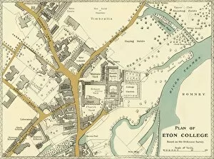
Background imageMaps Collection: Plan of Eton College, 1911. Creator: Unknown

Plan of Eton College, 1911. Creator: Unknown
Plan of Eton College, 1911. Generations of British and foreign aristocracy have been educated at Eton independent boarding school, founded in 1440 by King Henry VI

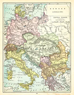
Background imageMaps Collection: Map of Central Europe, c1914. Creator: John Bartholomew & Son

Map of Central Europe, c1914. Creator: John Bartholomew & Son
Map of Central Europe, c1914. Europe as it looked at the beginning of the First World War. From " The Great World War - A History" Volume I, edited by Frank A Mumby

Background imageMaps Collection: Sketch Map of the Valley of the Aisne above Soissons, 1914, (c1920). Creator: Unknown

Sketch Map of the Valley of the Aisne above Soissons, 1914, (c1920). Creator: Unknown
Sketch Map of the Valley of the Aisne above Soissons, 1914, (c1920). Part of northern France, showing Laon and Rheims, at the start of the First World War

Background imageMaps Collection: The Second Phase of the Great Retreat... 1914, (c1920). Creator: Unknown

The Second Phase of the Great Retreat... 1914, (c1920). Creator: Unknown
The Second Phase of the Great Retreat: Plan Showing the British Positions from August 28 to September 6, 1914, 1920. The map also indicates the positions of the Allies

Background imageMaps Collection: The First Phase of the Great Retreat... 1914, (c1920). Creator: Unknown

The First Phase of the Great Retreat... 1914, (c1920). Creator: Unknown
The First Phase of the Great Retreat: Plan Showing the British Positions from August 23 to August 28, 1914, (c1920). Map of northern France and Belgium

Background imageMaps Collection: Map of Belgium and Northern France, c1914, (c1920). Creator: John Bartholomew & Son

Map of Belgium and Northern France, c1914, (c1920). Creator: John Bartholomew & Son
Map of Belgium and Northern France, c1914, (c1920). How the area looked at the start of the First World War. From " The Great World War - A History" Volume I, edited by Frank A Mumby

Background imageMaps Collection: Duke of Wellington at the Garonne

Duke of Wellington at the Garonne
An engraving from " The Heroes of England: Stories of the Lives of Englands Warriors by Land and Sea" edited by John G. Edgar and printed in 1859: published by Bickers & Son

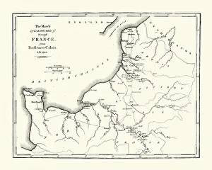
Background imageMaps Collection: Map of Edward III route through France

Map of Edward III route through France
Vintage engraving showing a Map of King Edward III route through France, from Barfleur to Calais in 1300. During the hundred years war

Background imageMaps Collection: Old Map of Acadie, Canada

Old Map of Acadie, Canada
Vintage engraving of Old Map of Acadie. Acadia, French name for the former French colony today comprising roughly the Canadian provinces of Nova Scotia, New Brunswick, and Prince Edward Island

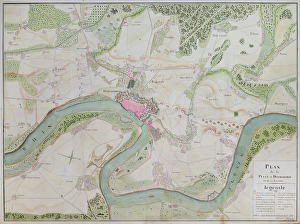
Background imageMaps Collection: Map of Dusseldorf and surrounding areas (pen & ink on paper)

Map of Dusseldorf and surrounding areas (pen & ink on paper)
2562868 Map of Dusseldorf and surrounding areas (pen & ink on paper) by French School, (18th century); Archives du Genie, Vincennes, France; French, out of copyright

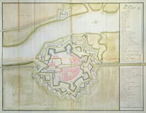
Background imageMaps Collection: Map of Sas van Gent, Netherlands, 1747 (pen, ink & w / c on paper)

Map of Sas van Gent, Netherlands, 1747 (pen, ink & w / c on paper)
898702 Map of Sas van Gent, Netherlands, 1747 (pen, ink & w/c on paper) by French School, (18th century); Service Historique de l Armee de Terre, Vincennes

Background imageMaps Collection: The Kingdom of France, from a nautical atlas, 1646 (ink on vellum)

The Kingdom of France, from a nautical atlas, 1646 (ink on vellum)
XOT330935 The Kingdom of France, from a nautical atlas, 1646 (ink on vellum) by Italian School, (17th century); Museo Correr, Venice, Italy; Italian, out of copyright

Background imageMaps Collection: Detail from the Catalan Atlas, 1375 (vellum)

Detail from the Catalan Atlas, 1375 (vellum)
XZL151844 Detail from the Catalan Atlas, 1375 (vellum) by Cresques, Abraham (1325-87); Bibliotheque Nationale, Paris, France; Spanish, out of copyright

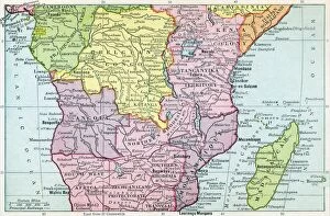
Background imageMaps Collection: Map Of Central Africa Circa 1930. From The Modern Atlas Of The World Published Circa 1930

Map Of Central Africa Circa 1930. From The Modern Atlas Of The World Published Circa 1930

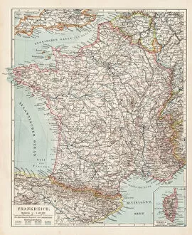
Background imageMaps Collection: Map of France 1900

Map of France 1900
Meyers hand-Atlas Leipzig und Wien Verlag des Bibliographischen Instituts 1900

Background imageMaps Collection: europe map 1829

europe map 1829
an old map form 1829, showing the whole europe

Background imageMaps Collection: 20 - France- Vintage Color Dark

20 - France- Vintage Color Dark
Map of France - Vintage Vector illustration

Background imageMaps Collection: Carta Pisana, ca 1275-1300. Artist: Anonymous master

Carta Pisana, ca 1275-1300. Artist: Anonymous master
Carta Pisana, ca 1275-1300. Found in the collection of the Bibliotheque Nationale de France

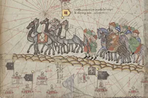
Background imageMaps Collection: Caravan on the Silk Road. Detail from the Catalan Atlas

Caravan on the Silk Road. Detail from the Catalan Atlas. Found in the Collection of Bibliotheque Nationale de France

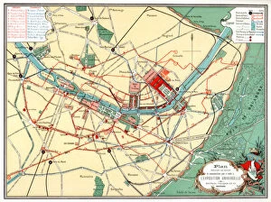
Background imageMaps Collection: Plan of the Universal Exposition, Paris, 1889

Plan of the Universal Exposition, Paris, 1889. The Exposition Universelle of 1889 was staged in commemration of the centenary of the French Revolution

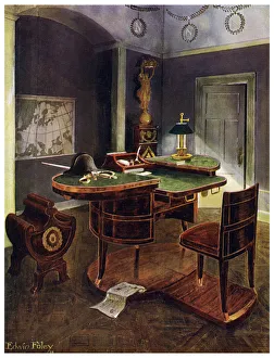
Background imageMaps Collection: Campaign desk of Napoleon I, Chateau de la Malmaison, France, 1911-1912. Artist: Edwin Foley

Campaign desk of Napoleon I, Chateau de la Malmaison, France, 1911-1912. Artist: Edwin Foley
Campaign desk of Napoleon I, Chateau de la Malmaison, France, 1911-1912. A print from The Book of Decorative Furniture its Form, Colour and History, Volume II by Edwin Foley, TC and EC Jack Ltd

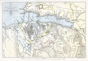
Background imageMaps Collection: Map showing the Siege of Sevastopol, Crimean War, 1854-1855, (1893). Artist: Robert Walker

Map showing the Siege of Sevastopol, Crimean War, 1854-1855, (1893). Artist: Robert Walker
Map showing the Siege of Sevastopol, Crimean War, 1854-1855, (1893). The Siege of Sevastopol, lasted from September 1854 until September 1855

Background imageMaps Collection: Echec au Roi, Franco-Prussian War, 1870-1871

Echec au Roi, Franco-Prussian War, 1870-1871. Caricature of Napoleon III of France and Wilhelm I of Prussia from Les Celebrites. From a private collection

Background imageMaps Collection: Map of Europe 1895

Map of Europe 1895
The Rand-McNally Grammar School Geography 1895 - Chicago & New York

Background imageMaps Collection: Map of Central Europe 1895

Map of Central Europe 1895
The Rand-McNally Grammar School Geography 1895 - Chicago & New York

Background imageMaps Collection: Plan of the Attack at 5.30pm, when these were almost exclusively the Ships engaged with

Plan of the Attack at 5.30pm, when these were almost exclusively the Ships engaged with the... 1854 Creator: Unknown
Plan of the Attack at 5.30pm, when these were almost exclusively the Ships engaged with the Forts, 1854. Crimean War. Map showing the besieged Black Sea port of Sebastopol

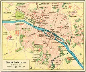
Background imageMaps Collection: Plan of Paris, France in 1789

Plan of Paris, France in 1789. From Historical Atlas, published 1923

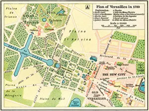
Background imageMaps Collection: Plan of Versailles, France in 1789

Plan of Versailles, France in 1789. From Historical Atlas, published 1923

Background imageMaps Collection: Elysee Palace - map

Elysee Palace - map
A plan of the Elysee Palace, Paris. Date: 1913

Background imageMaps Collection: Old engraved map of Brittany, the westernmost region of Metropolitan France

Old engraved map of Brittany, the westernmost region of Metropolitan France
Antique Illustration, Copyright has expired on this artwork. From my own archives, digitally restored

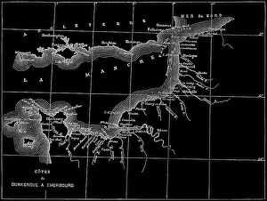
Background imageMaps Collection: Old engraved map of the English Channel or La Manche, an arm of the Atlantic Ocean that separates

Old engraved map of the English Channel or La Manche, an arm of the Atlantic Ocean that separates Southern England
Copyright has expired on this artwork. From my own archives, digitally restored

Background imageMaps Collection: Old engraved illustration of France geological map

Old engraved illustration of France geological map
Copyright has expired on this artwork. From my own archives, digitally restored

Background imageMaps Collection: PARIS

PARIS
THE MIUUS STUDIO

Background imageMaps Collection: Paris Map

Paris Map
Pictufy Studio II

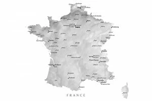
Background imageMaps Collection: Gray map of France

Gray map of France
Rosana Laiz Blursbyai

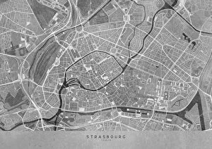
Background imageMaps Collection: Gray vintage map of Strasbourg downtown France

Gray vintage map of Strasbourg downtown France
Rosana Laiz Blursbyai

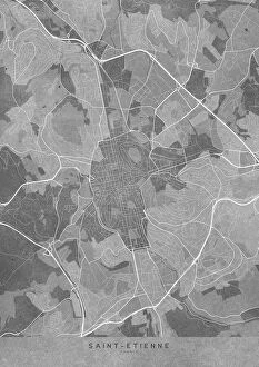
Background imageMaps Collection: Gray vintage map of Saint Etienne France

Gray vintage map of Saint Etienne France
Rosana Laiz Blursbyai

Background imageMaps Collection: Gray vintage map of Toulon France

Gray vintage map of Toulon France
Rosana Laiz Blursbyai

Background imageMaps Collection: Gray vintage map of Strasbourg France

Gray vintage map of Strasbourg France
Rosana Laiz Blursbyai

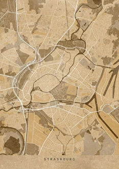
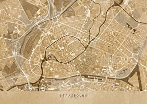
Background imageMaps Collection: Sepia vintage map of Strasbourg France

Sepia vintage map of Strasbourg France
Rosana Laiz Blursbyai

Background imageMaps Collection: Gray vintage map of Toulouse downtown France

Gray vintage map of Toulouse downtown France
Rosana Laiz Blursbyai

Background imageMaps Collection: Sepia vintage map of Toulouse France

Sepia vintage map of Toulouse France
Rosana Laiz Blursbyai

Background imageMaps Collection: Gray vintage map of Saint Etienne downtown France

Gray vintage map of Saint Etienne downtown France
Rosana Laiz Blursbyai

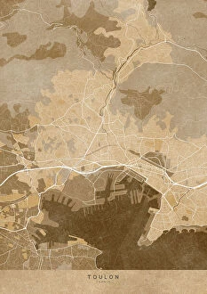
Background imageMaps Collection: Sepia vintage map of Toulon France

Sepia vintage map of Toulon France
Rosana Laiz Blursbyai

Background imageMaps Collection: Sepia vintage map of Strasbourg downtown France

Sepia vintage map of Strasbourg downtown France
Rosana Laiz Blursbyai

Background imageMaps Collection: Gray vintage map of Rennes France

Gray vintage map of Rennes France
Rosana Laiz Blursbyai

Background imageMaps Collection: Sepia vintage map of Rennes France

Sepia vintage map of Rennes France
Rosana Laiz Blursbyai

Background imageMaps Collection: Gray vintage map of Nantes France

Gray vintage map of Nantes France
Rosana Laiz Blursbyai


All Professionally Made to Order for Quick Shipping


-

Maps Collection

Maps of France Europe are essential tools for travelers and tourists who want to explore the continent. They provide an overview of the country, its major cities, and its attractions and are show roads, rivers, mountains, lakes, and other natural features that make up the landscape. Additionally, they often include information about local customs and culture as well as points of interest such as museums or monuments, and are be found in bookstores or online in various formats including paper maps or digital versions that can be accessed on mobile devices. With a map of France Europe in hand travelers will have no trouble navigating their way around this beautiful country.
+

Our beautiful Wall Art and Photo Gifts include Framed Prints, Photo Prints, Poster Prints, Canvas Prints, Jigsaw Puzzles, Metal Prints and so much more

The Maps of France Europe collection is a stunning assortment of wall art and framed prints that showcase the beauty and diversity of France. Our collection features an extensive range of maps, including antique maps dating back to the 16th century, as well as modern-day maps highlighting the country's cities, regions, and landmarks. Each print in our collection has been carefully curated by Media Storehouse to provide customers with a unique glimpse into French history and culture. From detailed depictions of Parisian streets to panoramic views of the Alps, these prints are sure to captivate anyone who loves France or European geography. Whether you're looking for a beautiful piece of artwork for your home or office or want to give someone special a thoughtful gift, Maps of France Europe offers something for everyone. With its high-quality printing techniques and durable framing options, our collection is sure to impress even the most discerning art enthusiasts.
+

What are Maps of France Europe art prints?

Maps of France Europe art prints are high-quality reproductions of vintage and contemporary maps showcasing the geography, topography, and landmarks of France and its neighboring European countries. These prints are perfect for those who love history, travel, or simply appreciate the beauty of cartography. The collection includes a wide range of styles, from antique maps dating back to the 16th century to modern designs featuring vibrant colors and intricate details. Some prints focus on specific regions or cities within France or Europe while others provide an overview of the entire continent. These art prints can be used to decorate any room in your home or office, adding a touch of sophistication and elegance to your space. They also make great gifts for anyone with an interest in geography or history. Whether you're looking for a unique piece to add to your personal collection or want to give someone special a thoughtful gift they'll treasure forever, Maps of France Europe art prints from Media Storehouse are sure to impress.
+

What Maps of France Europe art prints can I buy from Media Storehouse?

We offer a wide range of Maps of France Europe art prints that are perfect for those who love to travel or have an interest in geography. These maps come in various styles and designs, including vintage, antique, and modern versions. You can choose from different sizes and formats such as canvas prints, framed prints, posters or photographic prints. Some popular options include the Antique Map of France by John Speed which dates back to 1626; the Vintage Map of Paris which showcases the city's famous landmarks; and the Modern Map of Europe which highlights all major cities across the continent. Whether you're looking for a decorative piece for your home or office space or want to gift it to someone who loves history or geography- Media Storehouse has got you covered with their vast collection of Maps of France Europe art prints.
+

How do I buy Maps of France Europe art prints?

To buy Maps of France Europe art prints from Media Storehouse, you can browse through our extensive collection of maps and select the ones that interest you. Once you have made your selection, add them to your cart and proceed to checkout. You will be prompted to enter your shipping and payment information before completing the purchase. We offer a variety of sizes for their art prints, so make sure to choose the one that best fits your needs. The maps are printed on high-quality paper using state-of-the-art printing technology, ensuring that they look great in any setting. If you have any questions or concerns about purchasing Maps of France Europe art prints from Media Storehouse, our customer service team is available to assist you. They can provide additional information about the products or help with any issues that may arise during the ordering process.
+

How much do Maps of France Europe art prints cost?

We offer a wide range of Maps of France Europe art prints at varying prices. The cost of these prints depends on several factors such as the size, quality, and type of print you choose. Our standard paper prints are more affordable than our premium canvas or framed options. Additionally, some maps may be more intricate and detailed than others which can also impact the price. We strive to provide high-quality products at reasonable prices for all customers. Our Maps of France Europe art prints make great additions to any home or office decor and are perfect for history buffs or those who love travel. With a variety of sizes and styles available, there is something for everyone's taste and budget. We encourage customers to browse our selection online to find the perfect map print that fits their needs and preferences without breaking the bank.
+

How will my Maps of France Europe art prints be delivered to me?

We take great care in delivering your Maps of France Europe art prints to you. We use high-quality packaging materials to ensure that your artwork arrives in pristine condition. Your print will be carefully rolled and placed inside a sturdy tube for protection during transit. We work with trusted shipping partners who offer reliable delivery services. Once your order has been dispatched, you will receive an email notification with tracking information so that you can monitor the progress of your shipment. Our team is dedicated to providing excellent customer service, and we are always available to answer any questions or concerns you may have about the delivery process. If there are any issues with your order upon arrival, please contact us immediately so that we can resolve them as quickly as possible. You can trust Media Storehouse to deliver your Maps of France Europe art prints safely and efficiently straight to your doorstep.