
Maps Collection
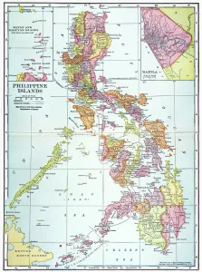
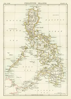
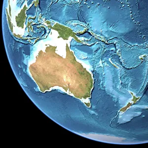
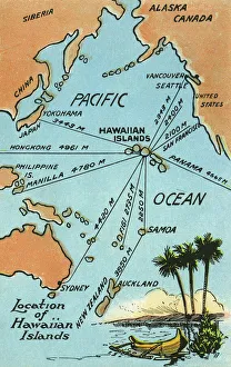
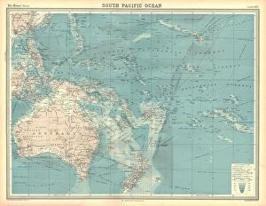
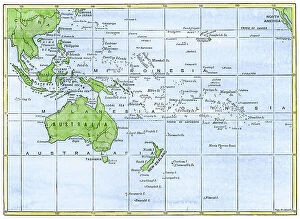
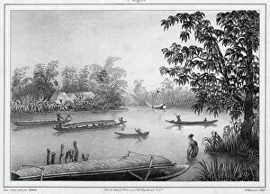
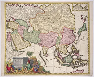
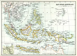
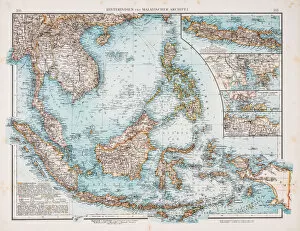
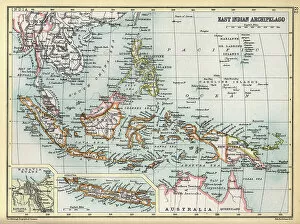
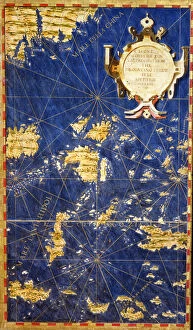
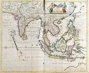
The Philippines is an archipelago of more than 7,000 islands located in Southeast Asia, and is bordered by the South China Sea to the west
Choose a picture from our Maps Collection for your Wall Art and Photo Gifts
87 items


All Professionally Made to Order for Quick Shipping
-
Maps Collection
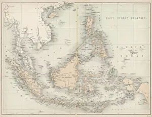
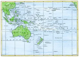
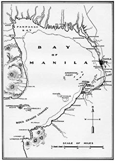
The Philippines is an archipelago of more than 7,000 islands located in Southeast Asia, and is bordered by the South China Sea to the west, the Philippine Sea to the east, and the Celebes Sea to the south. Maps of Philippines Asia provide a comprehensive overview of this diverse region. They show its major cities, rivers and lakes, mountain ranges and other geographical features. Political maps illustrate provincial boundaries as well as international borders with neighboring countries such as Malaysia and Indonesia. Physical maps highlight topography including mountains, valleys, plains and coastal areas while climate maps show average temperatures throughout each season. It also depict vegetation zones which range from tropical rainforest in some parts of Mindanao to grasslands in Luzon's central plain region. With so many islands and varied terrain, they can essential for navigating this fascinating part of Asia.
+
Our beautiful pictures are available as Framed Prints, Photos, Wall Art and Photo Gifts
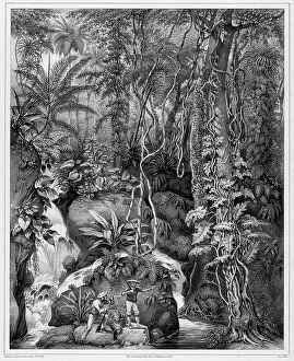
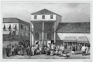
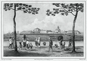
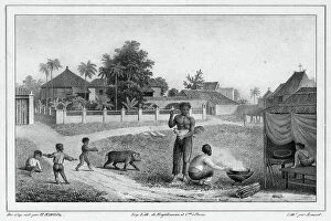
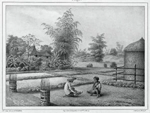
The Maps of Philippines Asia collection from Media Storehouse is a stunning array of wall art and framed prints that showcase the beauty and diversity of the Philippine archipelago. Our collection features a wide range of maps, including vintage maps dating back to the 16th century, as well as contemporary satellite images that capture the country's modern landscape. Each print in our collection is carefully crafted using high-quality materials to ensure its longevity and durability. Whether you're looking for a unique piece of artwork to decorate your home or office, or simply want to learn more about the geography and history of this fascinating region, these maps are sure to impress. From intricate cartographic details to vibrant colors and textures, each map in our collection tells its own story about the Philippines' rich cultural heritage and natural wonders. So why not explore this captivating corner of Southeast Asia today with one of these beautiful prints?
+
What are Maps of Philippines Asia art prints?
Maps of Philippines Asia art prints are high-quality reproductions of maps that depict the geography and topography of the Philippines, a country located in Southeast Asia. These prints showcase intricate details such as cities, towns, rivers, mountains and other landmarks that make up the archipelago. These maps are not only informative but also visually appealing with their vibrant colors and intricate designs. They can be used for educational purposes or simply as decorative pieces to add character to any space. The Maps of Philippines Asia art prints come in various sizes and formats including framed or unframed options depending on your preference. They are printed using state-of-the-art technology ensuring sharpness and clarity in every detail. Whether you're a history buff or just looking for unique wall decor, these maps offer an interesting perspective on one of the most beautiful countries in Asia.
+
What Maps of Philippines Asia art prints can I buy from Media Storehouse?
We offer a wide range of Maps of Philippines Asia art prints that you can choose from. These maps are available in different sizes and styles, including vintage, modern, and artistic designs. You can find detailed topographical maps that showcase the country's terrain or political maps that highlight its cities and provinces. In addition to traditional paper prints, Media Storehouse also offers canvas prints for a more textured look. These canvases come ready to hang on your wall and add an extra dimension to your decor. If you're looking for something unique, Media Storehouse also has customizable map prints where you can select specific locations or add text overlays. This is perfect for commemorating special events or creating personalized gifts. Whether you're interested in historical cartography or contemporary design, we have a variety of Maps of Philippines Asia art prints to suit your taste.
+
How do I buy Maps of Philippines Asia art prints?
To purchase Maps of Philippines Asia art prints from Media Storehouse, you can browse our extensive collection online and select the print that best suits your needs. Once you have found the artwork you want to buy, simply add it to your cart and proceed to checkout. During checkout, you will be prompted to enter your shipping information and payment details. We offer a variety of payment options including credit card, PayPal, and Apple Pay for added convenience. After completing your purchase, your Maps of Philippines Asia art print will be printed on high-quality paper using state-of-the-art printing technology. Once printed, the artwork will be carefully packaged and shipped directly to your doorstep. Whether you are looking for a unique piece of wall art or a thoughtful gift for someone special, Media Storehouse makes it easy to buy Maps of Philippines Asia art prints online with just a few clicks.
+
How much do Maps of Philippines Asia art prints cost?
We offer a wide range of Maps of Philippines Asia art prints that are available at different prices. Our collection includes various styles and sizes to suit everyone's preferences and budget. The cost of the Maps of Philippines Asia art prints may vary depending on factors such as the size, style, and quality of the print. We strive to provide high-quality products at affordable prices so that our you can enjoy beautiful artwork without breaking their bank accounts. Our team works hard to ensure that all our products meet industry standards while maintaining competitive pricing. Whether you're looking for a small or large-sized print, black and white or colored maps, we have something for everyone. We take pride in offering exceptional customer service and ensuring that every purchase is delivered promptly with no hassle. If you're interested in purchasing Maps of Philippines Asia art prints from us at Media Storehouse, please feel free to browse through our collection online or contact us directly for more information about pricing options.
+
How will my Maps of Philippines Asia art prints be delivered to me?
Your Maps of Philippines Asia art prints will be delivered to you in a safe and secure manner. We take great care in packaging your artwork so that it arrives at your doorstep undamaged. Our team uses high-quality materials, such as sturdy cardboard boxes and protective wrapping, to ensure that your prints are well-protected during transit. We work with trusted delivery partners who have years of experience in handling delicate items like art prints. They will deliver your order directly to the address you provided during checkout. Once your order has been dispatched, we will send you an email confirmation along with tracking information so that you can keep track of its progress until it reaches you. We pride ourselves on providing excellent customer service and ensuring that our customers receive their orders promptly and in perfect condition. If for any reason there is an issue with your delivery or print quality, please do not hesitate to contact us so that we can resolve the matter quickly and efficiently.