Fraud Blocker Skip to main content

Home > Asia > Pakistan > Maps

Maps Collection

Pakistan is a country in South Asia, located at the crossroads of Central Asia and Western Asia, and is bordered by India to the east, Afghanistan to the west

Choose a picture from our Maps Collection for your Wall Art and Photo Gifts

69 items

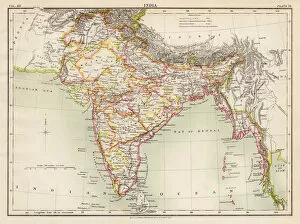
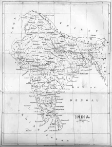
Background imageMaps Collection: India map 1881

India map 1881
Encyclopedia Britannica 9th Edition Vol XII Philadelphia j.M. Stoddart & Co 1881

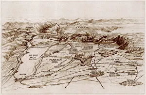
Background imageMaps Collection: Partition. Map of East and West Punjab

Partition. Map of East and West Punjab
The areas of the Western and Eastern Punjab where there were many outbreaks of violence between Muslims, Sikhs and Hindus following Partition and the creation of modern India and Pakistan

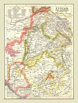
Background imageMaps Collection: Map of Punjab, Sind, Rajputana and Kashmir, 1902. Creator: Unknown

Map of Punjab, Sind, Rajputana and Kashmir, 1902. Creator: Unknown
Map of Punjab, Sind, Rajputana and Kashmir, 1902. From The Century Atlas of the World. [John Walker & Co, Ltd. London, 1902]

Background imageMaps Collection: Map of India, 1857. Creator: Unknown

Map of India, 1857. Creator: Unknown
Map of India, 1857. Map of the Indian subcontinent during the British colonial period, showing Kingdoms, States, Provinces &c...Principal Rivers...Bays, Gulfs &c...Principal Cities, Towns

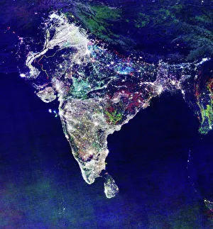
Background imageMaps Collection: India at night, satellite image

India at night, satellite image
India at night, satellite view. This image is a composite showing the change in illumination over India from 1992-2003. Satellite data from 2003 is coloured red

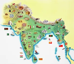
Background imageMaps Collection: India, map with illustrations showing distinguishing features

India, map with illustrations showing distinguishing features

Background imageMaps Collection: Map of the Tirah Campaign, c1900. Creator: Unknown

Map of the Tirah Campaign, c1900. Creator: Unknown
Map of the Tirah Campaign, c1900. The Tirah expedition was an Indian frontier campaign from September 1897 to April 1898. Tirah is a mountainous tract of country in what was formally known as

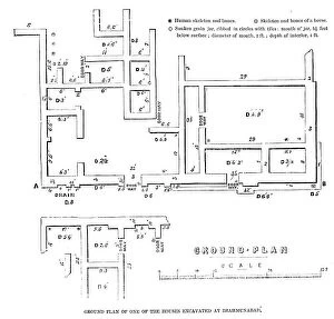
Background imageMaps Collection: Ground plan of one of the houses excavated at Brahmunabad, 1857. Creator: Unknown

Ground plan of one of the houses excavated at Brahmunabad, 1857. Creator: Unknown
Ground plan of one of the houses excavated at Brahmunabad, 1857. Ancient city in what is now Pakistan, excavated at his own expense by Mr. A. F

Background imageMaps Collection: 16th century, antique, archival, bangladesh, banner, bay of bengal, border, cartography

16th century, antique, archival, bangladesh, banner, bay of bengal, border, cartography, ceylon, country, document, geography, historic, historical, india, indian ocean, latitude, legend, map

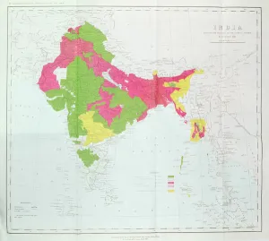
Background imageMaps Collection: Map of India, showing the progress of the Imperial Surveys, published under the direction

Map of India, showing the progress of the Imperial Surveys, published under the direction
XCF306005 Map of India, showing the progress of the Imperial Surveys, published under the direction of Colonel H.R. Thuillier, R.E

Background imageMaps Collection: Pakistan country map

Pakistan country map
2011 edition

Background imageMaps Collection: 13864015

13864015

Background imageMaps Collection: 13825172

13825172

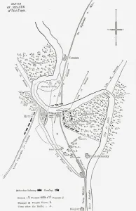
Background imageMaps Collection: Plan of the Battle of Meanee, c1891. Creator: James Grant

Plan of the Battle of Meanee, c1891. Creator: James Grant
Plan of the Battle of Meanee, c1891. From " Cassells Illustrated History of India Vol. II.", by James Grant. [Cassell Petter & Galpin, London, Paris and New York]

Background imageMaps Collection: Plan of the Battle of Dubba (engraving)

Plan of the Battle of Dubba (engraving)
1617126 Plan of the Battle of Dubba (engraving) by English School, (19th century); Private Collection; (add.info.: Plan of the Battle of Dubba)

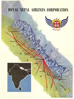
Background imageMaps Collection: Poster, Royal Nepal Airlines Corporation

Poster, Royal Nepal Airlines Corporation, with a map showing routes. 1958

Background imageMaps Collection: Seat of the War in India (engraving)

Seat of the War in India (engraving)
1101799 Seat of the War in India (engraving) by English School, (19th century); Private Collection; (add.info.: Seat of the War in India)

Background imageMaps Collection: Map of Afghanistan and the Adjacent Territories of Russian Turkestan, Persia, and India (engraving)

Map of Afghanistan and the Adjacent Territories of Russian Turkestan, Persia, and India (engraving)
1591060 Map of Afghanistan and the Adjacent Territories of Russian Turkestan, Persia, and India (engraving) by English School

Background imageMaps Collection: Map of Scinde (engraving)

Map of Scinde (engraving)
1617033 Map of Scinde (engraving) by English School, (19th century); Private Collection; (add.info.: Map of Scinde. Illustration for The Illustrated London News, 13 May 1843)

Background imageMaps Collection: The Frontier Fingerpost outlining the North-West Frontier of British India

The Frontier Fingerpost outlining the North-West Frontier of British India
TRV230420 The Frontier Fingerpost outlining the North-West Frontier of British India, from Gun-Running and the North-West Frontier by Arnold Keppel

Background imageMaps Collection: The Indian Rising, the Revolt of the Frontier Tribes (b / w photo)

The Indian Rising, the Revolt of the Frontier Tribes (b / w photo)
1042488 The Indian Rising, the Revolt of the Frontier Tribes (b/w photo) by English photographer, (19th century) (after); Private Collection; (add.info.: The Indian Rising)

Background imageMaps Collection: The Countries between British India and Russian Asia (engraving)

The Countries between British India and Russian Asia (engraving)
1621572 The Countries between British India and Russian Asia (engraving) by English School, (19th century); Private Collection; (add.info.: The Countries between British India and Russian Asia)

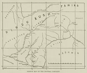
Background imageMaps Collection: Sketch Map of the Chitral Campaign (engraving)

Sketch Map of the Chitral Campaign (engraving)
1628067 Sketch Map of the Chitral Campaign (engraving) by English School, (19th century); Private Collection; (add.info.: Sketch Map of the Chitral Campaign)

Background imageMaps Collection: Afghanistan and its Surroundings, showing the Frontiers of Russia and British India (engraving)

Afghanistan and its Surroundings, showing the Frontiers of Russia and British India (engraving)
1059908 Afghanistan and its Surroundings, showing the Frontiers of Russia and British India (engraving) by English School

Background imageMaps Collection: The War in the Punjaub (engraving)

The War in the Punjaub (engraving)
1617899 The War in the Punjaub (engraving) by English School, (19th century); Private Collection; (add.info.: The War in the Punjaub. Illustration for The Illustrated London News, 27 January 1849)

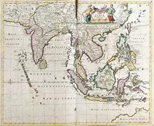
Background imageMaps Collection: Map of East India (South and Southeast Asia: Pakistan, India, Nepal, Bangladesh, Burma

Map of East India (South and Southeast Asia: Pakistan, India, Nepal, Bangladesh, Burma
LRI4710618 Map of East India (South and Southeast Asia: Pakistan, India, Nepal, Bangladesh, Burma, Sri Lanka, Thailand, Malaysia, Vietnam, Cambodia, Laos, Philipines)

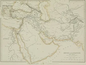
Background imageMaps Collection: Antique map of the Empire of Alexander the Great

Antique map of the Empire of Alexander the Great
afghanistan, antique, arabia, arabian, azerbijan, black, border, cartography, caspian, coordinates, countries, document, empire of alexander the great, geography, historic, historical, iran, iraq

Background imageMaps Collection: MAPS, ASIA, INDIA 1719

MAPS, ASIA, INDIA 1719
Crude map of northern India, previous to any extensive colonisation, including parts of Pakistan & Bangladesh & the sources of two great rivers the Ganges & Indus

Background imageMaps Collection: Map of India, published under the direction of Colonel H

Map of India, published under the direction of Colonel H
XCF306003 Map of India, published under the direction of Colonel H.R. Thuillier, R.E. Surveyor General of India, 1877 (colour litho) by English School, (19th century); Private Collection; English

Background imageMaps Collection: Map of the Indian Empire, 1902. Creator: Unknown

Map of the Indian Empire, 1902. Creator: Unknown
Map of the Indian Empire, 1902. Showing the Indian subcontinent during the period of the British Raj (rule by the British Crown). From The Century Atlas of the World. [John Walker & Co, Ltd

Background imageMaps Collection: Map of Persia, 1902. Creator: Unknown

Map of Persia, 1902. Creator: Unknown
Map of Persia, 1902. Showing Persia, Afghanistan and Baluchistan, and the Persian Gulf. From The Century Atlas of the World. [John Walker & Co, Ltd. London, 1902]

Background imageMaps Collection: Map of India - North Western Section

Map of India - North Western Section. Map showing Afghanistan and the Khyber Pass, what is now Pakistan, the Spin Ghar and Himalayan mountain ranges and parts of northern India

Background imageMaps Collection: Political map of South Western Asia

Political map of South Western Asia. Map of the Near and Middle East, showing parts of East Africa and the Arabian Peninsula. Plate 50 from The Times Atlas

Background imageMaps Collection: The Citadel of Attock and a bridge of boats over the Indus, Pakistan, 1895

The Citadel of Attock and a bridge of boats over the Indus, Pakistan, 1895. From The Universal Geography with Illustrations and Maps, division XVI

Background imageMaps Collection: A ruined tope (stupa) in the Khyber Pass, Pakistan / Afhanistan, 1895

A ruined tope (stupa) in the Khyber Pass, Pakistan / Afhanistan, 1895
A ruined tope (stupa) in the Khyber Pass, Pakistan/Afhanistan, 1895. A stupa is a type of Buddhist mound-like structure found across the Indian subcontinent, other parts of Asia

Background imageMaps Collection: The Srinagar Bridge over the river Jhelum, Pakistan, 1895

The Srinagar Bridge over the river Jhelum, Pakistan, 1895. From The Universal Geography with Illustrations and Maps, division XV, written by Elisee Reclus and published by Virtue & Co

Background imageMaps Collection: Whos to Pay?, 1878. Artist: Swain

Whos to Pay?, 1878. Artist: Swain
Whos to Pay?, 1878. British prime minister Benjamin Disraeli and a personification of India wearing a sari. Behind is a map of Indias North West Frontier and Afghanistan

Background imageMaps Collection: Map of India, 1847

Map of India, 1847. Illustration from The History of China and India, by Miss Corner, (Dean and Co, London, 1847)

Background imageMaps Collection: Bridge of boats over the Indus at Khushalgarh, Pakistan, 1895

Bridge of boats over the Indus at Khushalgarh, Pakistan, 1895. From The Universal Geography with Illustrations and Maps, division XV, written by Elisee Reclus and published by Virtue & Co

Background imageMaps Collection: The Raja of Bahawalpur and his Court, 1895

The Raja of Bahawalpur and his Court, 1895. From The Universal Geography with Illustrations and Maps, division XV, written by Elisee Reclus and published by Virtue & Co. Limited (London, 1895)

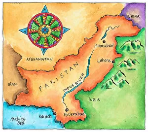
Background imageMaps Collection: Map of Pakistan

Map of Pakistan
wov040.jpg

Background imageMaps Collection: Proposed partition map of India and Pakistan

Proposed partition map of India and Pakistan
A map of India showing the suggested area of Pakistan - an independent state for Muslims in a free India. The shaded area shows the provinces forming the basis of Pakistan

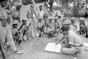
Background imageMaps Collection: A large area of East Pakistan territory is under the control of the Bangladesh Freedom

A large area of East Pakistan territory is under the control of the Bangladesh Freedom Fighters. These pictures were taken on patrol with an operational unit whose camp is in the Jungle just inside

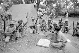
Background imageMaps Collection: Pakistan - Bangladesh Civil War June 1971 A large area of East Pakistan

Pakistan - Bangladesh Civil War June 1971 A large area of East Pakistan territory is under the control of the Bangladesh Freedom Fighters

Background imageMaps Collection: Map of India, published under the direction of Colonel H

Map of India, published under the direction of Colonel H
XCF306012 Map of India, published under the direction of Colonel H.R. Thuillier, R.E. Surveyor General of India, 1882 (colour litho) by English School, (19th century); Private Collection; English

Background imageMaps Collection: India Circa 1930. Before Partition. From Bacons Excelsior Atlas Of The World, Published Circa 1930

India Circa 1930. Before Partition. From Bacons Excelsior Atlas Of The World, Published Circa 1930

Background imageMaps Collection: Pakistan locator map

Pakistan locator map
2012 edition

Background imageMaps Collection: Pakistan reference map

Pakistan reference map
2010 edition


All Professionally Made to Order for Quick Shipping


-

Maps Collection

Pakistan is a country in South Asia, located at the crossroads of Central Asia and Western Asia, and is bordered by India to the east, Afghanistan to the west, Iran to the southwest and China in the far northeast. Maps of Pakistan are important tools for understanding its geography and political divisions. Maps show physical features such as rivers, mountains, deserts and forests; major cities; provincial boundaries; international borders; road networks; and other infrastructure. They also provide information about population density, economic activity, climate zones and other socio-economic indicators. Maps of Pakistan are essential for anyone travelling or doing business there as they provide an invaluable overview of this diverse country with its complex history.
+

Our beautiful pictures are available as Framed Prints, Photos, Wall Art and Photo Gifts

The Maps of Pakistan Asia collection from Media Storehouse is a stunning assortment of wall art and framed prints that showcase the beauty and diversity of Pakistan. Our collection features an array of maps, ranging from vintage to contemporary styles, which depict the country's geography, topography, and political boundaries. Each print in our collection is carefully crafted using high-quality materials to ensure longevity and durability. Customers can choose from a variety of sizes and framing options to suit their preferences. Whether you're looking for a unique piece of home decor or a thoughtful gift for someone who loves maps or has an interest in Pakistani culture, our collection offers something for everyone. With its striking colors and intricate details, each map is sure to be a conversation starter that will add character and charm to any room.
+

What are Maps of Pakistan Asia art prints?

Maps of Pakistan Asia art prints are high-quality reproductions of maps depicting the geographical features, cities, and regions of Pakistan. These prints are designed to showcase the beauty and intricacy of cartography as an art form while also providing a useful reference tool for those interested in exploring or studying the region. These maps can be used for educational purposes, such as in classrooms or libraries, or simply as decorative pieces in homes or offices. They come in a variety of sizes and styles to suit different preferences and needs. Whether you're looking to learn more about Pakistan's geography or simply appreciate the aesthetic value of these intricate maps, Maps of Pakistan Asia art prints offer a unique way to explore this fascinating country. With their detailed depictions of mountains, rivers, deserts, and other natural features, they provide a window into one of the world's most diverse and complex regions.
+

What Maps of Pakistan Asia art prints can I buy from Media Storehouse?

We offer a wide range of Maps of Pakistan Asia art prints that are perfect for anyone looking to add some cultural flair to their home or office. These maps showcase the intricate details and unique features of Pakistan, including its diverse geography, landmarks, and cities. Some popular options include vintage maps that capture the country's history and evolution over time, as well as contemporary designs that highlight its modernity and vibrancy. In addition to traditional paper prints, Media Storehouse also offers canvas prints that provide a more textured look and feel. These high-quality reproductions are created using state-of-the-art printing technology to ensure maximum clarity and color accuracy. Whether you're a collector of world maps or simply looking for an eye-catching piece of wall art, we have something for everyone. With so many different styles and sizes available, it's easy to find the perfect Maps of Pakistan Asia art print to suit your personal taste and decor style.
+

How do I buy Maps of Pakistan Asia art prints?

To buy Maps of Pakistan Asia art prints from Media Storehouse, you can browse through their vast collection of maps and select the one that suits your preferences. Once you have chosen the map, click on it to view its details and options for customization. You can choose from a range of sizes and framing options to suit your needs. To place an order, simply add the item to your cart and proceed to checkout. You will be prompted to enter your shipping address and payment information before completing the purchase. We offer high-quality art prints that are perfect for decorating homes or offices. Their maps are printed using state-of-the-art technology on premium quality paper, ensuring vibrant colors and sharp detail. Whether you're a collector or just looking for a unique piece of wall decor, buying Maps of Pakistan Asia art prints from Media Storehouse is easy and hassle-free.
+

How much do Maps of Pakistan Asia art prints cost?

We offer a wide range of Maps of Pakistan Asia art prints for purchase. The cost of these prints varies depending on the size and type of print that you choose. We have options ranging from small to large sizes, as well as different printing materials such as canvas or paper. Our Maps of Pakistan Asia art prints are high-quality reproductions that capture the beauty and detail of the original artwork. They make great additions to any home or office decor, adding a touch of culture and history to your space. We take pride in offering affordable prices for our customers without compromising on quality. Our goal is to provide you with beautiful art pieces that will last for years to come at a reasonable price point. If you're interested in purchasing one of our Maps of Pakistan Asia art prints, please visit our website or contact us directly for more information about pricing and availability.
+

How will my Maps of Pakistan Asia art prints be delivered to me?

We take great care in ensuring that your Maps of Pakistan Asia art prints are delivered to you safely and securely. We use high-quality packaging materials to protect your prints during transit, so they arrive at your doorstep in pristine condition. Once you place an order with us, our team will process it promptly and dispatch the prints from our warehouse. Depending on your location, we may use a variety of delivery services to get your order to you as quickly as possible. We understand how important it is for you to receive your artwork in a timely manner, which is why we work hard to ensure that all orders are shipped out within a reasonable timeframe. You can track the progress of your shipment using the tracking number provided by our delivery partners. We pride ourselves on delivering exceptional customer service and quality products. We hope that you enjoy your Maps of Pakistan Asia art prints.