
Maps Collection
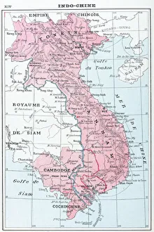
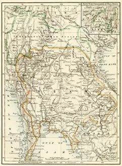
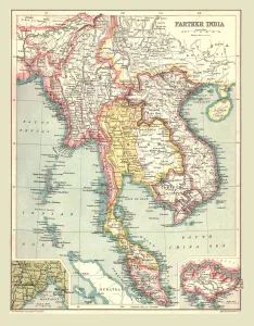
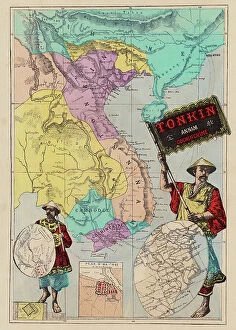
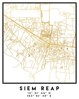
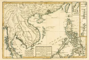
Cambodia is a country in Southeast Asia and has bordered by Thailand to the west and northwest, Laos to the northeast, Vietnam to the east and southeast
Choose a picture from our Maps Collection for your Wall Art and Photo Gifts
33 items


All Professionally Made to Order for Quick Shipping
-
Maps Collection
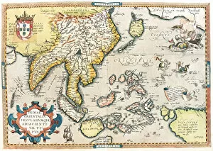
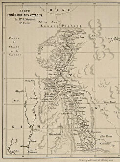
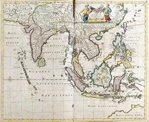
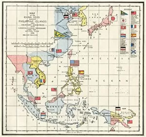
Cambodia is a country in Southeast Asia and has bordered by Thailand to the west and northwest, Laos to the northeast, Vietnam to the east and southeast, and the Gulf of Thailand to the southwest. Cambodia covers an area of 181,035 square kilometers (69,898 sq mi) and has a population of over 16 million people. The capital city is Phnom Penh. The terrain of Cambodia consists mainly of low-lying plains with mountains in the southwest region. The Mekong River flows through much of Cambodia's territory and provides an important source for irrigation for agriculture as well as transportation routes for goods throughout Southeast Asia and can essential tools for understanding this diverse country; they provide insight into its physical geography, political divisions, economic infrastructure, cultural heritage sites and more.
+
Our beautiful pictures are available as Framed Prints, Photos, Wall Art and Photo Gifts
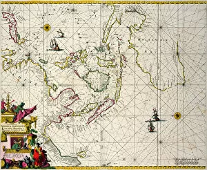
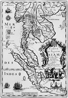
The Maps of Cambodia Asia collection from Media Storehouse is a stunning array of wall art and framed prints that showcase the beauty and history of Cambodia. Our collection features an extensive range of maps, including vintage maps dating back to the 17th century, as well as contemporary maps that highlight the country's modern infrastructure. Each map in our collection has been carefully selected for its unique style and historical significance. The intricate details on these maps provide a fascinating insight into Cambodia's past, while also showcasing its natural beauty. Whether you're looking to add some character to your home or office space, or simply want to learn more about this beautiful country, the Maps of Cambodia Asia collection from Media Storehouse is sure to impress. With a wide variety of sizes and framing options available, there's something for everyone in this impressive collection.
+
What are Maps of Cambodia Asia art prints?
Maps of Cambodia Asia art prints are high-quality reproductions of maps that depict the geography, topography and other features of Cambodia. These prints are created using advanced printing techniques to ensure that they capture every detail and nuance of the original map. These maps can be used for a variety of purposes such as educational or decorative purposes. They can be hung on walls in homes, offices or classrooms to add visual interest and provide information about the country's geography. Maps of Cambodia Asia art prints come in different sizes, styles and formats to suit various preferences. Some feature vintage designs while others have modern interpretations. The colors used vary from muted tones to bright hues depending on the style chosen. Maps of Cambodia Asia art prints offer an excellent way to learn about this fascinating country while also adding aesthetic value to any space they are displayed in.
+
What Maps of Cambodia Asia art prints can I buy from Media Storehouse?
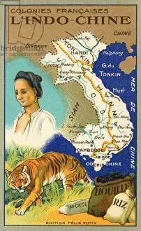
We offer a wide range of Maps of Cambodia Asia art prints that are perfect for anyone who loves history, geography or art. These maps showcase the beauty and complexity of Cambodia's landscape, highlighting its unique features such as rivers, mountains and temples. Some of the popular options include antique maps from the 19th century that depict Cambodia during French colonial rule, while others feature more contemporary designs with bold colors and intricate details. Whether you're looking to decorate your home or office space with a stunning piece of artwork or simply want to add to your collection of historical artifacts, we have something for everyone. Their selection includes high-quality prints in various sizes and formats including canvas prints, framed prints and poster prints. So whether you prefer classic vintage styles or modern interpretations of Cambodian cartography, there is sure to be something that catches your eye at Media Storehouse.
+
How do I buy Maps of Cambodia Asia art prints?
To buy Maps of Cambodia Asia art prints from Media Storehouse, you can browse our extensive collection online. Simply search for "Maps of Cambodia" in the search bar and select the print that catches your eye. Once you have found a suitable print, click on it to view more details such as size options and framing choices. To purchase the print, add it to your cart and proceed to checkout. You will be prompted to enter your shipping information and payment details before finalizing your order. We offer a variety of high-quality printing options including canvas, fine art paper, and photographic paper. We also offer custom framing services so that you can receive a finished product ready to hang on your wall. Whether you're looking for a unique piece of home decor or a thoughtful gift for someone special, our selection of Maps of Cambodia Asia art prints is sure to impress.
+
How much do Maps of Cambodia Asia art prints cost?
As We offer a wide range of Maps of Cambodia Asia art prints, the cost may vary depending on the size and type of print selected. The prices are competitive and affordable, making it accessible for everyone to own a piece of art that showcases the beauty and culture of Cambodia. Each print is carefully crafted using high-quality materials to ensure durability and longevity, allowing customers to enjoy their purchase for years to come. Whether you're looking for a small or large-sized print, black and white or colored, there's something available for every taste and budget. With its stunning designs and intricate details, these maps make an excellent addition to any home or office decor while also serving as an educational tool about the geography of Cambodia in Southeast Asia.
+
How will my Maps of Cambodia Asia art prints be delivered to me?
We take great care in delivering your Maps of Cambodia Asia art prints to you. We use high-quality packaging materials to ensure that your order arrives in pristine condition. Depending on the size and quantity of your order, we may ship it using a courier service or postal mail. For smaller orders, we typically use standard postal mail services which can take between 3-5 business days for delivery within the UK and up to 10 business days for international deliveries. For larger orders or those requiring special handling, such as framed prints, we may use a courier service with tracking information provided. Regardless of how your Maps of Cambodia Asia art prints are delivered to you, rest assured that our team takes every precaution necessary to ensure they arrive safely and securely at their final destination.