
Abraham Ortelius Collection
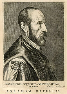
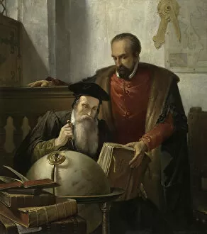
Abraham Ortelius (1527-1598) was a Flemish cartographer and geographer, widely recognized as the creator of the first modern atlas
Choose a picture from our Abraham Ortelius Collection for your Wall Art and Photo Gifts
380 items


All Professionally Made to Order for Quick Shipping
-
Abraham Ortelius Collection
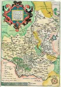
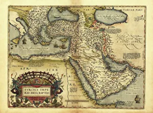
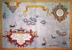
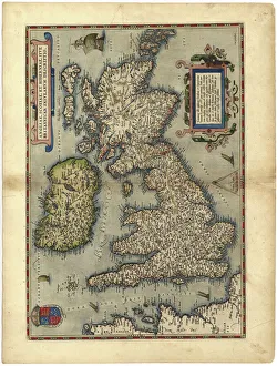
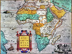
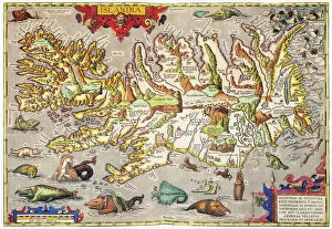
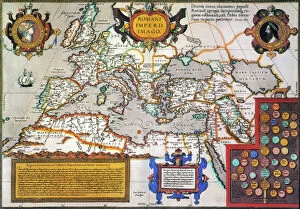
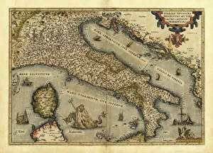
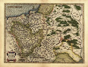
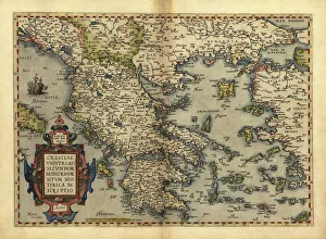
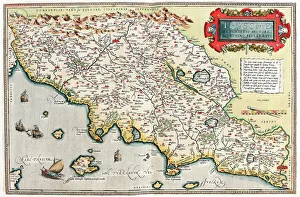
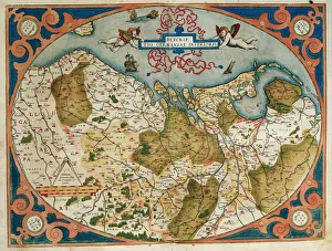
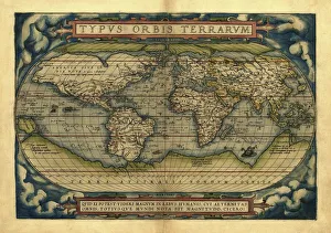
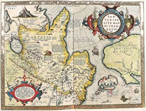
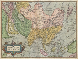
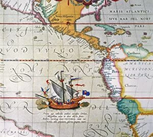
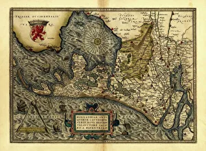
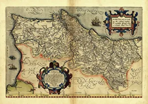
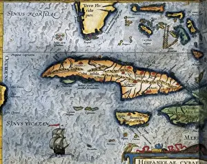
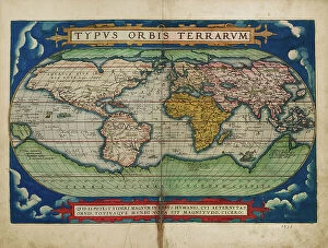
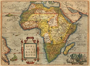
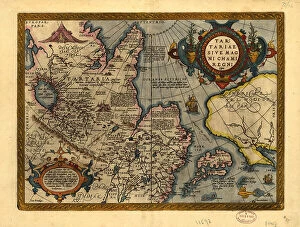
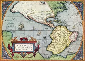
Abraham Ortelius (1527-1598) was a Flemish cartographer and geographer, widely recognized as the creator of the first modern atlas. He was born in Antwerp and studied classical literature, history, and geography. Ortelius compiled maps from various sources into a single volume entitled Theatrum Orbis Terrarum (Theatre of the World), which was published in 1570. This atlas contained 53 maps and became an instant success due to its accuracy and clarity. It also included a description of each map, making it easier for readers to understand their content. Ortelius' work revolutionized cartography by introducing standardization in map production, which allowed for more accurate comparison between different regions. His work also helped spread knowledge about geography throughout Europe during the 16th century Renaissance period.
+
Our beautiful pictures are available as Framed Prints, Photos, Wall Art and Photo Gifts
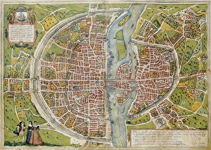
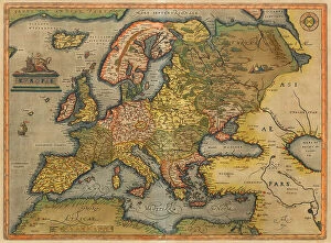
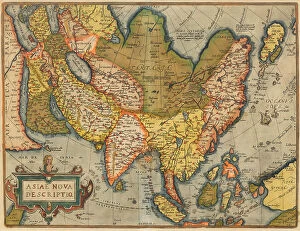
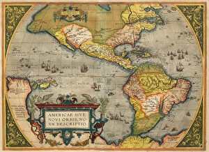
The Abraham Ortelius collection, available on Media Storehouse, is a stunning array of wall art, framed prints, photo prints, canvas prints, jigsaw puzzles and greeting cards. Our collection features the works of Abraham Ortelius who was a Flemish cartographer and geographer in the 16th century. His maps were highly regarded for their accuracy and beauty during his time. Media Storehouse has curated our collection to bring together some of the most beautiful pieces from Ortelius' work. Our collection includes detailed maps of various regions around the world such as Europe, Asia and Africa. These maps are not only historically significant but also visually appealing with intricate details that make them perfect for display in any setting. Whether you're looking for a unique piece of artwork or an educational tool to teach geography or history to your children or students; The Abraham Ortelius Collection is sure to impress. With its wide range of products available at affordable prices - there's something here for everyone.
+
What are Abraham Ortelius (Artists Arts) art prints?
Abraham Ortelius was a Flemish cartographer and geographer who lived during the 16th century. He is best known for his work in creating the first modern atlas, Theatrum Orbis Terrarum, which was published in 1570. His maps were highly detailed and accurate for their time, and they helped to shape our understanding of the world. Artists Arts has created a collection of art prints featuring some of Ortelius' most famous maps. These prints are high-quality reproductions that capture all of the detail and beauty of the original maps. They are perfect for anyone who loves history or geography, or who simply appreciates beautiful artwork. Whether you're looking to decorate your home or office with something unique and interesting, or you want to give a gift that will be treasured for years to come, Artists Arts' Abraham Ortelius art prints are an excellent choice. With their rich colors and intricate details, these prints are sure to impress anyone who sees them.
+
What Abraham Ortelius (Artists Arts) art prints can I buy from Media Storehouse?
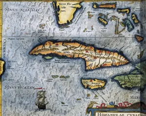
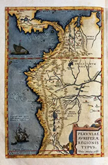
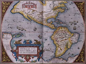
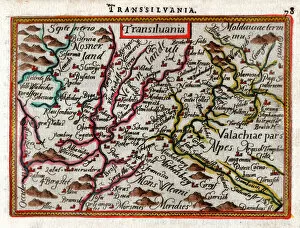
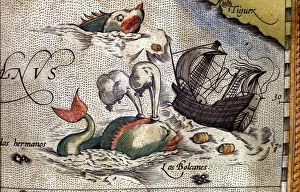
We offer a wide range of Abraham Ortelius art prints for purchase. As one of the most famous cartographers and engravers of the 16th century, Ortelius created many beautiful maps that are still admired today. Some popular options available on Media Storehouse include his world map from 1570, which was the first to use the term "atlas" to describe a collection of maps, as well as his map of Europe from 1595. Additionally, there are several individual country maps available such as Italy and Spain. In addition to his cartography work, Ortelius also produced some stunning illustrations such as those found in his book "Theatrum Orbis Terrarum". These include depictions of animals, plants and mythical creatures. Whether you're looking for a historical map or an intricate illustration by this talented artist, we have a great selection to choose from.
+
How do I buy Abraham Ortelius (Artists Arts) art prints?
To buy Abraham Ortelius art prints from Media Storehouse, you can browse our collection of prints online. Once you have found the print that you would like to purchase, simply add it to your cart and proceed to checkout. During the checkout process, you will be prompted to enter your shipping and payment information. We offer a wide range of sizes for their prints, so be sure to select the size that best suits your needs. We also offer framing options for an additional fee if desired. Once your order has been placed and processed, Media Storehouse will ship your print directly to you. It is important to note that all sales are final, so be sure that you have selected the correct print before completing your purchase. Buying Abraham Ortelius art prints from Media Storehouse is a simple and straightforward process that allows art lovers everywhere access to high-quality reproductions of some of history's most iconic works.
+
How much do Abraham Ortelius (Artists Arts) art prints cost?
Abraham Ortelius was a renowned cartographer and geographer who lived in the 16th century. His work has been celebrated for centuries, and his maps have become highly sought after by collectors all over the world. We offer a range of art prints featuring Ortelius' works, including some of his most famous maps. The cost of these prints can vary depending on a number of factors, such as the size of the print, the quality of the paper or canvas used, and whether or not it is framed. However, regardless of these variables, you can be sure that any Abraham Ortelius art print from Media Storehouse will be an investment worth making for anyone interested in history or geography. Whether you're looking to add some historical flair to your home decor or simply want to own a piece of art that represents one man's incredible contribution to our understanding of the world around us, an Abraham Ortelius art print is definitely worth considering.
+
How will my Abraham Ortelius (Artists Arts) art prints be delivered to me?
We take great care in ensuring that your Abraham Ortelius art prints are delivered to you safely and securely. We use high-quality packaging materials to protect your artwork during transit, including sturdy cardboard tubes for rolled prints and flat cardboard envelopes for smaller sizes. Once your order has been processed, our team carefully prepares your print for shipping. We then work with trusted delivery partners who specialize in handling delicate and valuable items to ensure that your artwork arrives at its destination in perfect condition. We understand the importance of receiving your art prints promptly, which is why we strive to dispatch all orders as quickly as possible. You can track the progress of your shipment using the tracking number provided once it's dispatched from our warehouse. At Media Storehouse, we're committed to providing a seamless shopping experience from start to finish. Rest assured that when you purchase an Abraham Ortelius art print from us, it will be delivered with care and attention every step of the way.