Home > Europe > Greece > Maps
Mouse Mat : Alexanders Expedition


![]()
Home Decor from Mary Evans Picture Library
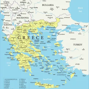
Alexanders Expedition
Map showing his expedition into Asia
Mary Evans Picture Library makes available wonderful images created for people to enjoy over the centuries
Media ID 594574
© Mary Evans Picture Library 2015 - https://copyrighthub.org/s0/hub1/creation/maryevans/MaryEvansPictureID/10046911
Mouse Pad
Standard Size Mouse Pad 7.75" x 9..25". High density Neoprene w linen surface. Easy to clean, stain resistant finish. Rounded corners.
Archive quality photographic print in a durable wipe clean mouse mat with non slip backing. Works with all computer mice
Estimated Image Size (if not cropped) is 23.7cm x 17cm (9.3" x 6.7")
Estimated Product Size is 23.7cm x 20.2cm (9.3" x 8")
These are individually made so all sizes are approximate
Artwork printed orientated as per the preview above, with landscape (horizontal) orientation to match the source image.
FEATURES IN THESE COLLECTIONS
> Asia
> Related Images
> Maps and Charts
> Early Maps
EDITORS COMMENTS
This historic map print depicts the epic journey of Alexander the Great's expedition into Asia, as he set out to expand the Macedonian Empire beyond Europe. Dated to around 323 BC, this map provides a visual representation of the monumental events that unfolded during one of the most significant periods in world history. Alexander III of Macedon, born in 356 BC, was a brilliant military strategist and a charismatic leader who conquered a vast territory from Greece to India in just over a decade. This map illustrates the key places and routes of his Asian campaign, which began in 334 BC with the conquest of the Persian Empire. Starting from the Aegean Sea, the map shows the western coast of Asia Minor, the Halys River, and the ancient cities of Troy and Pergamum. It then follows the progression of Alexander's army through modern-day Turkey, Syria, and Mesopotamia, all the way to the Indus River in present-day Pakistan. The map also highlights significant battles, such as the Battle of Issus, the Battle of Gaugamela, and the Siege of Tyre. Alexander's expedition not only resulted in the expansion of the Macedonian Empire but also brought about the spread of Greek culture and ideas throughout the ancient world. The map serves as a testament to the incredible achievements of this legendary conqueror and the profound impact his conquests had on history. This intricately detailed map print is a valuable resource for scholars, historians, and anyone interested in the ancient world. It offers a unique perspective on the geography, politics, and military strategies of the time, making it an essential addition to any collection of historical maps or ancient history.
MADE IN THE USA
Safe Shipping with 30 Day Money Back Guarantee
FREE PERSONALISATION*
We are proud to offer a range of customisation features including Personalised Captions, Color Filters and Picture Zoom Tools
SECURE PAYMENTS
We happily accept a wide range of payment options so you can pay for the things you need in the way that is most convenient for you
* Options may vary by product and licensing agreement. Zoomed Pictures can be adjusted in the Cart.