Fraud Blocker Skip to main content

Home > Africa > Tunisia > Maps

Maps Collection (page 2)

Tunisia is a country located in North Africa, bordered by Algeria

117 items

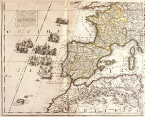
Background imageMaps Collection: Map of the Western Mediterranean countries: France, Spain

Map of the Western Mediterranean countries: France, Spain
LRI4711223 Map of the Western Mediterranean countries: France, Spain, Portugal and North Africa (Morocco, Algeria, Tunisia), with the Baleares, Corsica and Sardinia (etching, 1717) by Nolin

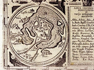
Background imageMaps Collection: View of Tunis (Tunes), Tunisia, with the fortress of Goulette (Guleta Arx

View of Tunis (Tunes), Tunisia, with the fortress of Goulette (Guleta Arx
LRI4707732 View of Tunis (Tunes), Tunisia, with the fortress of Goulette (Guleta Arx) which controls access to Lake Tunis and the new fortress (nova arx) in front of the city walls (etching)

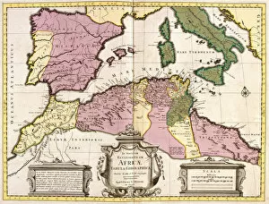
Background imageMaps Collection: Map of North Africa (Mauritania, Morocco, Algeria, Tunisia, Libya) and Europe (Spain

Map of North Africa (Mauritania, Morocco, Algeria, Tunisia, Libya) and Europe (Spain
LRI4706827 Map of North Africa (Mauritania, Morocco, Algeria, Tunisia, Libya) and Europe (Spain, Portugal, France, Italy, Greece with Balearic Islands, Sardinia, Corsica and Sicily) (etching)

Background imageMaps Collection: Cartegena, from Drakes West Indian Voyage 1585 - 86, pub

Cartegena, from Drakes West Indian Voyage 1585 - 86, pub
2909734 Cartegena, from Drakes West Indian Voyage 1585 - 86, pub. 1589 (hand coloured engraving) by Boazio, Baptista (fl.1588-1606); Private Collection; (add.info)

Background imageMaps Collection: Carthage view of the Gulf of Tunis in a 17th century historical atlas

Carthage view of the Gulf of Tunis in a 17th century historical atlas
GIA4770285 Carthage view of the Gulf of Tunis in a 17th century historical atlas. by Unknown Artist, (17th century); Private Collection; (add.info)

Background imageMaps Collection: The Ottoman Corsair Khayr al-Din Barbarossa against Charles Vs Army

The Ottoman Corsair Khayr al-Din Barbarossa against Charles Vs Army
2901855 The Ottoman Corsair Khayr al-Din Barbarossa against Charles Vs Army, by Franz Hogenberg, 1535, engraving by Hogenberg

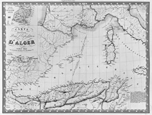
Background imageMaps Collection: Map drawn up for the Algiers expedition, 1830 (litho) (b / w photo)

Map drawn up for the Algiers expedition, 1830 (litho) (b / w photo)
CHT287706 Map drawn up for the Algiers expedition, 1830 (litho) (b/w photo) by French School, (19th century); Bibliotheque Nationale, Paris

Background imageMaps Collection: Action at Carthagena, Colombia, 1741

Action at Carthagena, Colombia, 1741
3781934 Action at Carthagena, Colombia, 1741 by Gravelot, Hubert Francois (1699-1773); (add.info.: Action at Carthagena, Colombia, 1741. Engraving from drawing by Gravelot)

Background imageMaps Collection: Map of Tunis, Tunisia (engraving, 16th century)

Map of Tunis, Tunisia (engraving, 16th century)
LRI4647127 Map of Tunis, Tunisia (engraving, 16th century) by Hogenberg, Franz (1540-c.1590); Private Collection; (add.info.: Map of Tunis)

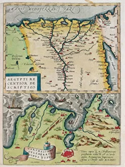
Background imageMaps Collection: Map of Egypt with the cities of the Nile and Carthage (Tunisia), 1570 (engraving)

Map of Egypt with the cities of the Nile and Carthage (Tunisia), 1570 (engraving)
LRI4705015 Map of Egypt with the cities of the Nile and Carthage (Tunisia), 1570 (engraving) by Ortelius, Abraham (1527-98); Museo Navale di Pegli, Genoa

Background imageMaps Collection: Map of Barbaria (Morocco, Algeria, Tunisia, Libya), Nigritude (Mali, Burkina Faso

Map of Barbaria (Morocco, Algeria, Tunisia, Libya), Nigritude (Mali, Burkina Faso
LRI4706870 Map of Barbaria (Morocco, Algeria, Tunisia, Libya), Nigritude (Mali, Burkina Faso, Niger) and Guinee (Senegal, Guinea, Sierra Leone, Liberia, Ivory Coast, Ghana, Togo, Benin)

Background imageMaps Collection: The Civil War in Spain, Siege of Cartagena (engraving)

The Civil War in Spain, Siege of Cartagena (engraving)
1058338 The Civil War in Spain, Siege of Cartagena (engraving) by English School, (19th century); Private Collection; (add.info.: The Civil War in Spain, Siege of Cartagena)

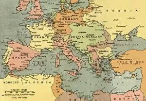
Background imageMaps Collection: Central Europe and the Mediterranean, 1919. Creator: London Geographical Institute

Central Europe and the Mediterranean, 1919. Creator: London Geographical Institute
Central Europe and the Mediterranean, 1919. Showing naval dockyards, fortified coastal towns, and forts. From " The History of the Great European War: its causes and effects", Vol

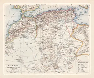
Background imageMaps Collection: Map of Tunisia and Algeria 1896

Map of Tunisia and Algeria 1896
Andres Allgemeiner Handatlas - Bielefeld und Leipzig 1896

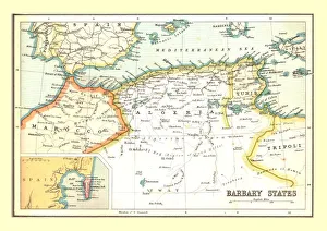
Background imageMaps Collection: Map of the Barbary States, 1902. Creator: Unknown

Map of the Barbary States, 1902. Creator: Unknown
Map of the Barbary States, 1902. Showing Morocco, Algeria, Tunisia, and Libya on the North African coast, with inset of Gibraltar. From The Century Atlas of the World. [John Walker & Co, Ltd

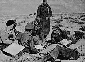
Background imageMaps Collection: Maps and plans are spread on the sand, 1942 (1944)

Maps and plans are spread on the sand, 1942 (1944)
Maps and plans are spread on the sand as the Brigadier takes his decisions and gives his orders, 1942 (1944). At the beginning of November 1942 the Eighth Army defeated Rommel in the decisive Second

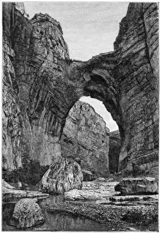
Background imageMaps Collection: The natural arch of Constantine, c1890. Artist: Barbant

The natural arch of Constantine, c1890. Artist: Barbant
The natural arch of Constantine, c1890. Rock arch in Tunisia. Illustration from The Universal Geography with Illustrations and Maps, Division XXI, (Virtue & Co Limited, London, c1890)

Background imageMaps Collection: Cliffs of the Igharghar, taken from the north of Temassinin, c1890. Artist: Armand Kohl

Cliffs of the Igharghar, taken from the north of Temassinin, c1890. Artist: Armand Kohl
Cliffs of the Igharghar, taken from the north of Temassinin, c1890. Tunisian landscape. Illustration from The Universal Geography with Illustrations and Maps, Division XXI, (Virtue & Co Limited)

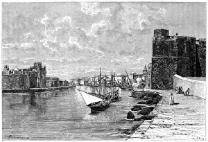
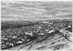
Background imageMaps Collection: Bizerta, viewed from the Kasbah, c1890. Artist: Bertrand

Bizerta, viewed from the Kasbah, c1890. Artist: Bertrand
Bizerta, viewed from the Kasbah, c1890. The Tunisian port of Bizerta on the Mediterranean. Illustration from The Universal Geography with Illustrations and Maps, Division XXI, (Virtue & Co Limited)

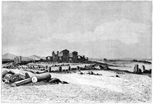
Background imageMaps Collection: Ruins of Sbeitla, the ancient Sufetula, c1890. Artist: Barbant

Ruins of Sbeitla, the ancient Sufetula, c1890. Artist: Barbant
Ruins of Sbeitla, the ancient Sufetula, c1890. The Roman city of Sufetula at Sbeitla in Tunisia. Illustration from The Universal Geography with Illustrations and Maps, Division XXI

Background imageMaps Collection: The amphitheatre of El Jemm, c1890. Artist: F Meaulle

The amphitheatre of El Jemm, c1890. Artist: F Meaulle
The amphitheatre of El Jemm, c1890. Roman ruins at El Djem, Tunisia. Illustration from The Universal Geography with Illustrations and Maps, Division XXI, (Virtue & Co Limited, London, c1890)

Background imageMaps Collection: Jerba Island, Castle near Humt Suk, Tunisia, c1890. Artist: F Meaulle

Jerba Island, Castle near Humt Suk, Tunisia, c1890. Artist: F Meaulle
Jerba Island, Castle near Humt Suk, Tunisia, c1890. The fortress at Houmt Souk on the island of Djerba. Illustration from The Universal Geography with Illustrations and Maps, Division XXI

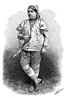
Background imageMaps Collection: Tunisian Jewess, c1890. Artist: Henri Thiriat

Tunisian Jewess, c1890. Artist: Henri Thiriat
Tunisian Jewess, c1890. Illustration from The Universal Geography with Illustrations and Maps, Division XXI, (Virtue & Co Limited, London, c1890)

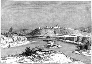
Background imageMaps Collection: The Mejerda at Slugia, above Mejez-el-Bad, c1890. Artist: Armand Kohl

The Mejerda at Slugia, above Mejez-el-Bad, c1890. Artist: Armand Kohl
The Mejerda at Slugia, above Mejez-el-Bad, c1890. The River Mejerda near Medjez-el-Bab, Tunisia. Illustration from The Universal Geography with Illustrations and Maps, Division XXI

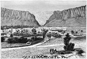
Background imageMaps Collection: The El-Kantara Gorge, Tunisia, 1895. Artist: Armand Kohl

The El-Kantara Gorge, Tunisia, 1895. Artist: Armand Kohl
The El-Kantara Gorge, Tunisia, 1895. From The Universal Geography with Illustrations and Maps, division XXI, written by Elisee Reclus and published by Virtue & Co. Limited (London, 1895)

Background imageMaps Collection: Old ports of Carthage, Tunisia, c1890. Artist: Hildibrand

Old ports of Carthage, Tunisia, c1890. Artist: Hildibrand
Old ports of Carthage, Tunisia, c1890. Illustration from The Universal Geography with Illustrations and Maps, Division XXI, (Virtue & Co Limited, London, c1890)

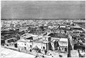
Background imageMaps Collection: View of Kairwan, Tunisia, c1890. Artist: Armand Kohl

View of Kairwan, Tunisia, c1890. Artist: Armand Kohl
View of Kairwan, Tunisia, c1890. Illustration from The Universal Geography with Illustrations and Maps, Division XXI, (Virtue & Co Limited, London, c1890)

Background imageMaps Collection: View of El Kef, Tunisia, c1890. Artist: Hildibrand

View of El Kef, Tunisia, c1890. Artist: Hildibrand
View of El Kef, Tunisia, c1890. Illustration from The Universal Geography with Illustrations and Maps, Division XXI, (Virtue & Co Limited, London, c1890)

Background imageMaps Collection: Cabes, Tunisia, 1895. Artist: Armand Kohl

Cabes, Tunisia, 1895. Artist: Armand Kohl
Cabes, Tunisia, 1895. As seen from the Jara Gardens. From The Universal Geography with Illustrations and Maps, division XXI, written by Elisee Reclus and published by Virtue & Co

Background imageMaps Collection: View from the Tellat Pass, Tunisia, c1890

View from the Tellat Pass, Tunisia, c1890. Illustration from The Universal Geography with Illustrations and Maps, Division XXI, (Virtue & Co Limited, London, c1890)

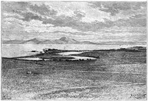
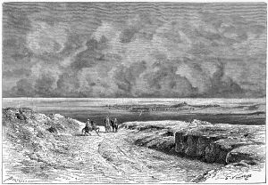
Background imageMaps Collection: Nafta and the Shott-el-jerid, c1890. Artist: Bertrand

Nafta and the Shott-el-jerid, c1890. Artist: Bertrand
Nafta and the Shott-el-jerid, c1890. Shat el Jerid, a salt lake at Nefta in Tunisia. Illustration from The Universal Geography with Illustrations and Maps, Division XXI, (Virtue & Co Limited, London)

Background imageMaps Collection: Map / Nw Africa 1719

Map / Nw Africa 1719
North-west Africa, showing portions of Barbary, land of the Berbers, known to Europeans as barbarians (today Morocco, Tunisia &c)

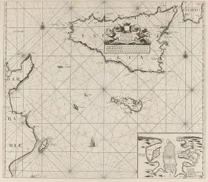
Background imageMaps Collection: Map islands Sicily Malta part coast Tunisia New pass

Map islands Sicily Malta part coast Tunisia New pass
Map of the islands of Sicily and Malta and a part of the coast of Tunisia New pass of the sea coasts of the land of Sicily and the coasts of Barbaria between C. Bona and I. Zerby

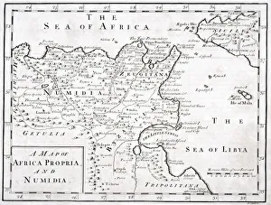
Background imageMaps Collection: A 19Th Century Map Of Africa Propria And Numidia

A 19Th Century Map Of Africa Propria And Numidia

Background imageMaps Collection: North Africa: Algeria, Morocco and Tunisia, lithograph, published in 1897

North Africa: Algeria, Morocco and Tunisia, lithograph, published in 1897
Topographic map of Algeria, Morocco and Tunisia with the borders at the end of the 19th century. Lithograph, published in 1897

Background imageMaps Collection: Map of Pantellaria (Pantelleria) by G. H. Davis

Map of Pantellaria (Pantelleria) by G. H. Davis
A contour map of Pantellaria (Pantelleria), a volcanic Italian island outpost which surrendered unconditionally on 11 June 1943 -- the first loss of Italian soil to the Allies during the Second World

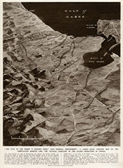
Background imageMaps Collection: Mareth Line, Tunisia, by G. H. Davis

Mareth Line, Tunisia, by G. H. Davis
A large-scale contour map of the complicated Mareth Line in Tunisia, North Africa, where General Montgomery stated that the enemys fate would be decided

Background imageMaps Collection: Map of Northern Africa

Map of Northern Africa. Date: 1807

Background imageMaps Collection: Plan of the Battle of Navarino, 21 October 1827, 1827 (coloured manuscript)

Plan of the Battle of Navarino, 21 October 1827, 1827 (coloured manuscript)
7339519 Plan of the Battle of Navarino, 21 October 1827, 1827 (coloured manuscript) by Unknown Artist, (19th century); 32x42 cm; National Maritime Museum, London

Geographic atlas: view of the Mediterranean Sea and the coasts of Barbaria (Algeria, Tunisia, Tripolitan)
JEB4874639 Geographic atlas: view of the Mediterranean Sea and the coasts of Barbaria (Algeria, Tunisia, Tripolitan). Atlas de Nicolas et Guillaume Sanson, 1670

Background imageMaps Collection: Franco-British Exhibition, White City, London

Franco-British Exhibition, White City, London
Photograph of the Tunis and Algiers building in a souvenir booklet for the Franco-British Exhibition, held at White City, West London

Background imageMaps Collection: Map of Tunisia by G. H. Davis

Map of Tunisia by G. H. Davis
Map of the Front Zone in Tunisia, North Africa, immediately prior to the capture of Mateur, opening the road to Tebourba and Djedeida for Allied forces during the Second World War. Date: 1943

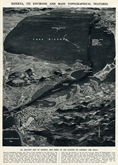
Background imageMaps Collection: Bizerta and environs by G. H. Davis

Bizerta and environs by G. H. Davis
Bizerta (Bizerte, Tunisia, North Africa), its environs and main topographical features. An air-view map of Bizerta, key point of air attacks on Sardinia and Sicily during the Second World War

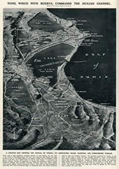
Background imageMaps Collection: Tunis commanding Sicilian Channel by G. H. Davis

Tunis commanding Sicilian Channel by G. H. Davis
Tunis, which with Bizerta commands the Sicilian Channel. A contour map showing the capital of Tunisia, its approaches, roads, harbour and surrounding terrain

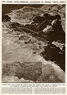
Background imageMaps Collection: Allied occupation of French North Africa by G. H. Davis

Allied occupation of French North Africa by G. H. Davis
The Allied Anglo-American occupation of French North Africa during the Second World War. A contour map of the Algerian and Tunisian coasts, with distances from Algiers to important sites

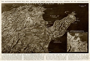
Background imageMaps Collection: Map of northern Tunisia by G. H. Davis

Map of northern Tunisia by G. H. Davis
The battleground which was expected to seal the fate of North Africa and gain full control of the Mediterranean during the Second World War

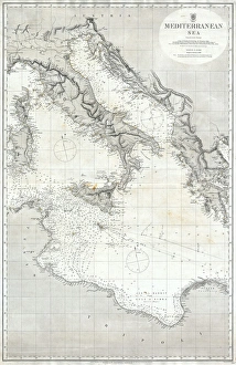
Background imageMaps Collection: 1868, British Admiralty Chart or Map of the Mediterranean Sea, Italy, Corsica, Greece

1868, British Admiralty Chart or Map of the Mediterranean Sea, Italy, Corsica, Greece, Tunisia

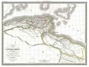
Background imageMaps Collection: 1829, Lapie Historical Map of Empire of Carthage, Modern Tunisia, topography, cartography

1829, Lapie Historical Map of Empire of Carthage, Modern Tunisia, topography, cartography
1829, Lapie Historical Map of Empire of Carthage, Modern Tunisia


All Professionally Made to Order for Quick Shipping


-

Maps Collection

Tunisia is a country located in North Africa, bordered by Algeria, Libya and the Mediterranean Sea and has a population of over 11 million people and its capital city is Tunis. Tunisia has a rich history and culture that dates back to ancient times. Its landscape includes mountains, deserts, forests and beaches. The country is home to many archaeological sites from the Roman Empire as well as some of the oldest cities in Africa. Maps of Tunisia are essential for anyone travelling or exploring this fascinating country. They provide an overview of its geography, including major cities, roads, rivers and lakes as well as national parks and other points of interest. They also show political boundaries such as provinces or regions which can be useful when planning trips or researching local customs or cultures.
+

Our beautiful pictures are available as Framed Prints, Photos, Wall Art and Photo Gifts

The Maps of Tunisia Africa collection from Media Storehouse is a fascinating and unique assortment of wall art and framed prints that depict the geography, history, and culture of Tunisia. Our collection features a range of maps dating back to the 16th century, including antique maps that showcase the country's cities, regions, and landmarks. These maps provide insight into Tunisia's rich history as well as its current political landscape. They also offer an opportunity for viewers to explore the diverse landscapes of this North African nation, from its sandy beaches to its rugged mountains. In addition to traditional cartographic depictions, the Maps of Tunisia Africa collection includes artistic renderings that highlight different aspects of Tunisian life such as agriculture or religion. These prints are perfect for anyone interested in exploring this beautiful country or adding some cultural flair to their home decor.
+

What are Maps of Tunisia Africa art prints?

Maps of Tunisia Africa art prints are high-quality reproductions of maps that depict the geography and topography of Tunisia, a country located in North Africa. These prints showcase the intricate details and features of the region, including its cities, towns, rivers, mountains, deserts and other landmarks. They are created using advanced printing techniques that ensure accurate reproduction of colors and fine details. Maps of Tunisia Africa art prints can be used for various purposes such as home decor or educational resources. They are perfect for those who love to travel or have an interest in geography or history. These prints also make great gifts for friends and family members who share similar interests. We offer a wide range of Maps of Tunisia Africa art prints to choose from. Our collection includes vintage maps as well as modern designs that cater to different tastes and preferences. All our products come with a quality guarantee so you can be assured that you're getting nothing but the best when you shop with us.
+

What Maps of Tunisia Africa art prints can I buy from Media Storehouse?

We offer a wide range of Maps of Tunisia Africa art prints that you can buy. These maps are available in various sizes and formats, including framed and unframed prints, canvas wraps, and photo gifts. You can choose from vintage or contemporary styles to suit your taste. Some popular options include the Tunis Map 1899 Vintage Style Print, which features intricate details of the city's streets and landmarks; the Tunisia Map Watercolor Art Print, which adds a splash of color to your walls with its vibrant hues; and the North Africa Political Map Poster, which provides an overview of the region's geography. Whether you're looking for a decorative piece for your home or office or a unique gift for someone who loves travel or history, we have plenty of Maps of Tunisia Africa art prints to choose from.
+

How do I buy Maps of Tunisia Africa art prints?

To buy Maps of Tunisia Africa art prints from Media Storehouse, you can browse our extensive collection of artwork online. Simply search for "Maps of Tunisia Africa" in the search bar on our website and select the print that catches your eye. Once you have found a print that you like, add it to your cart and proceed to checkout. During checkout, you will be prompted to enter your shipping information and payment details. After completing these steps, your order will be processed and shipped directly to your doorstep. We offer high-quality art prints that are perfect for adding a touch of culture and sophistication to any space. Whether you're looking for a unique piece of wall decor or a thoughtful gift for someone special, Maps of Tunisia Africa art prints are sure to impress. So why wait? Start browsing today.
+

How much do Maps of Tunisia Africa art prints cost?

We offer a wide range of Maps of Tunisia Africa art prints that are available at varying prices. The cost of each print depends on several factors such as the size, quality, and type of paper used to produce it. Our collection includes vintage maps, contemporary designs and artistic interpretations that cater to different tastes and preferences. We take pride in providing high-quality art prints that are affordable without compromising on their aesthetic value. Our Maps of Tunisia Africa art prints make great additions to any home or office space and can be purchased for personal use or as gifts for loved ones. Our website features an easy-to-use interface where you can browse through our extensive collection, select their preferred print(s), add them to cart and checkout securely. We also offer various payment options for convenience. The cost of our Maps of Tunisia Africa art prints is reasonable considering the quality they offer.
+

How will my Maps of Tunisia Africa art prints be delivered to me?

We take pride in delivering your Maps of Tunisia Africa art prints with utmost care and efficiency. Your order will be processed promptly upon receipt and dispatched to you via our trusted courier partners. We use only the best quality packaging materials to ensure that your artwork arrives at your doorstep in pristine condition. We offer a range of delivery options for you to choose from, depending on your location and urgency. Our standard delivery service is reliable and usually takes between 3-5 working days within the UK, while international deliveries may take slightly longer. Rest assured that we will keep you informed every step of the way through email notifications about the status of your order. You can also track its progress online using our tracking system. We are committed to providing a hassle-free experience when it comes to delivering your Maps of Tunisia Africa art prints right to your door.