
Maps Collection
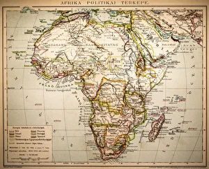
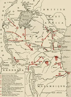
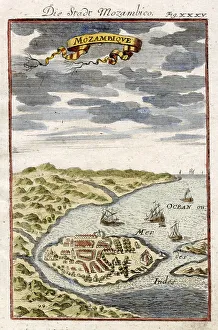
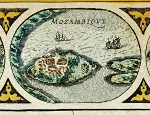
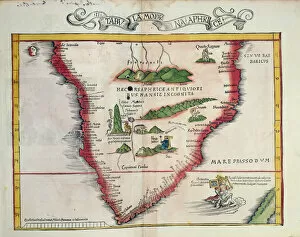
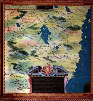
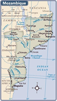
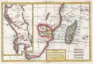
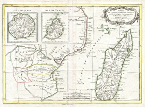
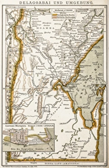
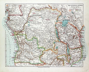
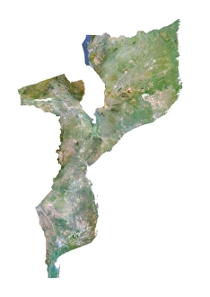
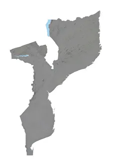
Mozambique is a country located in southeastern Africa, bordered by the Indian Ocean to the east and several other countries including South Africa, Zimbabwe
Choose a picture from our Maps Collection for your Wall Art and Photo Gifts
40 items


All Professionally Made to Order for Quick Shipping
-
Maps Collection
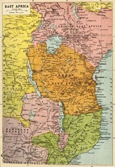
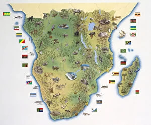
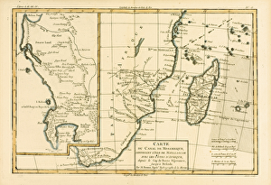
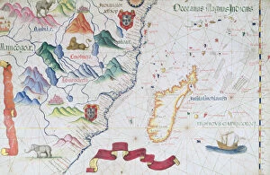
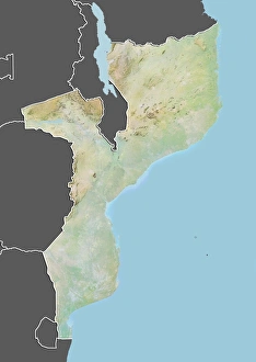
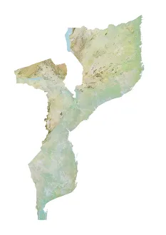
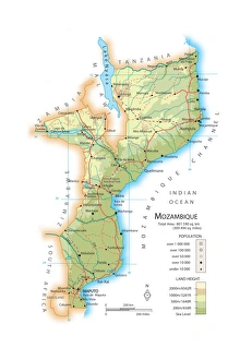
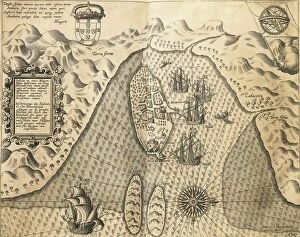
Mozambique is a country located in southeastern Africa, bordered by the Indian Ocean to the east and several other countries including South Africa, Zimbabwe, and Malawi. Maps of Mozambique provide an overview of its geography, showing its many rivers and lakes as well as its mountain ranges. The capital city of Maputo is also featured on maps of Mozambique. The country has a diverse climate ranging from tropical in the north to temperate in the south. It also shows major roads and highways that connect different parts of Mozambique with each other and with neighboring countries. Additionally they can be used to locate important cities such as Beira or Nampula, which are both major economic centers in the region.
+
Our beautiful pictures are available as Framed Prints, Photos, Wall Art and Photo Gifts
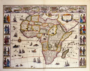
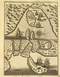
The Maps of Mozambique Africa collection from Media Storehouse offers a stunning range of wall art and framed prints that showcase the beauty and diversity of this African country. Our collection features a variety of maps, including vintage maps dating back to the early 20th century, as well as more contemporary designs that highlight Mozambique's natural resources, topography, and cultural landmarks. Each print is carefully crafted using high-quality materials to ensure long-lasting durability and vibrant colors. Whether you're looking for a unique piece to add to your home or office decor or want to give a thoughtful gift to someone special, the Maps of Mozambique Africa collection has something for everyone. From the lush forests in the north to the sandy beaches along its coastline, Mozambique is a country full of wonder and adventure. With these beautiful prints on display in your space, you can bring some of that magic into your everyday life.
+
What are Maps of Mozambique Africa art prints?
Maps of Mozambique Africa art prints are a collection of high-quality prints that showcase the beauty and intricacies of Mozambique, an African country located in the southeastern part of the continent. These prints feature detailed maps that highlight various regions and cities within Mozambique, including its capital city Maputo. The Maps of Mozambique Africa art prints are not only aesthetically pleasing but also informative, providing viewers with a better understanding of the geography and topography of this fascinating country. They make great additions to any home or office space, adding a touch of sophistication and cultural appreciation. These art prints come in a variety of sizes and styles to suit different preferences. Whether you prefer classic black-and-white designs or vibrant color schemes, there is something for everyone in this collection. Maps of Mozambique Africa art prints offer an excellent way to celebrate the natural beauty and rich history of this unique African nation.
+
What Maps of Mozambique Africa art prints can I buy from Media Storehouse?
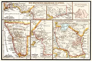
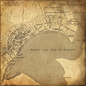
We offer a wide range of Maps of Mozambique Africa art prints that are perfect for anyone who loves to explore the beauty and diversity of this African country. These maps showcase the various regions, cities, towns, and landmarks in Mozambique with intricate details and vibrant colors. Some popular options include antique maps from the 19th century that depict the colonial history of Mozambique. You can also find modern topographic maps that show elevation changes, rivers, lakes, and other geographical features. In addition to traditional paper prints, Media Storehouse also offers canvas prints that add an extra dimension to your wall decor. These canvas prints are stretched over wooden frames for a gallery-quality finish. Whether you're looking for a unique gift or want to decorate your home or office with stunning artwork inspired by Mozambique's rich culture and heritage, we have something for everyone.
+
How do I buy Maps of Mozambique Africa art prints?
To buy Maps of Mozambique Africa art prints from Media Storehouse, you can browse our extensive collection online. Simply search for "Maps of Mozambique Africa" in the search bar on our website and select the print that catches your eye. Once you have found a print that you like, click on it to view more details about the product. From there, you can choose the size and framing options that suit your preferences. You will then be prompted to add the item to your cart and proceed with checkout. We offer a secure payment system where you can pay using various methods such as credit card or PayPal. We also offer international shipping so no matter where you are located, they will deliver your order right to your doorstep. Buying Maps of Mozambique Africa art prints from Media Storehouse is an easy process that allows anyone to own beautiful artwork depicting this stunning part of Africa.
+
How much do Maps of Mozambique Africa art prints cost?
We offer a wide range of Maps of Mozambique Africa art prints at varying prices to suit different budgets. Our collection includes both vintage and contemporary maps that showcase the diverse geography and topography of Mozambique. The cost of each print depends on factors such as size, framing options, and printing materials. We take pride in providing high-quality art prints that are produced using state-of-the-art printing technology to ensure vibrant colors and sharp details. Our prints are available in various sizes ranging from small to large formats, making it easy for customers to find the perfect fit for their space. Whether you're looking for a unique piece of wall decor or a thoughtful gift for someone who loves African culture and history, our Maps of Mozambique Africa art prints are an excellent choice. With our extensive selection and affordable pricing options, you can easily find something that fits your style and budget.
+
How will my Maps of Mozambique Africa art prints be delivered to me?
We take pride in delivering your Maps of Mozambique Africa art prints to you in the best possible condition. We use high-quality packaging materials to ensure that your prints are protected during transit and arrive at your doorstep without any damage. Your art prints will be carefully rolled and placed inside a sturdy cardboard tube for safe transportation. The tube is then sealed with tape to prevent any moisture or dust from entering. We work with trusted courier partners who offer reliable delivery services across the world. Once your order has been dispatched, you will receive an email notification along with a tracking number so that you can keep track of its progress. We understand how important it is for our customers to receive their orders on time and in perfect condition. That's why we go above and beyond to make sure that every aspect of the delivery process is handled with care and attention to detail.