Home > Europe > Luxembourg > Maps
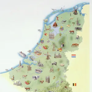
Map of Friesland. Netherlands

![]()
Wall Art and Photo Gifts from Mary Evans Picture Library
Map of Friesland. Netherlands
Map of Friesland. Netherlands. Made by Michaelis Tramezini, 1558. Printed by Iacobus Bossius
Mary Evans Picture Library makes available wonderful images created for people to enjoy over the centuries
Media ID 14337061
© Thaliastock / Mary Evans
1558 Cartography Friesland Luxembourg Mapping Michaelis Netherlands Frisia
FEATURES IN THESE COLLECTIONS
> Europe
> Luxembourg
> Maps
> Europe
> Netherlands
> Maps
> Maps and Charts
> Early Maps
> Maps and Charts
> Luxembourg
> Maps and Charts
> Netherlands
EDITORS COMMENTS
This exquisite map print, titled "Frieslandiae descriptio," is a rare and valuable relic from the 16th century, showcasing the intricate detail and advanced cartographic techniques of the time. Created by the renowned cartographer Michaelis Tramezini in 1558, this map is a testament to the rich history of mapmaking in Europe during the modern age. Tramezini's map of Friesland, a historical province in the north of the Netherlands, was produced during the height of the Dutch Golden Age. The map is notable for its accurate representation of the region's complex coastline, intricate waterways, and the various towns and cities within its borders. The map also includes detailed annotations and labels, providing valuable information about the geography, topography, and political divisions of the region. The map was printed by Iacobus Bossius, a prominent printer from Luxembourg, who is known for his high-quality map prints. The combination of Tramezini's expertise in cartography and Bossius' masterful printing techniques resulted in a map that is both visually stunning and historically significant. This map provides a fascinating glimpse into the past, offering insights into the political and geographical landscape of Friesland during the 16th century. It is a reminder of the important role that maps played in shaping our understanding of the world and the advancements in cartography that have shaped the way we navigate and explore our planet. This map is a must-have for collectors of historical maps, cartography enthusiasts, and anyone with an interest in the history of the Netherlands or Europe during the early modern period. Its intricate detail, historical significance, and beautiful design make it a true treasure for any collection.
MADE IN THE USA
Safe Shipping with 30 Day Money Back Guarantee
FREE PERSONALISATION*
We are proud to offer a range of customisation features including Personalised Captions, Color Filters and Picture Zoom Tools
SECURE PAYMENTS
We happily accept a wide range of payment options so you can pay for the things you need in the way that is most convenient for you
* Options may vary by product and licensing agreement. Zoomed Pictures can be adjusted in the Cart.