Home > Arts > Artists > M > Juan Martinez
Photographic Print : Map /s America 1582


![]()
Photo Prints from Mary Evans Picture Library
Map /s America 1582
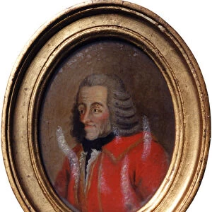
Part of a map by Juan Martinez atlas, published at Messina, of the Northern countries of South America
Mary Evans Picture Library makes available wonderful images created for people to enjoy over the centuries
Media ID 613456
© Mary Evans Picture Library 2015 - https://copyrighthub.org/s0/hub1/creation/maryevans/MaryEvansPictureID/10090799
1582 Atlas Countries Juan Maps Messina
14"x11" Photo Print
Introducing the captivating "Map /s America 1582" from our Media Storehouse collection of Photographic Prints, brought to you by Mary Evans Picture Library from Mary Evans Prints Online. This exquisite print showcases a rare and intriguing map, originally published in Messina, that offers a fascinating glimpse into the cartographic knowledge of the time. Drawn by Juan Martinez, this map highlights the Northern countries of South America in exquisite detail, providing a captivating window into the history of exploration and discovery. Add this beautiful and historically significant print to your collection and bring a touch of history into your home or office.
Photo prints are produced on Kodak professional photo paper resulting in timeless and breath-taking prints which are also ideal for framing. The colors produced are rich and vivid, with accurate blacks and pristine whites, resulting in prints that are truly timeless and magnificent. Whether you're looking to display your prints in your home, office, or gallery, our range of photographic prints are sure to impress. Dimensions refers to the size of the paper in inches.
Our Photo Prints are in a large range of sizes and are printed on Archival Quality Paper for excellent colour reproduction and longevity. They are ideal for framing (our Framed Prints use these) at a reasonable cost. Alternatives include cheaper Poster Prints and higher quality Fine Art Paper, the choice of which is largely dependant on your budget.
Estimated Product Size is 35.5cm x 27.9cm (14" x 11")
These are individually made so all sizes are approximate
Artwork printed orientated as per the preview above, with landscape (horizontal) or portrait (vertical) orientation to match the source image.
FEATURES IN THESE COLLECTIONS
> Arts
> Artists
> M
> Juan Martinez
> Europe
> Italy
> Sicily
> Messina
> Maps and Charts
> Early Maps
EDITORS COMMENTS
This stunning print captures a piece of history with a map of South America from 1582. Part of a larger atlas by Juan Martinez, this particular section focuses on the northern countries of the continent. Published in Messina, Italy, this map provides a glimpse into the geographical knowledge and cartography techniques of the time.
The intricate details and ornate design showcase the artistry and skill that went into creating maps during this period. Each country is labeled with precision, giving viewers an insight into how these regions were perceived centuries ago. From Venezuela to Colombia, each area is depicted with care and accuracy.
As we gaze upon this historical artifact, we are transported back in time to an era when exploration and discovery were at the forefront of human endeavor. The map serves as a reminder of the importance of geography in shaping our understanding of the world around us.
Thanks to Mary Evans Picture Library, we are able to appreciate and admire this piece of history from their collection. It serves as a valuable resource for researchers, historians, and anyone interested in delving into the past through visual representations like maps.
MADE IN THE USA
Safe Shipping with 30 Day Money Back Guarantee
FREE PERSONALISATION*
We are proud to offer a range of customisation features including Personalised Captions, Color Filters and Picture Zoom Tools
SECURE PAYMENTS
We happily accept a wide range of payment options so you can pay for the things you need in the way that is most convenient for you
* Options may vary by product and licensing agreement. Zoomed Pictures can be adjusted in the Cart.