Home > Europe > United Kingdom > Wales > Powys > Newtown
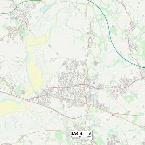
Pembrokeshire SA62 4 Map

![]()
Wall Art and Photo Gifts from Map Marketing
Pembrokeshire SA62 4 Map
Postcode Sector Map of Pembrokeshire SA62 4
Media ID 19979761
Chapel Road Chapel Row Clay Lane Cross Lane Dingle Close Dingle Lane Elm Park Greenway Greenway Close Guildford Harcourt Close Holly Lane Hook Leven Close Main Street Middle Hill Mill Street Moorland Road New Road Newtown Road Pembrokeshire Rectory Close Rectory Road River View Riverside View Rosemary Close St Leonards Avenue The Avenue The Close The Grove Bethlehem Hill Mountain Llangwm New Bridge Tangiers Wiston
FEATURES IN THESE COLLECTIONS
> Animals
> Mammals
> Mountain Lion
> Arts
> Landscape paintings
> Waterfall and river artworks
> River artworks
> Arts
> Portraits
> Pop art gallery
> Street art portraits
> Europe
> United Kingdom
> Scotland
> Fife
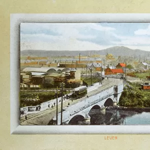
> Leven
> Europe
> United Kingdom
> Wales
> Ceredigion
> New Quay
> Europe
> United Kingdom
> Wales
> Pembrokeshire
> Related Images
> Europe
> United Kingdom
> Wales
> Powys
> Newtown
> Map Marketing
> Postcode Sector Maps
> SA - Swansea
> Maps and Charts
> Related Images
MADE IN THE USA
Safe Shipping with 30 Day Money Back Guarantee
FREE PERSONALISATION*
We are proud to offer a range of customisation features including Personalised Captions, Color Filters and Picture Zoom Tools
SECURE PAYMENTS
We happily accept a wide range of payment options so you can pay for the things you need in the way that is most convenient for you
* Options may vary by product and licensing agreement. Zoomed Pictures can be adjusted in the Cart.