Home > Asia > Turkey > Izmir
Izmir Region of Turkey - Map

![]()
Wall Art and Photo Gifts from Mary Evans Picture Library
Izmir Region of Turkey - Map
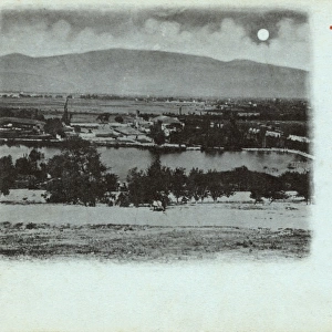
An Ottoman Map depicting the Izmir region of Turkey with several Greek Islands, incorporating several Western Turkish provinces
Mary Evans Picture Library makes available wonderful images created for people to enjoy over the centuries
Media ID 4419555
© Mary Evans Picture Library 2015 - https://copyrighthub.org/s0/hub1/creation/maryevans/MaryEvansPictureID/10279806
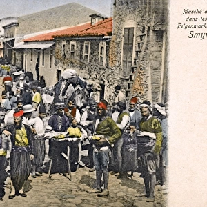
Chart Coast Line Plan Provinces Region Rhodes Script Smyrna Smyrne Ottoman
FEATURES IN THESE COLLECTIONS
> Maps and Charts
> Early Maps
EDITORS COMMENTS
1. Title: "A Glimpse into the Past: An Ottoman Map of the Izmir Region, Turkey (16th Century)" This exquisite antique map print showcases the Izmir region of present-day Turkey, as depicted in an Ottoman chart from the 16th century. The map reveals a rich historical tapestry, illustrating the coastal areas, provinces, and several Greek islands that were once under Ottoman rule. The map's intricate details bring to life the geographical features of the western Turkish provinces, with the Aegean Sea forming the backdrop. The coastline is meticulously drawn, revealing the natural harbors and inlets that have long played a crucial role in the region's maritime history. The script on the map, written in Ottoman Turkish, provides valuable historical context. The name "Smyrna," an ancient Greek city and former capital of the province, is clearly visible in the central part of the map. The map also identifies several other provinces, including Aydin, Mugla, and Chios, which were integral to the Ottoman Empire's expansion and rule in the region. The map also features several Greek islands, such as Rhodes, Samos, and Lesbos, which have a complex and intriguing history. These islands, with their rich cultural heritage, have long been a source of fascination for historians, archaeologists, and travelers alike. This Ottoman map offers a unique perspective on the history of the Izmir region, providing a glimpse into the past and shedding light on the complex interplay of cultures and empires that have shaped this fascinating part of the world. The map's intricate design and historical significance make it a valuable addition to any collection of historical maps or Turkish and Greek studies.
MADE IN THE USA
Safe Shipping with 30 Day Money Back Guarantee
FREE PERSONALISATION*
We are proud to offer a range of customisation features including Personalised Captions, Color Filters and Picture Zoom Tools
SECURE PAYMENTS
We happily accept a wide range of payment options so you can pay for the things you need in the way that is most convenient for you
* Options may vary by product and licensing agreement. Zoomed Pictures can be adjusted in the Cart.