Fraud Blocker Skip to main content

New World Collection (page 56)

"Exploring the New World: A Journey through Time and Maps" Embark on a voyage of discovery as we delve into the captivating history of the "New World

Background imageNew World Collection: EXPL2A-00150

EXPL2A-00150
Chart of Vitus Berings voyage from Kamchatka, Russia, to North America, 1700s. Hand-colored 19th-century woodcut reproduction

Background imageNew World Collection: EXPL2A-00143

EXPL2A-00143
La Salle landing in Matagorda Bay Texas to colonize Louisiana Terrritory and the Mississippi valley area, 1685. Hand-colored 19th-century woodcut reproduction of an earlier illustration

Background imageNew World Collection: EXPL2A-00109

EXPL2A-00109
Samuel de Champlain and his Huron allies going to fight the Iroquois, Lake Champlain, 1600s. Hand-colored woodcut of a 19th-century illustration

Background imageNew World Collection: EXPL2A-00110

EXPL2A-00110
Samuel de Champlains defeat of the Iroquois at Lake Champlain, opening the settlement of New France, 1600s. Hand-colored woodcut

Background imageNew World Collection: EXPL2A-00183

EXPL2A-00183
Samuel de Champlains fortified camp at Quebec on the St Lawrence River, 1600s Hand-colored 19th-century woodcut of a 17th-century map

Background imageNew World Collection: EXPL2A-00232

EXPL2A-00232
Jacques Cartier aboard ship arriving on the shore of Canada, 1534. Hand-colored woodcut of a 19th-century illustration

Background imageNew World Collection: EXPL2A-00246

EXPL2A-00246
Hochelaga, site of Montreal, shown as a Native American village in Lescarbots map, 1609. Hand-colored 19th-century woodcut reproduction of a 17th-century document

Background imageNew World Collection: EXPL2A-00247

EXPL2A-00247
Jacques Cartier embraced by Donnacona, a native Canadian Huron chief, Gaspee Peninsula, 1535. Hand-colored woodcut of a 19th-century illustration

Background imageNew World Collection: EXPL2A-00251

EXPL2A-00251
Title page of the London edition of Jacques Cartiers book about his discoveries in Canada, printed in 1580. Watercolor wash over a 19th-century printed halftone reproduction

Background imageNew World Collection: EXPL2A-00249

EXPL2A-00249
French colonists building fort at Hochelaga, a native village and the site of Montreal, Canada, 1600s. Hand-colored halftone reproduction of a 17th-century illustration

Background imageNew World Collection: EXPL2A-00087

EXPL2A-00087
Jacques Cartier on the summit of Mont Real, now Montreal, Canada, 1535. Hand-colored woodcut of a 19th-century illustration

Background imageNew World Collection: EXPL2A-00085

EXPL2A-00085
English Explorer John Cabot landing on the shore of Canada, 1484. Hand-colored woodcut of a 19th-century illustration

Background imageNew World Collection: Cartier monument on the St Lawrence, Quebec

Cartier monument on the St Lawrence, Quebec
Monument marking Jacques Cartiers landing place on the St Lawrence River in Quebec. Digital photograph

Background imageNew World Collection: Cartiers landing place on the St Lawrence, Quebec

Cartiers landing place on the St Lawrence, Quebec
Replica cross marking Jacques Cartiers landing place on the St Lawrence River in Quebec. Digital photograph

Background imageNew World Collection: EXPL2A-00306

EXPL2A-00306
Discovery of grapes by Leif Erikssons expedition, 1001 AD, leading to naming the new land Vinland. Hand-colored woodcut of a 19th-century illustration

Background imageNew World Collection: EXPL2A-00295

EXPL2A-00295
Champlains Quebec fort, 1613, showing the dwellings (C, D), drawbridge (I), Moat (M), cannon (N), garden (O). Hand-colored 19th-century woodcut reproduction of Champlains drawing

Background imageNew World Collection: EXPL2A-00296

EXPL2A-00296
Map of Champlains settlement on the Isle de Sainte Croix, Canada, 1613. Hand-colored 19th-century woodcut reproduction of the original map

Background imageNew World Collection: EXPL2A-00267

EXPL2A-00267
Fort Frontenac on Lake Ontario, 1600s, at the head of the St Lawrence River, now Kingston, Ontario. Hand-colored 19th century halftone reproduction of the original map

Background imageNew World Collection: Llamas at Ingapirca, Ecuador

Llamas at Ingapirca, Ecuador
Llamas amid the Inca ruins at Ingapirca in the Andes Mountains, Ecuador. Digital photograph

Background imageNew World Collection: EXPL2A-00244

EXPL2A-00244
Possibly the earliest engraving of an American buffalo, 1558 - first mentioned by Cabeza de Vaca. Hand-colored 19th-century woodcut reproduction of the original 16th-century engraving

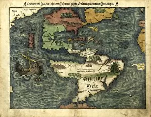
Background imageNew World Collection: Map of the Americas, 1550

Map of the Americas, 1550
16th century map of the Americas. Published in 1550, this German map shows a rudimentary geography of the newly-discovered Americas


All Professionally Made to Order for Quick Shipping

"Exploring the New World: A Journey through Time and Maps" Embark on a voyage of discovery as we delve into the captivating history of the "New World. " From the mighty Viking ship gracefully sailing across vast seas to intricate 17th-century world maps, each hint offers a glimpse into an era brimming with exploration and wonder. Juan Vespucci's meticulously crafted world map from 1526 takes us back to a time when intrepid explorers sought to unravel the mysteries of uncharted territories. Meanwhile, TENOCHTITLAN (MEXICO CITY) at the time of Spanish Conquest reveals a vibrant cityscape teeming with life, captured in exquisite detail by a colored woodcut in 1556. The Cantino World Map of 1502 unveils half our planet's western hemisphere, showcasing early cartographic attempts to comprehend this newfound land. Fast forward to 1720, where an intricately designed map paints a vivid picture of how much knowledge had been gained about our globe over time. Intriguingly, Dutch cartographer's creation presents us with an insightful perspective on North and South America during the mid-17th century. This invaluable document allows us to witness how boundaries were being redrawn and cultures intertwined within this evolving landscape. As we journey further into history, we encounter poignant moments such as Pilgrims' Thanksgiving in 1621 – immortalized by Jean Leon Gerome Ferris' evocative painting. It serves as a reminder that amidst exploration and conquests lay stories of unity and gratitude for new beginnings. Venturing southwards towards Caribbean islands depicted in an enchanting French woodcut from c. 1688 brings forth tales rich in diversity and cultural exchange that shaped these tropical paradises forever.