
Meriwether Lewis Collection
Meriwether Lewis, the renowned American explorer, played a pivotal role in shaping the nation's history


All Professionally Made to Order for Quick Shipping
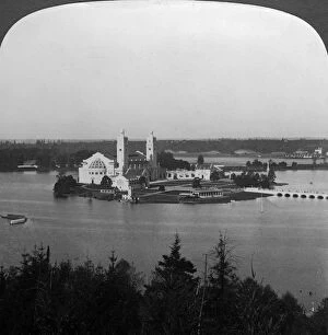
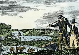
Meriwether Lewis, the renowned American explorer, played a pivotal role in shaping the nation's history. PEXP2D-00013 captures an iconic moment when Native Americans met Lewis and Clark at Council Bluffs, showcasing their mutual curiosity and cultural exchange. Lewis's keen eye for nature is evident in his description of Blue flax, a native wildflower found in Montana. The significance of his expeditions resonates through various artistic representations like the screen print "Lewis and Clark Greeted by Native Americans" (1914) and woodcut print "Explorers: Lewis and Clark in the American Frontier" (1931). These artworks immortalize their encounters with indigenous communities along their journey. Charles Balthazar Julien Fevret de Saint-Memin masterfully captured Meriwether Lewis's essence in 1802 and again between 1803-1807, showcasing his determination as he embarked on this historic expedition. The Missouri River near Great Falls, Montana depicted in c1900 photographs reveals the challenging terrain faced by these explorers during their arduous travels. Another image showcases the majestic Missouri River below Great Falls during that time period. In 1905, at the Lewis and Clark Exposition held in Portland, Oregon, HC White's artwork depicts Government Building where visitors could learn about this remarkable exploration firsthand. Meriwether Lewis remains an emblematic figure whose legacy lives on as an intrepid explorer who fearlessly ventured into uncharted territories to expand our understanding of America's vast frontier.