
Henry Lange Collection
Henry Lange, a renowned cartographer and co-author of the atlas with Th. Von Liechtenstern, left an indelible mark on the world of antique maps


All Professionally Made to Order for Quick Shipping
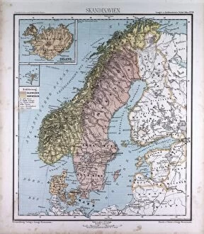
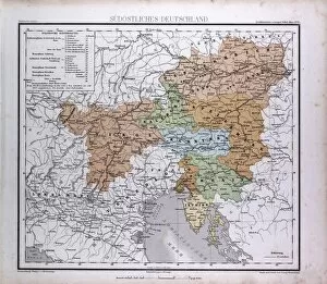
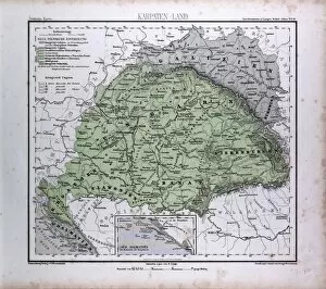
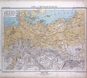
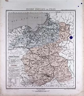
Henry Lange, a renowned cartographer and co-author of the atlas with Th. Von Liechtenstern, left an indelible mark on the world of antique maps. His meticulous craftsmanship is evident in every detail of his creations, including the exquisite Asia Map from 1869. This masterpiece transports us back in time, allowing us to explore the vast landscapes and diverse cultures that shaped this continent. Lange's passion for geography shines through in his work, capturing not only the geographical features but also the spirit of each region he depicted. The Western Asia map showcases its rich history and cultural heritage, while Great Britain and Ireland map highlights their majestic beauty. In 1869, Lange's artistic genius took flight once again as he crafted an enchanting Italy map. Every stroke tells a story of ancient ruins, Renaissance artistry, and picturesque landscapes that have captivated travelers for centuries. Venturing beyond Europe, Lange's Australia and Oceania Map reveals a world teeming with exotic wonders - from pristine beaches to lush rainforests - inviting explorers to embark on unforgettable adventures across these distant lands. South America comes alive through Lange's skillful hands as he brings forth its vibrant colors and awe-inspiring natural wonders on another antique map from 1869. Meanwhile, North American and Central America maps offer glimpses into the diverse tapestry of cultures that make up this vast continent. Lange's dedication to his craft is further exemplified by multiple editions of North America Maps produced over time. Each edition reflects new discoveries made during expeditions or advancements in cartography techniques - testaments to his unwavering commitment to accuracy. As we trace our fingers along these antique maps created by Henry Lange himself alongside Th. Von Liechtenstern, we are transported through time and space. Their legacy lives on within these intricately designed pages; reminders of their contribution to our understanding of our planet’s past while igniting our curiosity for the world that lies beyond.